2019:663 - CARRICK-ON-SUIR: Abbey Hill Road/Bridge Street/Dillon Bridge/Castle Lane/etc., Tipperary
County: Tipperary
Site name: CARRICK-ON-SUIR: Abbey Hill Road/Bridge Street/Dillon Bridge/Castle Lane/etc.
Sites and Monuments Record No.: N/A
Licence number: Unlicenced Monitoring
Author: Marion Sutton & Seán Shanahan, Shanarc Archaeology Ltd.
Author/Organisation Address: Unit 39A, Hebron Business Park, Hebron Road, Kilkenny
Site type: Town
Period/Dating: Modern (AD 1750-AD 2000)
ITM: E 640130m, N 621676m
Latitude, Longitude (decimal degrees): 52.345211, -7.411030
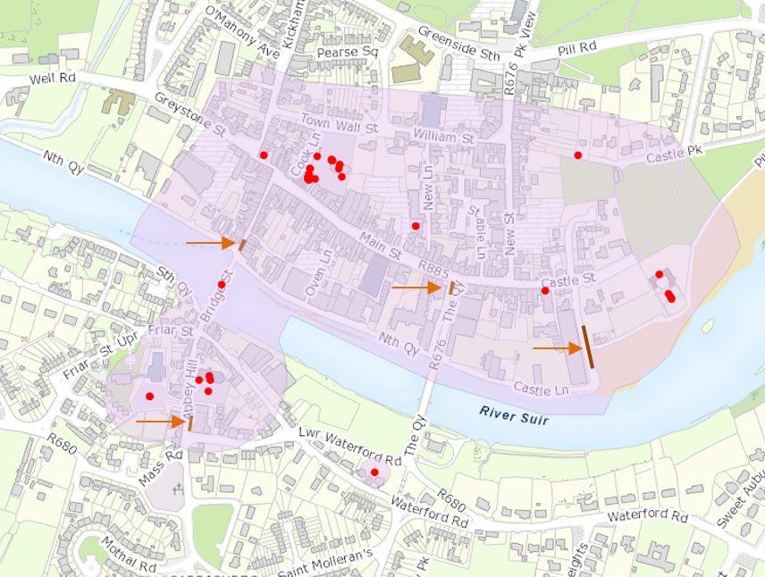
Footpath reconstruction works undertaken on behalf of Tipperary County Council in the historic town of Carrick-on-Suir were archaeologically monitored from 1-5 November 2018 and from 14–15 January 2019.
Works were carried out in numerous locations around Carrick-on Suir, but were principally concentrated around Dillon Bridge, Bridge Street, Castle Lane and Abbey Hill Road, all within the zone of archaeological potential of the historic town (TS085-004).
No features, deposits or finds of archaeological interest or significance were exposed or disturbed during the course of footpath reconstruction works at Dillon Bridge, Bridge Street and Abbey Hill Road. This was to be expected given the shallow nature of the works, and the fact they took place in footpaths heavily disturbed by urban infrastructure and sub-surface services.
At Dillon Bridge, a sub-surface limestone wall footing was identified during the course of digging around the base of an existing street light. The footing extended below the level of the bottom course of the worked limestone wall that retains the road leading onto the bridge. The unworked limestone, which is mortared, was partially dug through to facilitate the original installation of the street light.
A compact clay surface and masonry remains were recorded below the surface at the entry to the ‘Strand Walkway’/Pill Road on the east side of Castle Lane. It has not been possible to establish the origin of the clay surface and masonry remains, although the presence of red brick below the clay surface and in the joints of a probable wall suggests a post-medieval date. 19th-century Ordnance Survey maps do not show a structure on the street side of the walls bordering the ‘Strand Walkway’/Pill Road, and it is possible the remains predate the Survey. It is assumed the masonry remains extend westward into Castle Lane.
Finds consisted of a small amount of post-medieval pottery and glass sherds.