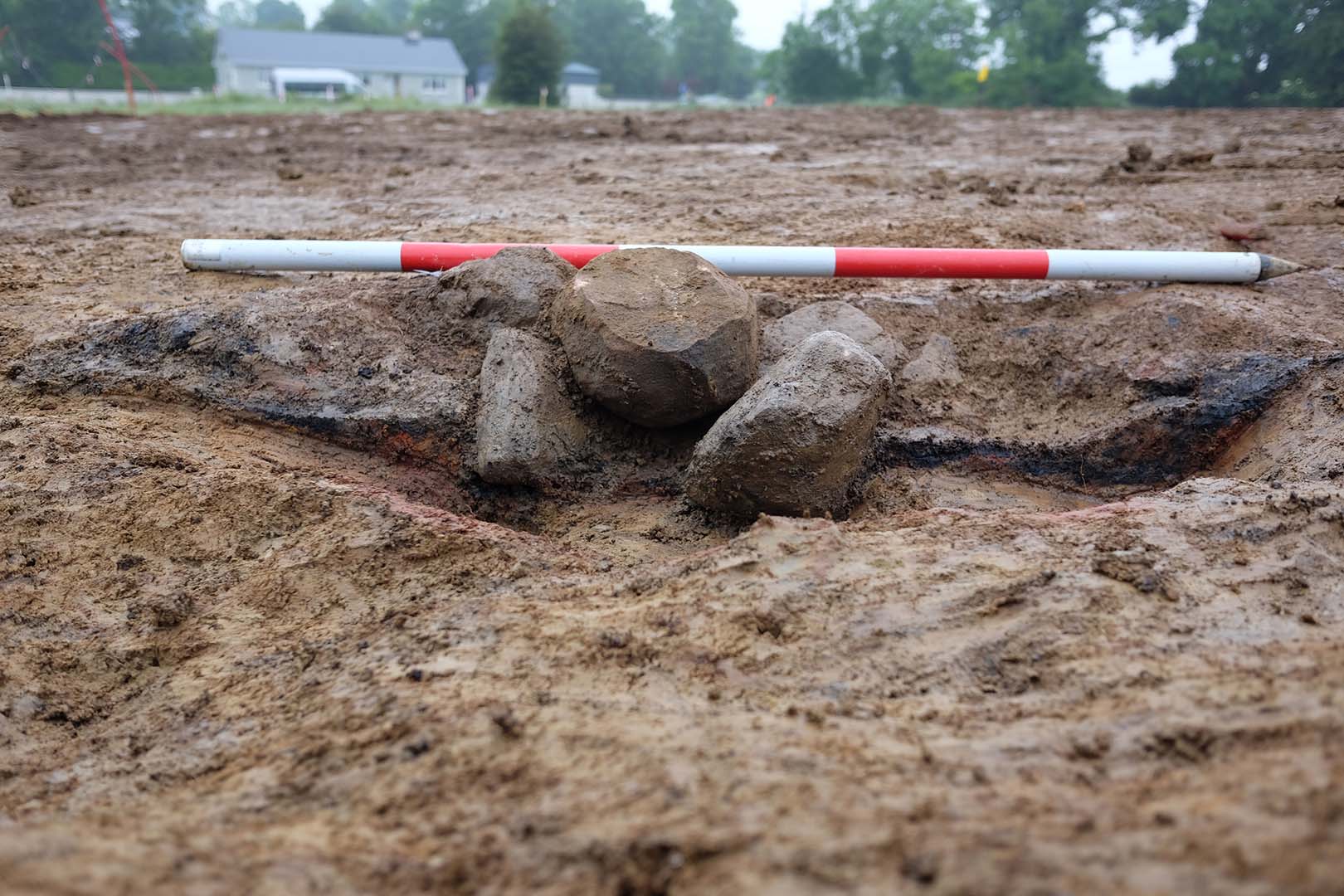
2019:856 - CLOONYEFFER (1), Roscommon
County: Roscommon
Site name: CLOONYEFFER (1)
Sites and Monuments Record No.: N/A
Licence number: Registration No. E5076, Ministerial Direction No. A077
Author: John Channing, c/o Archaeological Management Solutions Ltd.
Author/Organisation Address: Fahy’s Road, Kilrush, Co. Clare
Site type: Hearth and Pit
Period/Dating: Neolithic (4000BC-2501 BC)
ITM: E 581040m, N 787535m
Latitude, Longitude (decimal degrees): 53.836960, -8.288059
Cloonyeffer 1 was excavated in advance of construction of the N5 Ballaghaderreen to Scramoge Road Project in County Roscommon by Archaeological Management Solutions (AMS) for Roscommon County Council (RCC) and Transport Infrastructure Ireland (TII).
Cloonyeffer 1 was identified during geophysical survey of possible sites identified by LiDAR (Licence Refs. 15R0123 and 15E0438) and was subject to advance test excavation (see Davis 2015; Bonsall & Gimson 2016, 13; O’Connell 2016). Stage (ii) Topsoil stripping of Cloonyeffer 1 in advance of Stage (iii) excavation identified a curvilinear feature, possible hearths, and a shallow pit in addition to a strip-field system of furrows.
Area 1 comprised the curvilinear feature truncated by a test trench. The southern extent of this feature was orientated northwest–southeast, measured c.5m in length, c.1m in width and 0.2–0.3m in depth, with a sharp break of slope at the top and moderately sloping sides that broke gradually to a rounded base. The northern extent of this curvilinear feature was orientated roughly north–south and extended beyond the limit of excavation to the north. It measured c.6m in length, 0.5–1.4m in width and 0.2m in depth with a sharp break of slope at the top and moderately sloping sides that broke gradually to a rounded base. The feature contained a single fill. A sample of hazel charcoal from the fill returned an Early Neolithic date of 3701–3528 cal. BC (UBA-48094; 4839±37BP); a chert flake (E5076:1) was also recovered from its fill.
Area 2 comprised a continuation of the test trench which truncated the furrows which were aligned on a north-northeast/south-southwest axis and were visible in geophysical survey. They were on average 0.45m in width and 0.2m in depth, with a distance of c.0.5–1.4m between them. The furrows had a sharp break of slope at the top, straight/gently sloping sides and flat/rounded bases and contained a uniform fill. A furrow also extended through Area 2 and Area 3 and was 0.52m in width and 0.4m in depth with an unknown total length. This furrow had a sharp break of slope at the top, gradually sloping sides that broke gradually to a rounded base and contained a single fill.
Area 3 comprised a continuation of a furrow, two possible hearths and a shallow pit which contained burnt clay and may also have been a potential hearth. The first possible hearth was located in the south-west extent of Area 3. It was sub-oval in plan, 0.7m long, 0.52m wide, 0.02–0.07m deep with a sharp break of slope at the top, gently sloping sides which broke gradually to a flat base and contained a single fill. It was truncated by a furrow. The second possible hearth was located 60m to the east-northeast of the first possible hearth in the eastern extent of Area 3. It was sub-oval in plan, 1.2m long, 0.7m wide, 0.01m deep, with a sharp break of slope at the top and gently sloping sides which broke gradually to a rounded base and contained a single fill. A sample of hazel charcoal from the fill of the second hearth returned an Early Neolithic date of 3777–3641 cal. BC (UBA-48093; 4926±37BP).
A shallow cut which contained a deposit of burnt clay was identified to the north-northeast of the first possible hearth and to the northwest of the second possible hearth, in the centre of Area 3. This cut was sub-oval in plan with a gradual break of slope at the top and gradually sloping sides that broke gently to a flat base. It measured 0.7m long, 0.25m wide, and 0.02–0.04m deep and comprised a single fill.
A single chert flake was recovered during the investigation. Charcoal from the curvilinear feature and from one of the hearths comprised oak, hazel, pomaceous fruitwood and holly.
References
Bonsall, J. & Gimson, H. 2016. Geophysical Survey Report, N5 Ballaghaderreen-Scramoge Road Development. Unpublished report prepared by Earthsound Archaeological Geophysics Ltd on behalf of RCC and TII.
Davis, S. 2015. N5 Strokestown-Ballaghaderreen corridor: LiDAR Assessment. Unpublished report prepared by UCD School of Archaeology for Roscommon County Council and TII.
Hardy, C. 2021. N5 Ballaghaderreen to Scramoge Road Project Stage (i)a, (i)b, (i)c Test Excavation, Stage (i)m Testing in Felled Forestry and Stage (i)f Townland Boundary Survey. Ministerial Direction No. A077, Registration No. E5070. Unpublished AMS report for TII and RCC.
O’Connell, A. 2016. N5 Ballaghaderreen-Scramoge Road Development, Archaeological Consultancy Services Contract, Stage (i) Services Area AH01-AH03; Kilvoy, Corry West 7 Cloonyeffer, Co. Roscommon, Licence No. 15E0588. Unpublished report by Archer Heritage Planning for RCC and TII.

