2019:855 - KILLEEN EAST (1), Roscommon
County: Roscommon
Site name: KILLEEN EAST (1)
Sites and Monuments Record No.: N/A
Licence number: E005098
Author: Brian O'Hara and Ros Ó Maoldúin, AMS
Author/Organisation Address: Fahy's Road, Kilrush, Clare
Site type: Ring-ditch, Structure and Pit
Period/Dating: Multi-period
ITM: E 587507m, N 786126m
Latitude, Longitude (decimal degrees): 53.824494, -8.189750
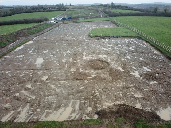
The archaeological remains excavated at Killeen East 1 included an annular ring-ditch, pits, post-holes and ditches. The excavation work was carried out in advance of construction of the N5 Ballaghaderreen to Scramoge Road Project in County Roscommon by Archaeological Management Solutions (AMS) for Roscommon County Council (RCC) and Transport Infrastructure Ireland (TII). To the south of the site there was a D-shaped enclosure (RO022-170—-) identified through LiDAR analysis (Davis 2015) and confirmed in geophysical survey (Bonsall & Gimson 2015), which was preserved in situ.
The on-site Stage (iii) Excavation Services at Killeen East 1 were undertaken by AMS between 25 November and 19 December 2019.
The ring-ditch was 5.32m in external diameter, 0.25–0.47m deep and contained five distinct fills, all of which ran throughout the full circumference of the cut. A lower fill contained a substantial amount of burnt bone, 16 faience and glass beads, and one flint flake. A sample of hazel charcoal from it was dated to the Middle or Developed Iron Age (167 cal. BC–cal. AD 6; UBA-49403; 2070+25BP). A subsequent fill contained a stone bangle fragment and the uppermost fill contained another eleven beads and more burnt bone. The beads were of turquoise, green and blue faience, yellow opaque glass and blue/black glass.
Of the pits, one, which occurred adjacent the D-shaped enclosure, returned a Middle or Developed Iron Age date (193–44 cal. BC; UBA-49404; 2098+24BP), similar to the ring-ditch. A spherical blue glass bead, animal bone and charcoal were retrieved from its fill.
Two of four pits to the east of the D-shaped enclosure returned early medieval dates on cereal grains (cal. AD 434–602; UBA-48087; 1532+30BP & cal. AD 442–642; UBA-48088; 1505+31BP) and another to its north returned a later medieval date, also on cereal grain (cal. AD 1459–1635; UBA-48086; 353+28BP). The early medieval pits contained a lot of charred barley grain and appear to be for drying, processing or cooking. They were accompanied by another pit which was likely of similar date but used to produce oak charcoal. The later medieval pit contained a mixture of animal bone, cereal grains, including wheat and appears to have been domestic refuse. It may have been associated with a crate-like structure which left no archaeological signature.
Two parallel north–south ditches that extended across the site do not appear on any historical Ordnance Survey maps and may have backfilled prior to the 1837 survey.
This report was submitted on behalf of its authors.
References
Bonsall, J. & Gimson, H. 2015. Geophysical Survey Report, N5 Ballaghaderreen-Scramoge Road Development. Unpublished report prepared by Earthsound Archaeological Geophysics on behalf of Roscommon County Council.
Davis, S. 2015. N5 Strokestown-Ballaghaderreen corridor: LiDAR Assessment. Unpublished report prepared by UCD School of Archaeology for Roscommon County Council and TII.
Hardy, C. 2021. N5 Ballaghaderreen to Scramoge Road Project Stage (i)a, (i)b, (i)c Test Excavation, Stage (i)m Testing in Felled Forestry and Stage (i)f Townland Boundary Survey. Ministerial Direction No. A077, Registration No. E5070. Unpublished AMS report for TII and RCC.