2019:851 - CREEVE (2), Roscommon
County: Roscommon
Site name: CREEVE (2)
Sites and Monuments Record No.: N/A
Licence number: E005117
Author: Gerry Mullins and Kevin Kearney, AMS
Author/Organisation Address: Fahy's Road, Kilrush, Clare
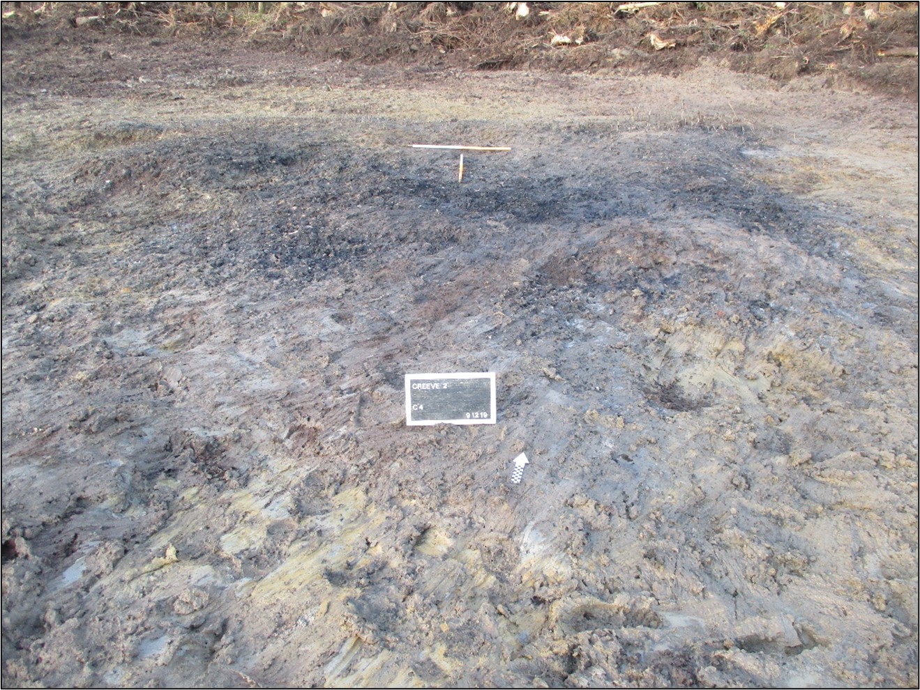
Site type: Burnt spread and troughs
Period/Dating: Chalcolithic (2500 BC-2201 BC)
ITM: E 583702m, N 787077m
Latitude, Longitude (decimal degrees): 53.832935, -8.247592
Creeve 2 was excavated in advance of construction of the N5 Ballaghaderreen to Scramoge Road Project in County Roscommon by Archaeological Management Solutions (AMS) for Roscommon County Council (RCC) and Transport Infrastructure Ireland (TII). It was identified during Stage (i)m archaeological testing in an area of forestry, felled as part of this development, carried out by AMS under Ministerial Direction (Direction No. A077, Registration No. E5070; Hardy 2021).
The archaeological remains comprised a burnt spread and three pits, interpreted as troughs. The spread comprised charcoal-rich dark black silty sand and heat-shattered stone 8.5m by 6.15m in plan and 0.17m deep. The troughs were badly disturbed by tree roots, but it was possible to discern their original shape. The largest trough was sub-oval in plan and measured 2.2m long, 1.57m wide and 0.21m deep. A sample of hazel charcoal from its fill was dated to the Early Bronze Age, 2395–2039 cal. BC (UBA-46759, 3782±40BP). Two stake-holes measuring 0.08–0.09m in diameter and 0.16–0.19m deep occurred in its base.
A second sub-oval trough measuring 1.5m long, 1.2m wide and 0.28m deep adjoined the larger trough. A sample of hazel charcoal from its fill was dated to the Chalcolithic/Early Bronze Age, 2470–2298 cal. BC (UBA-46760, 3914±27BP).
A sub-rectangular trough, measuring 1.05m long, 1m wide and 0.13m deep was located c.1m north of the sub-oval troughs. A sample of hazel charcoal was dated to the Early Bronze Age, 2286–2043 cal. BC (UBA-46758, 3761±27BP).
No artefacts were found during the investigations. Palaeo-environmental analysis of the fills of the troughs identified charred wood macro-remains of hazel, oak, ash and fruit trees.
Reference
Hardy, C. 2021. N5 Ballaghaderreen to Scramoge Road Project Stage (i)a, (i)b, (i)c Test Excavation, Stage (i)m Testing in Felled Forestry and Stage (i)f Townland Boundary Survey. Ministerial Direction No. A077, Registration No. E5070. Unpublished AMS report for TII and RCC.