2019:850 - LAVALLY (1), Roscommon
County: Roscommon
Site name: LAVALLY (1)
Sites and Monuments Record No.: N/A
Licence number: A077; E5084
Author: Eve Campbell, Archaeological Management Solutions
Author/Organisation Address: Fahy's Road, Kilrush, Co. Clare
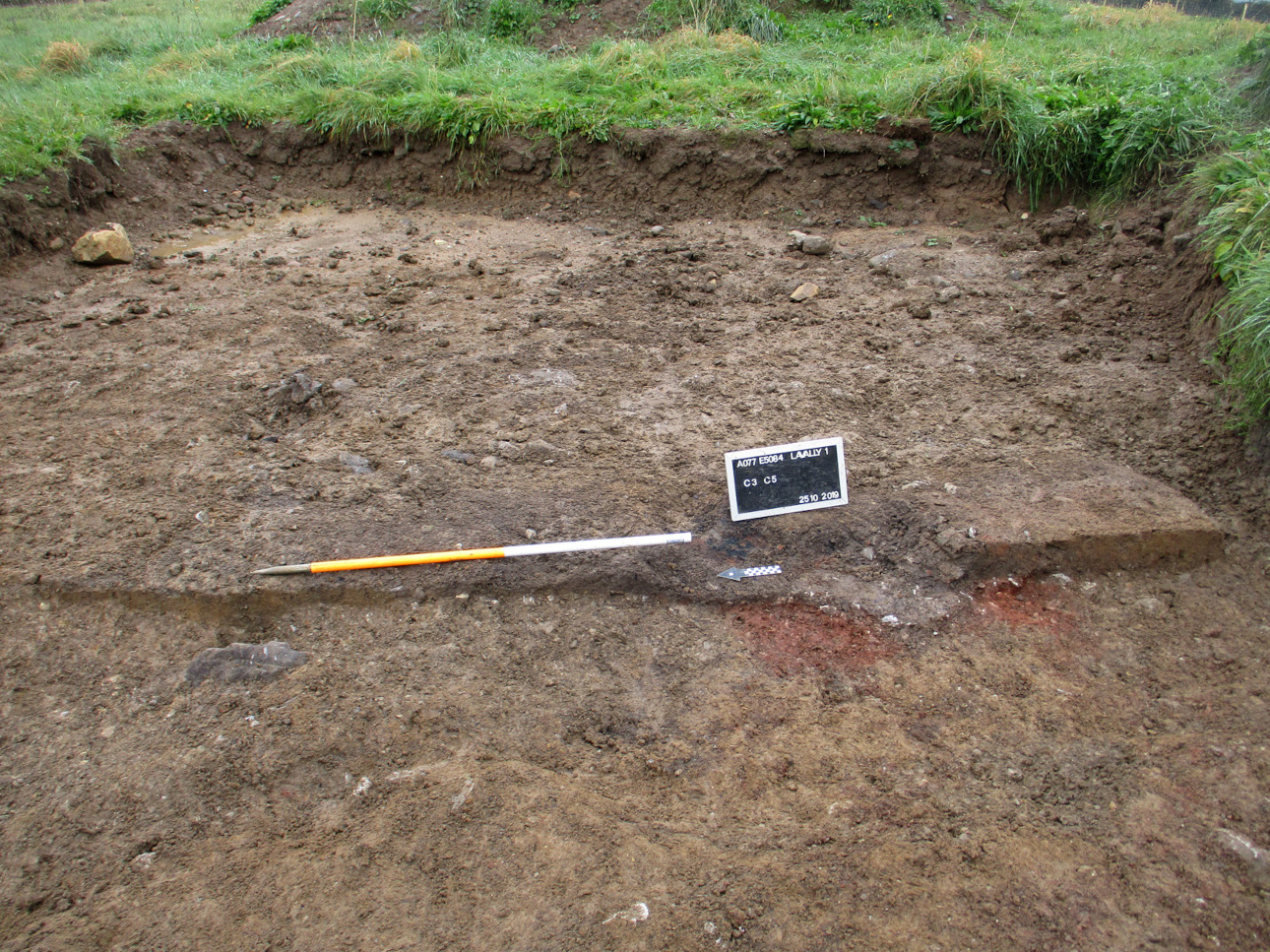
Site type: Hearth
Period/Dating: Late Medieval (AD 1100-AD 1599)
ITM: E 593864m, N 782105m
Latitude, Longitude (decimal degrees): 53.788475, -8.093117
Lavally 1 was excavated in advance of construction of the N5 Ballaghaderreen to Scramoge Road Project in County Roscommon by Archaeological Management Solutions (AMS) for Roscommon County Council (RCC) and Transport Infrastructure Ireland (TII).
Lavally 1 comprised a single hearth, truncated by an agricultural furrow. The site was identified during Stage (ii) Pre-Excavation Services carried out by AMS under Ministerial Direction (Direction No. A077, Registration No. E5084) based on previous investigations undertaken at this location including LiDAR analysis (Davis 2015), geophysical survey by Earthsound Archaeological Geophysics under licence 15R0123 (Bonsall & Gimson 2016) and test excavations by Archer Heritage Planning under licence 15E0589 (O’Connell 2016).
The hearth was sub-oval in plan and orientated northeast to southwest. It had gently sloping sides, an imperceptible break of slope at the bottom and a flat base. It was 2.29m long, 0.68m wide and 0.13m deep. The base of the hearth exhibited significant in-situ scorching and it was filled by a soft dark greyish-brown silty clay with frequent inclusions of charcoal, a moderate number of stones and a significant quantity of animal bone.
The charcoal included hazel, alder and pomaceous fruitwood, a sample of which was dated to the medieval period (cal. AD 1266–1378; UBA-47430; 717±25BP). The animal bone included burnt and unburnt bone, about half of which was unidentifiable to species. The bones that could be identified included adult sheep/goat, mouse and the wing of a thrush-sized bird. No artefacts were found during excavation. While some of the bones may have been intrusive, it seems likely that the hearth was for cooking meat, and that it was associated with habitation in one of the many surrounding raths that were likely occupied late into the medieval period in this region.
References
Bonsall, J. & Gimson, H. 2016. Geophysical Survey Report, N5 Ballaghaderreen-Scramoge Road Development. Unpublished report prepared by Earthsound Archaeological Geophysics on behalf of RCC.
Davis, S. 2015. N5 Strokestown-Ballaghaderreen corridor: LiDAR Assessment. Unpublished report prepared by UCD School of Archaeology for Roscommon County Council and TII.
O’Connell, A. 2016. N5 Ballaghaderreen-Scramoge Road Development, Archaeological Consultancy Services Contract, Stage (i) Services Area AH05; Lavally and Vesnoy, Co. Roscommon, Licence No. 15E0589. Unpublished report by Archer Heritage Planning for RCC and TII.