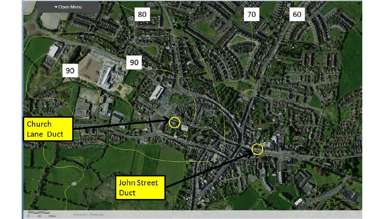
2019:831 - KELLS: ESB Ducting, Church Lane and John Street, Meath
County: Meath
Site name: KELLS: ESB Ducting, Church Lane and John Street
Sites and Monuments Record No.: ME017-044
Licence number: Unlicensed
Author: Niall Roycroft
Author/Organisation Address: c/o Meath County Council
Site type: Historic town
Period/Dating: Multi-period
ITM: E 673791m, N 775981m
Latitude, Longitude (decimal degrees): 53.728261, -6.881768
Archaeological monitoring took place of two ESB Ducting Trenches in Church Lane (57m x 0.55m wide x up to 0.75m deep at 673791/775981) and John Street (28m x 0.55m wide x up to 0.9m deep at 674196/775841) in Kells, Co.Meath in September 2019. The monitoring was carried out following Notification to National Monuments Service. Due to time constraints, the work was undertaken on behalf of Meath County Council rather than ESB.
The works took place inside Kells Historic Town RMP ME017-044 and the Church Lane area was at the west end of the boundary to the Garda Station in the area of the Kells Town Defences ME017-044004 and a potential Gatehouse on Church Lane.
Excavations in the 1980s in the Garda Station revealed the remains of a ringfort (SMR ME017-044028) and c. 30m east from the works termination is St Columb’s Church, ME017-044011, which is National Monument (Ownership) No. 108. The John Street works were in the general vicinity of a probable gatehouse for the Town Defences as they cross north-south over John Street–Headfort Place.
In Church Lane the trench was dug from the south-west corner of the Garda Station and then along the north footpath of Church Lane, before crossing the road to connect to the existing ESB box. At both west and east ends of the trench bedrock was exposed around 0.6m below present footpath level capped with a glacial, weathered till and shattered rock that filled in the erratic surface of the rock. Above this till were wholly modern deposits connected with the present cobble-lock paving. Along most of the central area of the footpath trench the concrete stepped foundation to the Garda Station boundary wall was exposed in the base of the trench at around 0.6m below present ground level.
In John Street (outside the Bank of Ireland) the north-south section of trench exposed a thick massed dump of imported material containing domestic waste and occasional green-glazed pottery. This layer was up to 0.65m thick and was possibly an attempt to vertically realign John Street as it ran east up to Market Square (the layer included many randomly oriented, tipped stones). The alternative is that this layer was a mixed ‘dark earth’ deposit where archaeological layers had all melded together. The dumped deposit was directly overlain by a 0.2m thick gravel road deposit that also contained the remains of a cobbled roadside gutter which is visible in old photographs of Kells available from the National Library of Ireland website. This cobbled road was 0.26m below present footpath level but the previous footpath seen in the photographs had been removed. Modern tarmacadam 80mm thick had been laid directly on the gravel road. The tarmac had in turn been covered with a layer of sand and chippings and then the present cobble-lock paving.

