2020:666 - LEIXLIP: Kilmacredock Upper and Collinstown, Kildare
County: Kildare
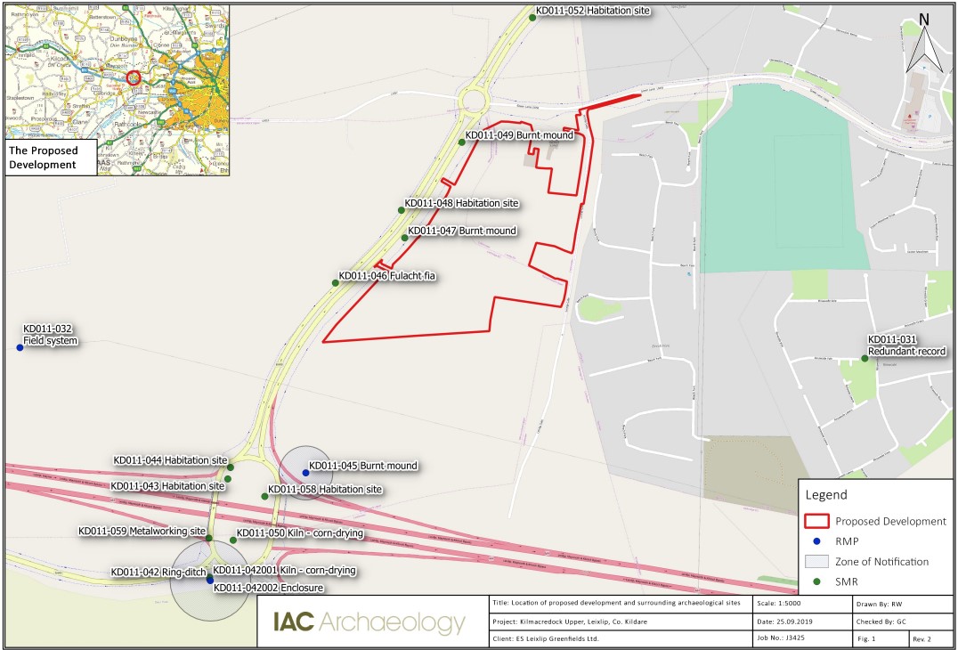
Site name: LEIXLIP: Kilmacredock Upper and Collinstown
Sites and Monuments Record No.: N/A
Licence number: 19E0762
Author: Marc Piera & David McIlreavy, c/o IAC Archaeology Ltd.
Author/Organisation Address: Unit G1 Network Enterprise Park, Kilcoole, Co. Wicklow
Site type: No archaeology found
Period/Dating: N/A
ITM: E 698028m, N 735827m
Latitude, Longitude (decimal degrees): 53.363543, -6.527176
A programme of archaeological testing was undertaken at Kilmacredock Upper and Collinstown, Leixlip, County Kildare, between 16 and 20 December 2019. It followed on from an archaeological desktop assessment (Waters 2019) and geophysical survey (McCormack 2019, Licence Ref.: 19R0115).
A total of 23 trenches were designed to be excavated across the site, targeting geophysical anomalies and open green space. Four trenches along the eastern extent of the development area (Trenches 24-27) were not excavated as access was not permitted.
Topsoil across the test area was recorded as a mid- to dark brown sandy clay, although in Field 2 this material was recorded as saturated.
Subsoil across Field 1 and 3 was recorded as a mid-brown to orange sandy clay with stone inclusions whilst in Trench 2 it was recorded as a heavy grey clay with stone inclusions. The non-porous nature of this subsoil matrix is considered responsible for the saturate topsoil in this area.
The northern extent of Field 1 would seem to have been subject to percolation drain insertion in the 19th century, along with a sump feature encountered in Trench 11. However, no similar improvements were recorded in Field 2. A ditch feature encountered in Field 3 corresponds with a field division shown on First Edition OS mapping of the area, but which is not recorded on later editions.
No archaeological features were recorded within the test trenches described above.