2019:201 - ATHY: Geraldine Road, Clonmullin, Kildare
County: Kildare
Site name: ATHY: Geraldine Road, Clonmullin
Sites and Monuments Record No.: N/A
Licence number: 19E0356
Author: Michael Greiner & Marion Sutton, Shanarc Archaeology Ltd.
Author/Organisation Address: Unit 39a, Hebron Business Park, Hebron Road, Kilkenny
Site type: No archaeology found
Period/Dating: N/A
ITM: E 669027m, N 694675m
Latitude, Longitude (decimal degrees): 52.998344, -6.971691
Testing was carried out on 19 and 20 June 2019 in relation to Phase 2 of a proposed 3-phase housing development at Geraldine Road, Clonmullin, Athy, Co. Kildare. Work was carried out in response to a further information request from Kildare County Council in respect of Planning Ref. 19/234.
The proposed development site is located in a greenfield environment in Clonmullin and Shamrocklodge townlands, on the edge of existing residential estates on the north-east side of Athy town. The development site extends from Geraldine Road to the south, which branches from the N78 (Dublin Road) in Shamrocklodge townland, to the Moneen River to the north, which forms the north boundary of Clonmullin townland. A series of land drainage channels drain the site, and the surrounding land to the north and east, to the Moneen River. Shamrock Lodge, with associated curtilage, is situated in Shamrocklodge townland on the north side of the proposed development entrance on Geraldine Road. Described as a Regency house, built in c. 1835, the house is listed in the National Inventory of Architectural Heritage for Kildare (NIAH: 11504025). Its entrance gates on Geraldine Road are listed on the Athy Record of Protected Structures (AY009).
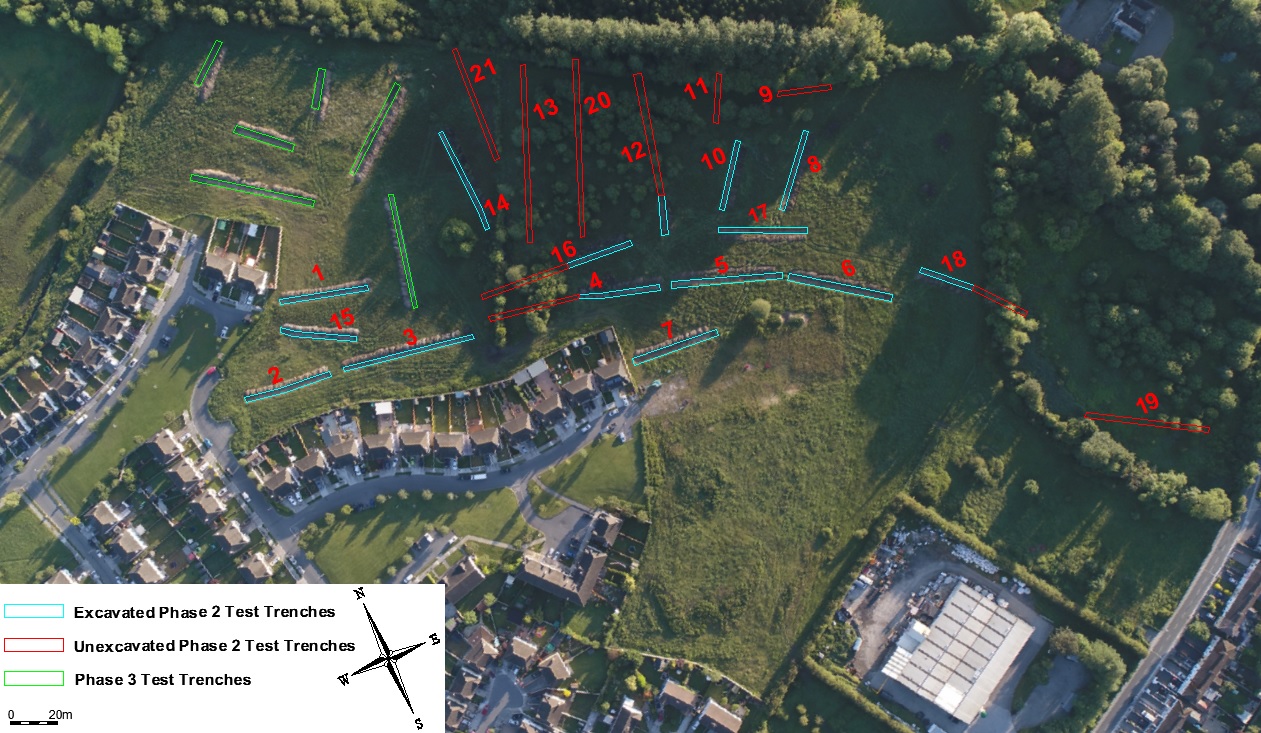
A total of 15 test trenches were machine-excavated across the proposed Phase 2 development site. The trenches were excavated with a mechanical digger utilising a 2m-wide flat-bladed bucket. Trenches measured approximately 2m in width and ranged from 15m to 60m in length, and 0.25-0.7m in depth.
Of the twenty-one test-trenches initially planned for Phase 2 of the proposed development, eleven were excavated fully, four were partially excavated and six were not excavated due to being located in inaccessible, wooded and marshy areas of the site.
Site stratigraphy was largely uniform, typically consisting of mid-brown silty topsoil, sealing natural mid-grey to yellow-grey stony subsoil; the only variations being in the trenches located in the wet, central area of the site, where an additional layer of peat c.0.2m in thickness separated the topsoil from the subsoil.
No finds or archaeologically significant features were identified in any of the excavated trenches.