2019:128 - BENNETSBRIDGE: Athy Distributor Road, Kildare
County: Kildare
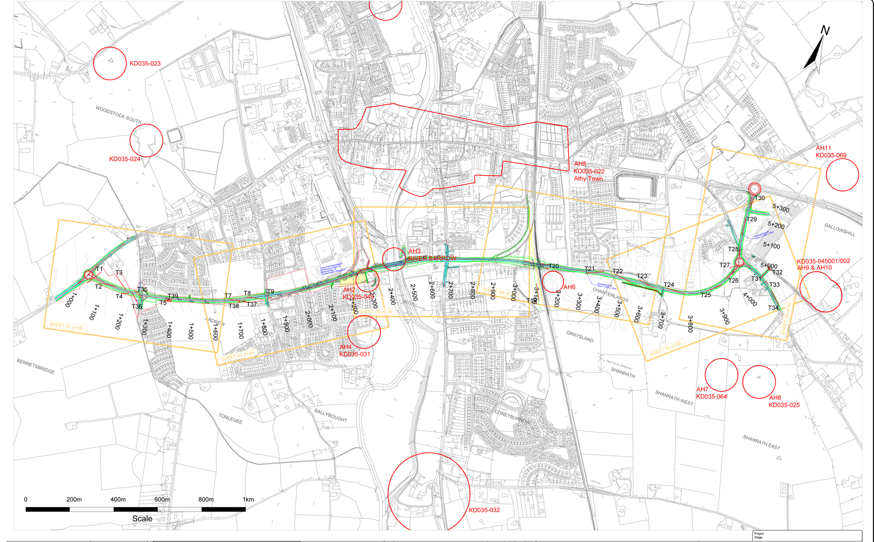
Site name: BENNETSBRIDGE: Athy Distributor Road
Sites and Monuments Record No.: KD035-049
Licence number: 18E0598
Author: Steve Hickey, Courtney Deery Heritage Consultancy
Author/Organisation Address: CDHC, Lynwood House, Ballinteer Road, Dublin 16
Site type: Excavation - miscellaneous
Period/Dating: Multi-period
ITM: E 668249m, N 693398m
Latitude, Longitude (decimal degrees): 52.986969, -6.983549
A testing programme consisting of 29 test trenches and 29 slot trenches was excavated across the approved road development. The combined length of the trenches was 1559m. The testing was informed by the results of a geophysical survey (Licence No: 18R0031) and the previous archaeological monitoring of preliminary site investigation works (Licence No. 18E0135). The 29 test trenches were spread across the approved road development and varied in length from 14–80m, whilst the 29 slot trenches measured 2.5–5m and were monitored as part of further site investigation works carried out in areas of potential soil contamination. Potential archaeological features were noted in two of the trenches, T21 and T29; full excavation to take place at a future date has been recommended for these features. Further monitoring/testing has been recommended for inaccessible areas along the route.
The approved by-pass follows the route of a disused rail trackway constructed in 1918 (chainage 1+150 to chainage 2+900) for approximately half of the total 3.4km route, with the rest of the route running through agricultural fields. Testing has shown that the presence of the former railway tracks (chainage 1+850 to chainage 2+900), combined with areas where the original tracks have been removed and the land returned to greenfield (chainage 1+150 to chainage 1+850), has resulted in disturbance along a portion of the landtake of the approved route. The areas of archaeological interest discovered during testing occurred outside the route of the tracks in previously undisturbed agricultural areas.
The testing provided a general understanding of the varying depths of natural subsoils, extant deposits and the presence of disturbed modern layers on site, and in the case of two trenches (T21 and T29) uncovered archaeological features and deposits at chainage 3+325 (curvelinear feature) and chainage 5+125 (oval pit). The type of features that were revealed were discreet, small in scale and no finds or datable material was recovered. There is a possibility that additional archaeological features are present in the immediate proximity of these identified features. All of these features fall within areas where preservation in situ is not viable. It has been recommended that these identified archaeological features are excavated and their immediate surround investigated in advance of construction works taking place for the road development.
It has also been recommended that further monitoring or test excavation be carried in 3 areas that were not assessed due to access and/or environmental issues. These include
1). Bleach townland c. 2+300 in the environs of the recorded burial (KD035-049). This area was examined during site investigation works and no archaeology was revealed, however the presence of contaminated soils, curtailed the archaeological investigation.
2). Bleach and Coneyburrow townlands, c. chainage 2+370-2+500 – Monitoring of excavation works associated with the crossing of the River Barrow.
3). Athy townland, c. chainage 2+700-3+050 – Due to the suspected presence of contaminants within the CIE lands, site investigation works will be undertaken by specialists. Their results and SI logs will be made available to the archaeologists for review and assessment.