2019:638 - DOIRE FHIONÁIN MÓR, Kerry
County: Kerry
Site name: DOIRE FHIONÁIN MÓR
Sites and Monuments Record No.: KE106-073; -073001
Licence number: 18E0657
Author: Laurence Dunne
Author/Organisation Address: 3 Lios Na Lohart, Ballyvelly, Tralee, Co. Kerry
Site type: Ringfort - cashel
Period/Dating: Medieval (AD 400-AD 1600)
ITM: E 452684m, N 558789m
Latitude, Longitude (decimal degrees): 51.762019, -10.134227
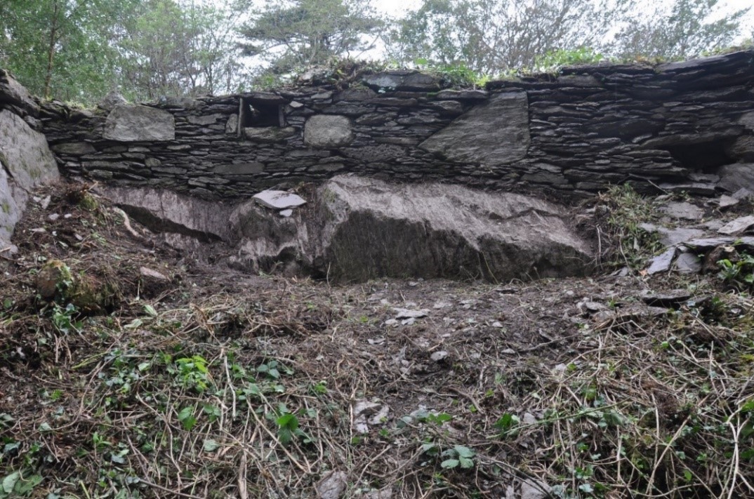
Phase 2 of archaeological works at Derrynane caiseal took place in September 2019. The entirety of the inner and outer facing stone of the caiseal wall was fully cleaned by hand. The objective of the cleaning was (1) to improve the overall visual experience by exposing the entirety of the caiseal wall and (2) to identify any potential areas of collapse to inform potential future conservation works. The cleaning also incorporated the bedrock on which the caiseal was constructed. Removal of the vegetation and cleaning of the facing stone revealed a number of differing construction types. It would appear that the differing construction techniques reflect an adaptation or re-use of the caiseal most likely in the 18th and 19th centuries when it was assimilated into the estate of the O’Connell family. A relict aspect of this in a structural expression is the additional masonry added at the south-east quadrant with a niche on the uppermost limits of the masonry, i.e. facing outwards and above a sharp break of slope that falls away from the bedrock (see image).
As well as cleaning off all the vegetation from the caiseal wall, five small targeted areas were investigated (Cuttings 1–5). Cutting 1 was situated in the western limits of the caiseal in an area between exposed bedrock and the exposed souterrain. The area 3.8m x 2.5m was de-sodded exposing uniform and sterile stony material. The cutting was excavated to maximum depth of 0.65m when sloping bedrock was reached. No archaeological finds or features were noted in Cutting 1.
Cutting 2 (1.2m by 1m) was opened just east of Cutting 1 to establish the maximum height of the internal wall and to expose its possible foundation. No evidence of the wall was found below the ground level. The full height of the internal wall was c.0.5m. A number of capstones of the newly discovered souterrain section were uncovered at c.0.4m from the surface.
Cutting 3 (1.7m x 0.9m) was opened in a partially collapsed part of the souterrain to establish a possible access into this drop-down area and to determine if the passageway connected to the external opening. The cutting was excavated to c.1m below the internal caiseal wall where a capstone was recorded. The capstone was removed with a mini-digger and access into the souterrain part of the wall was gained. Excavation of Cutting 3, which provided limited access into this area, revealed a previously unrecorded passageway that extended along within the caiseal wall for c.6m at which point it was blocked by a collapse.
Cutting 4 (1.8m by 1.1m) was excavated at the south-west part the external wall of the cashel to establish a morphology of an opening/exit. Cleaning of the void within the opening proved that this part of the souterrain completely collapsed in the past but also that there was a connection between the souterrain in Cutting 2 and Cutting 4 and that the souterrain continues in a northerly direction within the wall of the cashel.
Cutting 5 was situated at the entrance of the souterrain. The works within this cutting involved only light cleaning and small investigation. The cleaning exposed a poor ragged wall and the lintel, and removal took place of some loose stones from the inside a stone surface/step into the souterrain.