2019:440 - GARRYANTANVALLY (1–3), Kerry
County: Kerry
Site name: GARRYANTANVALLY (1–3)
Sites and Monuments Record No.: N/A
Licence number: E005063
Author: Tony Bartlett, Archaeological Management Solutions Ltd.
Author/Organisation Address: Unit 1, Hector Street Mills, Kilrush, Co. Clare
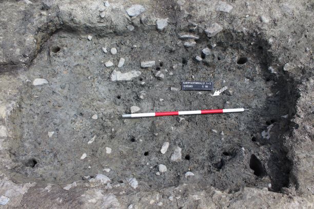
Site type: Burnt mound and Burnt spread
Period/Dating: Bronze Age (2200 BC-801 BC)
ITM: E 497445m, N 632251m
Latitude, Longitude (decimal degrees): 52.432114, -9.508150
Stage (iii) Excavation was carried out between 8 and 25 July 2019 at the site of Garryantanvally 1−3 in advance of construction of the N69 Listowel Bypass Scheme, Co. Kerry. The work was carried out under Ministerial Direction number A076 and Registration numbers E005063 (Excavation) and R000507 (Metal Detection), on behalf of Kerry County Council. The site was discovered in the south of the scheme in the townland of Garryantanvally during advance Stage (i) Test Excavations undertaken in 2018 by AMS.
The site consisted of the levelled remains of two burnt mounds (Garryantanvally 1 and Garryantanvally 3) and one burnt spread (Garryantanvally 2), and associated subsoil-cut features including troughs and pits. Several post-medieval agricultural field drains were recorded at the site, some of which truncated the archaeological features. A palaeochannel was identified meandering through the site. The burnt mounds and burnt spread were situated on slightly elevated ground in relation to the palaeochannel, and Garryantanvally 1 and Garryantanvally 3 were located immediately adjacent to it.
Garryantanvally 1 comprised a burnt mound and a single trough. The mound contained six deposits of heat-shattered stones in charcoal-enriched soil matrices. It was sub-circular in plan, measured 11.9m by 11.3m and had a maximum thickness of 0.45m. A modern field drain truncated the entirety of the mound from north-west through south-east, while a second field drain slightly cut the mound in the north-west. The trough was revealed beneath the mound. It was sub-oval in plan, measured 2.06m by 2m by 0.49m in depth, and contained three fills. The larger of the field drains that truncated the mound also truncated the trough.
Garryantanvally 2 comprised a burnt spread, a single trough and two pits. The single deposit of the spread consisted of frequent heat-shattered stones in a charcoal-enriched dark brownish black sandy silt matrix. It was sub-oval in plan and measured 6.25m by 3.7m and had a maximum thickness of 0.12m. No features were revealed beneath the spread. The trough was sub-oval in plan, measured 1.86m by 1.3m by 0.53m in depth, and contained four fills. The first of the pits was sub-oval in plan, measured 2.2m by 1.5m by 0.18m in depth, and contained two fills, while the second was sub-oval in plan, measured 1.14m by 1.13m by 0.43m in depth, and contained two fills.
Garryantanvally 3 comprised a burnt mound, two troughs and a pit. The mound contained five deposits of heat-shattered stones in charcoal-enriched soil matrices. It was sub-oval in plan and extended beyond the limit of excavation to the north-east. A modern field drain truncated the mound in the south-east. It had maximum dimensions within the excavation area of 12.2m by 9.5m by 0.39m in thickness. Both of the troughs, one of which was sub-rectangular in plan and one of which was sub-oval, were revealed beneath the mound. The sub-rectangular trough measured 2.18m by 1.44m by 0.42m in depth and contained five fills. This trough had several stake-holes cut into the base indicating the former presence of upright stakes that held a former timber lining and the very poorly preserved remains of some of the basal timbers had survived. The sub-oval trough measured 1.8m by 1.18m by 0.51m in depth and contained four fills. This trough was truncated by the later field drain. The pit measured 1.12m by 0.5m by 0.06m in depth and contained a single fill.
No artefacts were recovered from the excavations at the site. In the absence of absolute dating, given the nature of the site type, it would not be unreasonable to suggest a Bronze Age date for the archaeology at Garryantanvally 1−3.
Post-excavation analysis is ongoing and it is hoped that specialist reports, including radiocarbon dating and comparative research, will further enhance our understanding of the site.