2019:849 - DUBLIN 7: Lower House, Grangegorman Lower, Dublin
County: Dublin
Site name: DUBLIN 7: Lower House, Grangegorman Lower
Sites and Monuments Record No.: N/A
Licence number: 19E0058
Author: Liza Kavanagh, c/o IAC Archaeology
Author/Organisation Address: Unit G1 Network Enterprise Park, Kilcoole, Co. Wicklow
Site type: Structure
Period/Dating: Modern (AD 1750-AD 2000)
ITM: E 714623m, N 734988m
Latitude, Longitude (decimal degrees): 53.352671, -6.278262
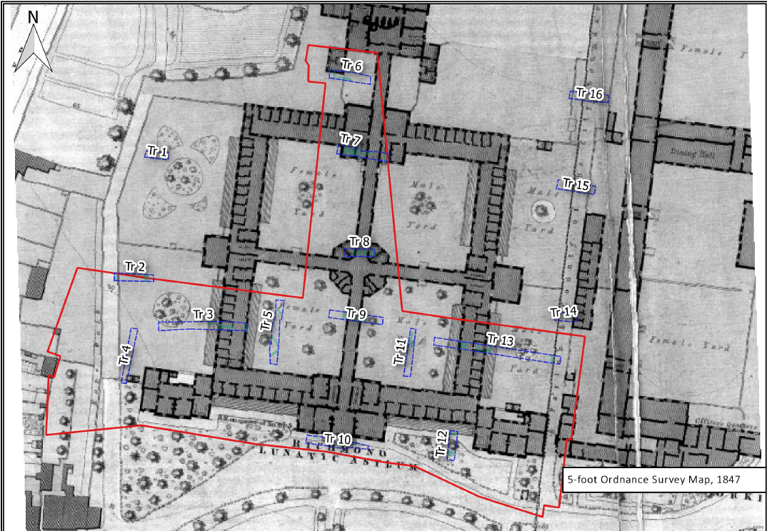
Archaeological testing was carried in two phases over the course of six days from March 4 to 26 August 2019. The locations of the test trenches were designed to target the footprints of buildings identified from historic mapping and any potential areas of construction impact, to fully investigate the archaeological potential of the site.
Testing revealed a number of roughly hewn mortar-bonded limestone walls and red brick walls. These walls represent elements of the foundations of the east, west and north ranges of the Richmond Lunatic Asylum, including structures associated with corridors, walkways and courtyards. These elements are for the most part identifiable on the range of mapping depicting the area from 1821 to 1984 as well as on a number of plans available from the Irish Architectural Archive, dating to 1815.
Following the recommendations of this course of testing, monitoring and rescue excavations were carried out across the site in 2020 under the direction of Neil O’Flanagan (2020:438).

