2019:836 - DUBLIN 22: Grange Castle West Access Road, Loughtown Upper, Clondalkin, Dublin
County: Dublin
Site name: DUBLIN 22: Grange Castle West Access Road, Loughtown Upper, Clondalkin
Sites and Monuments Record No.: N/A
Licence number: 19E0370
Author: Marc Piera, c/o IAC Archaeology
Author/Organisation Address: Unit G1 Network Enterprise Park, Kilcoole, Co. Wicklow
Site type: Kiln, Linear earthwork, Pit and Enclosure
Period/Dating: Multi-period
ITM: E 700943m, N 731658m
Latitude, Longitude (decimal degrees): 53.325542, -6.484725
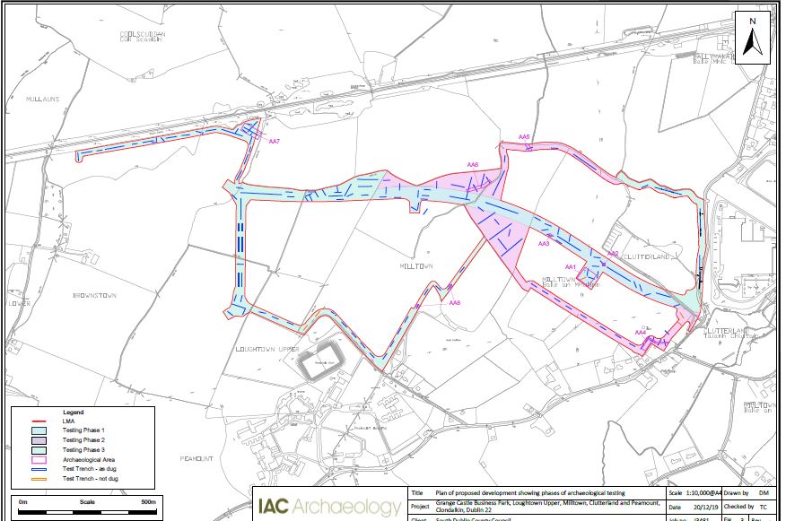
Archaeological testing was carried out on a phased basis due to crop harvesting. Phase 1 testing identified three areas of archaeological significance, which have been designated as Archaeological Areas 1–3. These comprise an enclosure consisting of two concentric enclosing ditches (AA1), a possible kiln (AA2) and a pit filled with charcoal and heat-shattered stone, likely associated with burnt mound activity (AA3). Phase 2 testing identified a further three areas of archaeological significance, which have been designated as Archaeological Areas 4–6. These comprise a cluster of ditches and linear features (AA4) and two linear ditches (AA5 and AA6). These features were later excavated under the licences 19E0680-82 (Milltown 1-3). Phase 3 of testing identified two further areas of Archaeological Potential (AA7 & AA8). These consisted of a possible brick kiln/roadway and a linear ditch and 2 isolated pits. These features were later excavated under the licence 19E0370 ext. (Brownstown).

