2019:762 - DUBLIN: Phoenix Street, Dublin
County: Dublin
Site name: DUBLIN: Phoenix Street
Sites and Monuments Record No.: N/A
Licence number: 18E0385
Author: Niall O'Hora
Author/Organisation Address: —
Site type: Historic town
Period/Dating: Multi-period
ITM: E 714664m, N 734407m
Latitude, Longitude (decimal degrees): 53.347443, -6.277857
Archaeological excavation during monitoring of the works for the development of the Irish Distiller’s Building and carpark was carried out at Phoenix Street North between 31 October 2018 and 09 May 2019, while monitoring of works continued into June 2019.
The site was bounded by New Church Street to the north, Bow Street to the east and Smithfield Square to the west. To the south, the site was bounded by Phoenix Street North, including the Luas Line along the north side of Phoenix Street.
The site was in an area of high archaeological potential being close to the medieval St Michan’s Church and graveyard to the east, while the area to the immediate south-east was in the medieval period the Viking suburb of Oxmanstown.
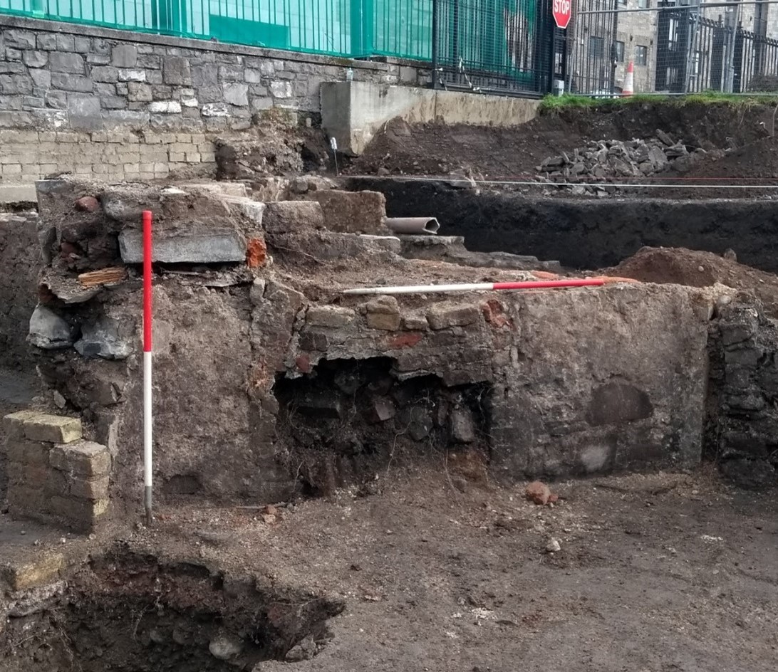
The main findings of the excavation were located over two areas of the site: the north half which brought to light a number of buildings of 17th- to 19th-century date, a well, latrines and drains. Most importantly, a large deposit of clay pipes was found and yielded c. 8007 items, including parts of bowls and stems; the south half where deep refuse pits up to 4.5m in depth below ground level yielded pottery and animal bone from the 12th/13th century to the late 18th/early 19th century.
Medieval Period
The earliest phase of activity on the site relates to dumping in the southern half of the site throughout the later medieval period which was characterised by successive layers and pits of refuse and cess material of varying size, thickness and extent. The deposits were all very mixed and mostly contained food and general refuse material as well as pottery, glass, tile and slate. The date range of the medieval pottery was from the 12th–16th centuries.
The dumping activity here accords well with the documentary evidence for the area where it was ordered by the city authorities in 1468 that nobody was to dump waste anywhere but the designated area west of Hangman’s Lane, presently Hammond Lane, directly to the south-east of this site (see Gilbert 1889, i. 329 as shown in MGL 2010). The 12th/13thth-century pottery from the lower deposits on the site appears to show that dumping activity here was carried out long before the area was officially designated as one of the city’s dumps. That the area to the immediate south of this excavation was also used as a dumping ground in the medieval period is evident from monitoring carried out by France Myles on Phoenix Street North where a large medieval cess pit or series of cess pits with medieval pottery was recorded (Myles 2001:416).
Post-medieval
The material recovered from the dump and cess deposits overlying the medieval deposits in the southern half of the site dated from the sixteenth to the nineteenth centuries, demonstrating that the area continued to be used as a dumping ground from the medieval into the post-medieval period. This evidence also corroborates well with both the historical record and with the results of several other archaeological excavations in the area (Myles, 2001:416; 2010:295; Gahan, 1999:272)
The main characteristic of the post-medieval archaeology in the northern half of the site relates to the construction of the buildings depicted on John Rocque’s 1756 ‘Exact survey of the city and suburbs of Dublin’, which are probably late seventeenth/eighteenth century in date, and their associated gardens and working areas. While all that survived in the central area along the northern boundary wall were the remains of cellar floors and walls, the structures in the north-western corner comprised the basement level of the houses which altogether consisted of 4 rooms, 4 probable latrines to the north, a possible latrine to the south, a number of metalled surfaces, and a possible lightwell. The structures were constructed of brick and limestone and two triangular corner fireplaces were recorded back to back either side of a partition wall.
Industrial Period
The most significant find from the site was the clay pipe pit which contained just over 8000 items, including stems and bowls, some of which are highly ornate and probably date to the mid – late nineteenth century. The remains of a brick muffle kiln measuring 4m north-south by 1.2m located 4.8m to the south of the pit may have been used to fire them. Industrial activity in the nineteenth century on the site included ale brewing and iron working while the Dublin Almanac provides details of occupiers along Church Street New, including a coppersmith and grocers. The clay pipe kiln on the Phoenix Street excavation has shown that industrial activity in this area at this time included clay pipe manufacturing.
Bibliography
Gahan, Audrey. 1999 Stable Lane/Phoenix Street North. In Excavations 1999:272
Gilbert, J. T. 1889. Calendar of Ancient records of Dublin. 19 vols. Dublin
MGL (Margaret Gowen and Company Ltd) 2010. Archaeological Desk Study, Smithfield, Phoenix Street. Unpublished report for Linders of Smithfield.
Myles, Franc. 2001 Tram Street/Phoenix Street in Excavations 2001:416
Myles, Franc. 2010 Smithfield, Dublin 7. In Excavations 2010:295

