2019:759 - DUBLIN 6W: 126-128 Harold's Cross Road, Dublin
County: Dublin
Site name: DUBLIN 6W: 126-128 Harold's Cross Road
Sites and Monuments Record No.: N/A
Licence number: 19E0690
Author: Thaddeus Breen, Marion Sutton & Danny Mulcahy; Shanarc Archaeology Ltd.
Author/Organisation Address: Unit 39a, Hebron Business Park, Hebron Road, Kilkenny
Site type: Historic town
Period/Dating: Multi-period
ITM: E 714601m, N 731916m
Latitude, Longitude (decimal degrees): 53.325080, -6.279704
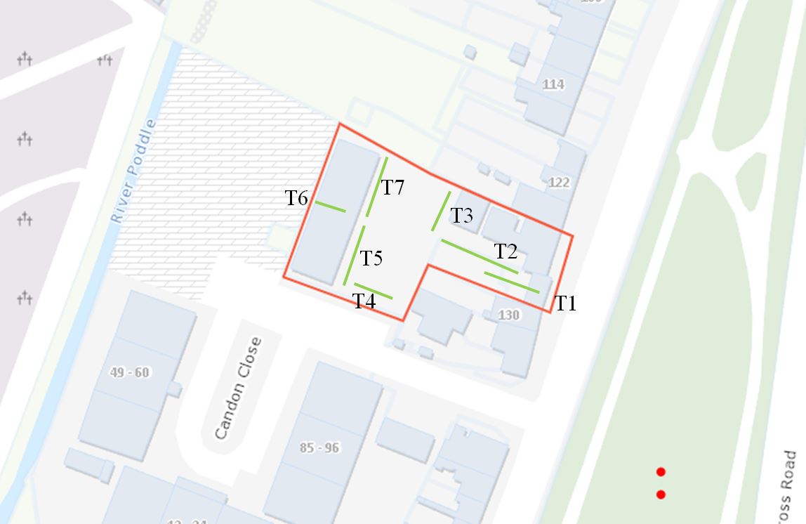
Archaeological test excavation and monitoring of geotechnical site investigations was undertaken on 13–14 November 2019, at 126–128 Harold’s Cross Road, Dublin 6W, in relation to a proposed residential development under An Bórd Planeanála ref. ABP-304552-19, planning application 4735/18.
Seven test trenches were excavated, measuring 1.3–2m in width, 3.6–14m in length and 1–3.5m in depth. Testing established that a stone wall, cobbled and flagstone surfaces and a possible rubbish pit survived between 0.8–2.5m below the current ground levels to the rear of the demolished house at No. 128 Harold’s Cross Road. The stone wall, exposed on the edge of the present concrete drive to the rear of No. 126, is part of the original boundary wall between Nos 126 and 128.
Additional geotechnical site investigations, comprising three boreholes, were monitored concurrently with the excavation of the archaeological test trenches; no additional information to that provided by test excavation was obtained from the boreholes.