2019:718 - KILMAINHAM: Kilmainham Mill, Rowerstown Lane, Dublin
County: Dublin
Site name: KILMAINHAM: Kilmainham Mill, Rowerstown Lane
Sites and Monuments Record No.: DU018-020288
Licence number: 19E0657
Author: Steve Hickey, c/o AMS
Author/Organisation Address: Fahy's Road, Kilrush, Co. Clare
Site type: Water mill - unclassified
Period/Dating: Modern (AD 1750-AD 2000)
ITM: E 712770m, N 733700m
Latitude, Longitude (decimal degrees): 53.341499, -6.306541
Archaeological monitoring of trial pits was carried out in October/November 2019 within the footprint of the grounds of Kilmainham Mill, located in the townland of St James Ward, Kilmainham, in Dublin 8.
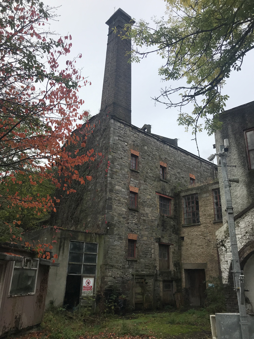
Kilmainham Mill is an upstanding nineteenth-century flour/textile mill built on the site of a medieval water mill (DU018-020288), believed to date to the twelfth century. The site also lies within the Zone of Archaeological Potential for Dublin City (DU018-020). No remains of the medieval water mill are evident above ground.
A total of six trial pits (with an aggregate length of 21.5 linear metres) were excavated at the rear of the mill on the c.2.9-hectare site. The trial pits were excavated in specific areas with the potential of establishing if undisturbed medieval layers were present on site, notably below the route of the nineteenth-century millrace. The trial pits established ground conditions to a depth of 1.4–2.2m and revealed an extensive build-up of modern debris and indicated the original water level of the nineteenth-century millrace. During the course of the siteworks, an eighteenth-century arched culvert, which runs below South Circular Road and into the site, was exposed. The full extent of a nineteenth-century cast-iron aqueduct was also revealed.
The findings informed recommendations and mitigation measures during the proposed enabling works. Due to the very substantial extent of modern build-up encountered across the site, five of the six trial pits revealed no archaeological layers pre-dating the latter half of the nineteenth century. One of the trial pits (T2) revealed a layer at 1.24m below ground level that may indicate the original millrace bank level.
Kilmainham Mil is potentially the location of a key medieval site in an area steeped in medieval activity. Cartographic and primary source evidence indicates the presence of a medieval water mill on the site, and there is a strong likelihood that in situ archaeological deposits and features survive within the proposed development site. However, in the trial pits monitored it was indicated that the levels of these potential deposits are at least 1.2m below the present ground level.
A review of the proposed enabling works was carried out and archaeological monitoring of future works was recommended.