2019:626 - DUBLIN 18: Glencairn, Murphystown, Dublin
County: Dublin
Site name: DUBLIN 18: Glencairn, Murphystown
Sites and Monuments Record No.: DU023-025
Licence number: 17E0120
Author: Kim Rice, Courtney Deery Heritage Consultancy
Author/Organisation Address: Lynwood House, Balinteer Road, Dublin 16
Site type: Excavation - miscellaneous
Period/Dating: Multi-period
ITM: E 719520m, N 725625m
Latitude, Longitude (decimal degrees): 53.267483, -6.208270
The Glencairn site is in the townland of Murphystown, Dublin 18. The lands are currently bounded to the west and north-west by the LUAS Green Line and by the M50 motorway, and by a tributary of the Loughlinstown River to the north. The ruins of Murphystown Castle (DU023-025) are in the south-west corner of the site and the development footprint encloses Glencairn House and estate to the north, east and west.
The site has been the subject of a series of desk-based studies, as well as archaeological testing and monitoring assessments. These include two phases of test excavation under licence 17E0120, which were undertaken in June and October 2017 respectively. The key objective of these preliminary investigations was to establish the distribution, extent, character and date of archaeological remains onsite, define an exclusion zone for the castle and inform the integrated design approach for development in the vicinity of the castle.
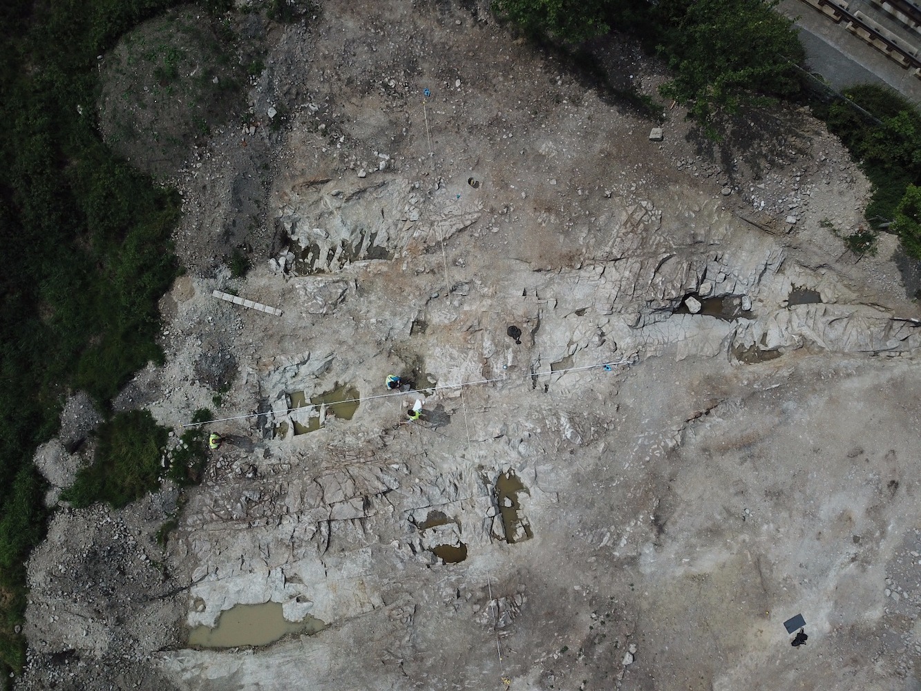
Topsoil was stripped under archaeological supervision between April and June 2019. The monitoring identified three zones of archaeological potential. These included the ‘castle field’, which was excavated over a period of eleven weeks from April to June 2019. A nineteenth-century vernacular structure and paved surface were also uncovered along the access road to the east and these were investigated in May 2019. The final zone of archaeological potential was identified in the area of a proposed compound and comprised a series of nineteenth-century formal landscape features. These were also investigated in May 2019.
The medieval features, which dated from the late twelfth to the fourteenth centuries, were located in the north-eastern part of the ‘castle field’. They consisted of a series of pits and spreads, as well as linear and curvilinear gullies that produced local and French medieval wares, in addition to animal bone and plant macrofossil remains.
The excavation also uncovered evidence for late medieval to post-medieval activity that included cobbled surfaces, rock-cut ditches, wall foundations, refuse pits, drainage features and structural remains. These features, which were predominantly located in the eastern half of the field, produced ceramic, stone, metal, leather and glass artefacts that dated from the late sixteenth to the mid-eighteenth centuries, while a portion of a human skull was recovered from one of the rock-cut ditches. This phase possibly relates to the final occupation of Murphystown Castle during the seventeenth century and the subsequent construction and use of Murphystown House in the early eighteenth century.
The south-western part of the site, which lay to the north of the castle, was occupied by a series of granite quarry pits. A series of drains and formal stone-capped culverts drained into the quarry pits and appeared to be contemporaneous with them. The quarry pits, which predominantly dated from the late eighteenth to the nineteenth century, were mostly opened with the use of gunpowder and the seams were then exploited with iron wedges and chisels. However, sections of some of the pits were hand-dug, and some produced sherds of medieval and late medieval pottery, which suggests an earlier phase of quarrying onsite that was largely eradicated by later activity. Almost all the pits were subsequently backfilled with waste stone and processing debris, in addition to domestic refuse that included substantial quantities of ceramics, glass and metal artefacts.