2019:324 - KILGOBBIN, Dublin
County: Dublin
Site name: KILGOBBIN
Sites and Monuments Record No.: N/A
Licence number: 18E0740
Author: Gill McLoughlin, Courtney Deery Heritage Consultancy
Author/Organisation Address: Lynwood House, Ballinteer Road, Dublin 16
Site type: Pit and Structure
Period/Dating: Bronze Age (2200 BC-801 BC)
ITM: E 719894m, N 724236m
Latitude, Longitude (decimal degrees): 53.254922, -6.203189
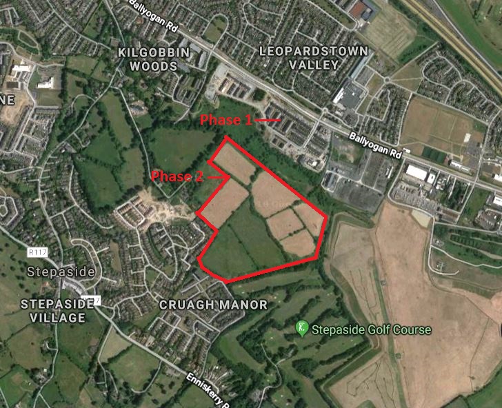
Testing was carried out at Kilgobbin, Co. Dublin in 2014 (excavations bulletin 2014:129) in advance of a planning application being submitted for a proposed development, and four areas of archaeological activity were identified. Area 2 (719802E, 724290N) in Phase 2 of the development comprised a collection of pits and a spread of charcoal-rich soil which were fully excavated from 14 March–9 April 2019. General monitoring of all excavation works within the Phase 2 development area also commenced in January 2019 and will be ongoing on an intermittent basis into 2020. A ditched enclosure site referred to as Area 3 was also fenced and will be preserved in situ as part of this phase of works (ITM 720106E, 724063N).
Area 2 comprised three separate areas (2A-C). In area 2B there was just one feature, a small circular pit, measuring 0.29m x 0.26m x 0.14m deep. It had the appearance of a post-hole but there were no further features associated with it so it may just have been a small pit. Two fills were contained within the feature. The basal and main fill comprised moderately compacted, black gravelly silty sand with frequent inclusions of burnt bone and charcoal. During excavation it was thought possible that it could have been a token cremation deposit however the total weight of the burnt bone retrieved was just 32g and specialist analysis confirmed that there were no identifiable human elements and as such it is more likely that the feature represents a small rubbish pit containing the remnants of food waste.
Area 2C contained three features of potential archaeological interest however no finds or other material retrieved from their fills indicated a function so it could not be definitively stated whether they were archaeological in nature. Pit C6 was an oval cut, 1.47m x 0.9m x 0.3m deep with steep sides and a flat base. It contained a single sterile fill of moderately compacted mid-brown silty sand. Two shallow cuts (C12 and C14) measured 1.9m x 0.7m x 0.12m deep and 0.45m x 0.85m x 0.05m deep respectively; each contained one fill with infrequent charcoal inclusions. Little can be said about these features, they were shallow and irregular in plan and no function was apparent.
The features in Area 2A comprised a cluster of pits and post-holes, along with a number of features which appeared to represent tree root activity and it is possible that some archaeological features could have been disturbed or obliterated altogether by root activity. Late Bronze Age pottery and fragments of granite grinding stones were recovered from the fills of pits, along with charred cereals and charcoal. Although some of the features excavated appeared to be post-holes their layout did not indicate a formal structure. Most of the pits and post-holes were located in an area that could be seen as possibly enclosing an area measuring approximately 6m east-west x 9m, however there was no uniformity in the features which ranged from post-hole-type features to large pits.
The presence of pottery indicates a domestic setting and the charred cereal is evidence of cultivation. The grinding stones also indicate domestic activity and cereal processing. The fact that the grinding stones are heat-affected and broken and were found in a pit along with charred cereal indicates a possible conflagration event, although there was no burning site or hearths identified within the excavation area.