2019:725 - DINISH PIER EXPANSION PROJECT: Capital Dredging, Castletownbere Harbour, Cork
County: Cork
Site name: DINISH PIER EXPANSION PROJECT: Capital Dredging, Castletownbere Harbour
Sites and Monuments Record No.: N/A
Licence number: 18E0383, 18D0092, 18R0130
Author: Rex Bangerter (ADCO)
Author/Organisation Address: No. 2, Main Street, Bennettsbridge, Co. Kilkenny
Site type: Pier/jetty and Wreck
Period/Dating: Multi-period
ITM: E 467999m, N 545514m
Latitude, Longitude (decimal degrees): 51.646569, -9.907469
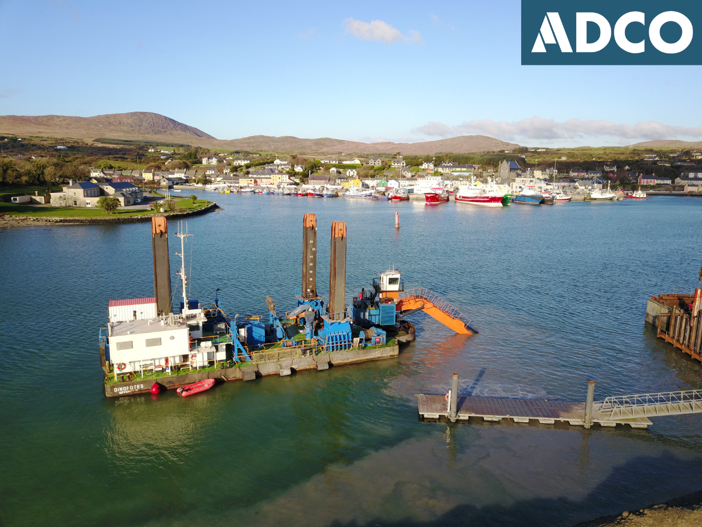
ADCO completed ninety-eight days of active monitoring of the capital dredging works associated with the Dinish Pier Expansion project. This monitoring work took place between 12 October 2018 and 5 July 2019, carried out under licence numbers 18E0383, 18R0130 and 18E0383 ext., 18R0130 ext. A Dive Survey licence (18D0092) was also in place to facilitate the underwater inspection/assessment of any features that may be impacted by the dredging works.
The ongoing pier expansion project includes the insertion of two new breakwater structures, the reclamation of two sections of intertidal foreshore (to form part of a new wharf structure), and associated dredging works which include the harbour’s approach channel and a new berthing slot for the wharf structure. Marine dredging was undertaken across three seabed areas.
Area 1 (ITM 467877E, 545343N; centrepoint coordinate) comprised an 86m (east-west) x 53m area of seabed, located on the west side of the approach channel, off Frenchman’s Point, an area that extends across the north-east side of the western breakwater that is under construction. Area 1 was dredged to a maximum depth of -6.5m CD.
Area 2 (ITM 468003E, 545454N; centrepoint coordinate) comprised a 90m (east-west) x 146m area of seabed, located on the east side of the approach channel, off Carrigaglas Rock, an area that extends across the location of the eastern breakwater that is under construction. Area 2 was dredged to a maximum depth of -6.5m CD.
Area 3 (ITM 468014E, 545605N; centrepoint coordinate) comprised a rectangular dredge-box measuring 245m length (north-south) and 39m width; an area designed to accommodate a deep-water berthing slot for the newly extended wharf structure. This area was dredged to a maximum depth -8m CD and included rock-breaking along its eastern side.
On the sixty-second day of the dredging operation (14 May 2019), the dredger moved into position at a point immediately to the west of the build-extent of a causeway for the Eastern Breakwater (Area 2), being constructed off Carrigalas Rock. A series of nine ship-related timbers were brought to the surface by the dredge-bucket at this location; Find Numbers 18E0383:003-011.
These timbers were torn/twisted by the dredger and the nature/amount of timbers recovered indicated that further remains could lie in-situ within/on the seabed. A surface position was recorded for the timbers at grid coordinate ITM 468036E 545400N, later refined through underwater assessment to ITM 468028E, 545397N. In accordance with the Archaeological Monitoring Protocols that were in place for the project, dredging was halted at this location and an exclusion zone implemented.
It was observed that these timbers were of a similar nature to a number of disarticulated ship’s timbers recovered as part of the archaeological monitoring of dredging operations for the Fishery Harbour Development carried out by ADCO in 2005/2006. These timbers were also recovered from seabed areas near the entrance to the harbour’s approach channel.
An underwater investigation of the source/find location of the timbers was subsequently carried out on 18 May 2019. This comprised a comprehensive survey of the seabed surrounding the impact location and included detailed mapping of the seabed topography present. An additional four timbers were recovered as part of the investigation, Find Numbers 18E0383:012-015. These timbers were planned, described, and recorded prior to excavation and removal. Additional surface recording of the timber assemblage was also carried out prior to placement within secure wet-storage onshore. The existing seabed topography and visible substrate was also recorded as part of the underwater work. In addition, an intensive probe survey was undertaken across a 40m by 10m area of the seabed, centred on the source/find location. No indication of distinct in-situ wreckage was observed at the source location.
Further ship-related timbers (Find Numbers 18E0383:016-027) were recovered as part of dredging works carried out on the west side of the approach channel on Days 90-91 and Day 95 of the monitoring programme.
A total of twenty-seven finds were recovered, the majority of which (25 in number) comprise ship-related timbers. Twenty-three of the timbers represent structural components from a wreck, while two are components from a large wooden-barrel (most likely ship-related cargo). The ship’s timbers are of a hardwood fabric, with a tight-grain structure that is consistent with oak; however, the reddish/pink appearance of the timbers does not appear to conform to the common European Oak varieties. Only two timbers from the assemblage are not ship-related, comprising timber pieces from a probable twentieth-century jetty/pier structure or similar, recovered from the seabed at a location close to the northern end of the footprint for the new pier extension/berthing slot (Area 3).
The assemblage of recovered ship’s timbers is thought to represent debris from an historic wreck, located somewhere outside, but also close, to the approach to Castletownbere Harbour; prevailing south-westerly winds serving to carry pieces from the main body of the wreck to various locations towards the harbour’s approach channel.