2018:225 - DELGANY: Wicklow Arms, Wicklow
County: Wicklow
Site name: DELGANY: Wicklow Arms
Sites and Monuments Record No.: N/A
Licence number: 18E0681
Author: Seán Shanahan & Michael Greiner, Shanarc Archaeology Ltd.
Author/Organisation Address: Unit 39a, Hebron Business Park, Hebron Road, Kilkenny
Site type: Urban
Period/Dating: —
ITM: E 727609m, N 710911m
Latitude, Longitude (decimal degrees): 53.133437, -6.092956
Test excavations took place at the Wicklow Arms, Delgany on 13–14 December 2018 in accordance with the requirements of Wicklow County Council Planning Application Ref: 16/639 in relation to the proposed construction of a mixed residential and commercial development and the redevelopment of a listed structure “The Wicklow Arms Public House” (RPS: 08-13/NIAH: 16305005).
The site comprised the existing car park to the rear of the Wicklow Arms Public House.
A hollow-way/road (SMR: WI013-004005) was previously recorded along the northern boundary of the site, and the southern part of the site falls within the Archaeological Zone of Potential for the historic Delgany Graveyard (SMR: WI013-004002).
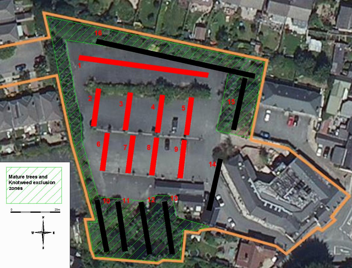
The initial proposal with regards to archaeological test trenches was to excavate sixteen trenches strategically placed across the proposed development site; however of the initially proposed test trenches only numbers 1-9 were excavated, with the remainder being located in areas with mature trees and Japanese Knotweed groundwork exclusion zones, or areas currently occupied by structures scheduled for demolition.
Four trenches (#2-#5) were placed in such a way as to intersect a roadway shown to have been bisecting the site from north-west to south-east on the 1st edition OS map, probably contemporary with the previously recorded hollow-way shown on the same map; however no remains of this feature were detected.
Trenches were 2m in width, 0.6–1.7m in depth, and varied in length from 11-55m. The stratigraphy across the site was relatively consistent: generally comprising a natural layer of light brown stony clay, sealed by a layer of mid to dark brown silty clay 0.5–0.9m in depth, which was in turn sealed by a layer of grey silty clay 0.1–0.3m in depth. In some areas of the southern trenches the excavated material consisted largely of built-up ground comprising redeposited mid brown clay and modern construction rubble. The upper layers across the site consisted of 0.1–0.3m of grey gravel sealed by 0.05m of tarmac.
No archaeological features were found during excavation. Limited finds consisted of occasional animal bone, post-medieval pottery sherds and clay-pipe fragments from Trenches 1, 3 & 5.
As those areas of the site in closest proximity to the recorded monuments at the north and south of the development area could not be tested, additional monitoring of ground-works in these areas will take place during the construction phase.