2018:216 - KNOCKMULLEN, Wexford
County: Wexford
Site name: KNOCKMULLEN
Sites and Monuments Record No.: N/A
Licence number: 18E0403
Author: Sean Shanahan & Michael Greiner, Shanarc Archaeology
Author/Organisation Address: Unit 39a, Hebron Business Park, Hebron Road, Kilkenny
Site type: No archaeology found
Period/Dating: N/A
ITM: E 715757m, N 658721m
Latitude, Longitude (decimal degrees): 52.667290, -6.288564
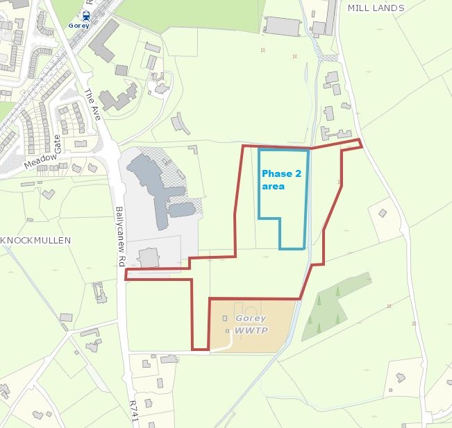
A total of 6 test trenches were monitored at Knockmullen, Gorey, Co. Wexford in accordance with Condition No.17 of Wexford Council Planning Reg. No. 20170786.
The excavation comprised the second Phase of a two-phase testing program. Trenches were numbered 21–26, continuing from Phase 1. For Phase 1 see Excavation Licence 17E0665 / Excavation bulletin 2017:249
The Site was located to the south-east of Gorey town. The Phase 2 area of the site is located on lightly undulating ground, with a gradual downward slope toward the townland boundary which is formed by the river Banoge to the east. The site was largely greenfield, with an area of woodland and duck-ponds at the north-east.
The earliest deposit in all trenches was a natural layer of mid-grey to orange-grey stony clay. This layer was sealed by a layer of mid-brown silty topsoil 0.2–0.5m in depth. Occasional flecks of charcoal where found within the topsoil of 2 trenches probably linked to land/brushwood clearance activities.
No archaeological materials or features were found in any of the excavated trenches.