2018:729 - BALLYKINAVA & CUILMORE, Mayo
County: Mayo
Site name: BALLYKINAVA & CUILMORE
Sites and Monuments Record No.: N/A
Licence number: 18E0120
Author: Dominic Delany, Dominic Delany & Associates
Author/Organisation Address: Creganna, Oranmore, Co. Galway
Site type: Burnt spread and Kiln
Period/Dating: Multi-period
ITM: E 539002m, N 773244m
Latitude, Longitude (decimal degrees): 53.705321, -8.923858
Archaeological monitoring of the construction phase of a windfarm development was carried out at Ballykinava and Cuilmore, Co. Mayo between March and September 2018. No archaeology had been found during pre-development testing at this site in May and June 2014 (2014:724) but three spreads of burnt material and a keyhole-shaped pit/kiln were found during monitoring. The burnt spreads were uncovered during monitoring of the topsoil strip in the vicinity of the access road close to the main site entrance at Ballykinava. No further excavations were required in these areas as the development works comprised the floating of the access road and associated landscaping and grading up to the road. The burnt spreads were covered in geotextile sheeting and sand prior to stoning up, thereby achieving preservation in situ.
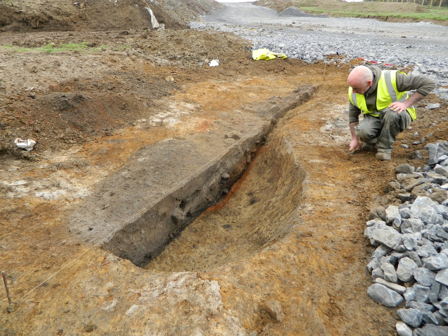
A keyhole-shaped feature (5.7m north-south x 1.7m) was uncovered during monitoring of the topsoil strip on the access road to Turbine B18. Excavation revealed a large sub-circular pit in the north (2.4m x 1.7m) with a flue-type extension terminating in a small, shallow sub-circular pit in the south (1m x 0.9m). The large pit had a maximum depth of 0.6m and contained mixed clay and ash fills over a thin basal deposit of charcoal-enriched silty clay. Fire-reddened clay at the base of the south part of the pit indicated intense heat/burning in this area. The feature was identified as a kiln.
A possible fulacht fiadh was identified in a field adjacent to an existing farm track which was being upgraded at Ballykinava. A tractor wheel had created a rut in the feature and exposed some burnt material. Examination of the area revealed a low mound measuring 9m x 8m in extent and with a maximum height of 0.3m. This feature was not in the direct line of any windfarm-related development works but was cordoned off during construction to protect against any impact.
The excavation of trenches for underground cabling along the grid connection route between Ballykinava and Cloontooa substation was also monitored but no archaeology was found.