2018:241 - BAUNACLOKA, Mungret, Limerick
County: Limerick
Site name: BAUNACLOKA, Mungret
Sites and Monuments Record No.: N/A
Licence number: 18E0528
Author: Sean Shanahan & Marion Sutton, Shanarc Archaeology
Author/Organisation Address: Unit 39a Hebron Business Park, Hebron Road, Kilkenny
Site type: Pit
Period/Dating: Medieval (AD 400-AD 1600)
ITM: E 554555m, N 653785m
Latitude, Longitude (decimal degrees): 52.633380, -8.671350
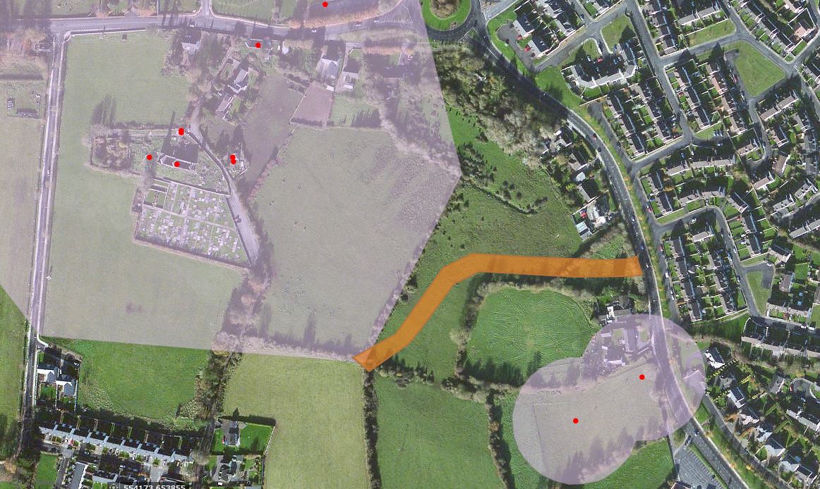
Monitoring was conducted of excavations associated with the construction of approximately 300m of the Mungret Distributer Link Road in Baunacloka townland, off the R510 road, in the south-west suburbs of Limerick city.
Monitoring was preceded by a geophysical survey (Leigh 2017) under licence number 17R0021, and comprehensive test excavation by Aegis Archaeology Limited (2017) under licence number 17E0165.
The greenfield site lies to the east of the historic town of Mungret (LI013-009) and is characterised by low-lying, damp ground, which rises gradually to the south and to the west. A modern fill deposit, with associated modern debris, was identified during test excavation and subsequent monitoring in the central and low-lying part of the distributer road alignment. The deposit was typically found to be 1m in depth.
Stone field drains of early modern or modern date were identified during test excavation and subsequent monitoring. Drains, orientated generally north-west/south-east, were exposed on very gently rising ground across the southern third of the link road alignment between 0.2m and 0.3m below the surface.
A shallow refuse pit, measuring 0.94m north-south x 0.73m x 0.1–0.14m deep, was identified below 0.2m of topsoil at the south-west end of the link road alignment (labelled 9.1 in Trench 9 of Aegis Archaeology test excavation report (2017)). One pottery sherd found in the pit is part of a jug of medieval date (mid-late 13th century). Two additional sherds recovered during the stripping of topsoil in the vicinity of the pit date to the same period.

