2018:474 - KILKENNY: Sweeney's Orchard, Abbey Quarter, Kilkenny
County: Kilkenny
Site name: KILKENNY: Sweeney's Orchard, Abbey Quarter
Sites and Monuments Record No.: KK019–026
Licence number: 18E0213
Author: Kim Rice, Courtney Deery Heritage Consultancy
Author/Organisation Address: Lynwood House, Balinteer Rd., Dublin 16, D16 H9V6
Site type: Historic town
Period/Dating: Multi-period
ITM: E 650431m, N 656526m
Latitude, Longitude (decimal degrees): 52.657574, -7.254580
Testing was carried out over eight days at a site known as ‘Sweeney’s Orchard’ in Kilkenny City. The route of the Kilkenny Central Access Scheme forms the southern boundary of the site and the River Nore defines its eastern edge. It is located 100m due east of Vicar Street, 100m to the south-west of Green’s Bridge and 100m due south of Green Street, while the confluence of the Nore and Bregagh rivers lies 100m to the north-east. Both the historical and archaeological record indicate that the proposed development site occurs within an area of significant archaeological potential. Previous investigations onsite exposed late medieval and post-medieval remains, as well as evidence for activities related to the adjoining ‘Chancellor’s Mills’ along the River Nore.
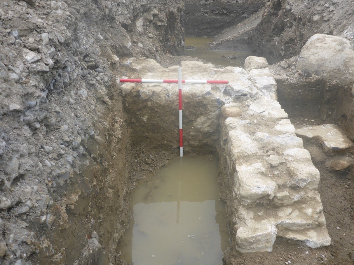
Eleven test trenches were opened throughout the site, which uncovered a comparable range of late medieval and post-medieval remains. These included a late medieval ditch, post-medieval boundary walls, field drains, reclamation deposits and alluvial sediments. The assessment also uncovered a substantial post-medieval structure in Trench 11, which was in close proximity to the River Nore. It was initially suspected that the wall and associated buttress were medieval and a mortar sample was obtained for dating and analysis.
The mortar did not contain any inclusions that were suitable for radiocarbon dating (the lime was recrystallised and contaminated). However, it incorporated fragments of coal and red brick, which indicated it was post-medieval in date.