2018:220 - PRUSSELSTOWN, Kildare
County: Kildare
Site name: PRUSSELSTOWN
Sites and Monuments Record No.: N/A
Licence number: 18E0639
Author: Seán Shanahan & Edel Barry, Shanarc Archaeology Ltd.
Author/Organisation Address: Unit 39a, Hebron Business Park, Hebron Road, Kilkenny
Site type: Burnt spread
Period/Dating: Undetermined
ITM: E 669391m, N 695546m
Latitude, Longitude (decimal degrees): 53.006124, -6.966083
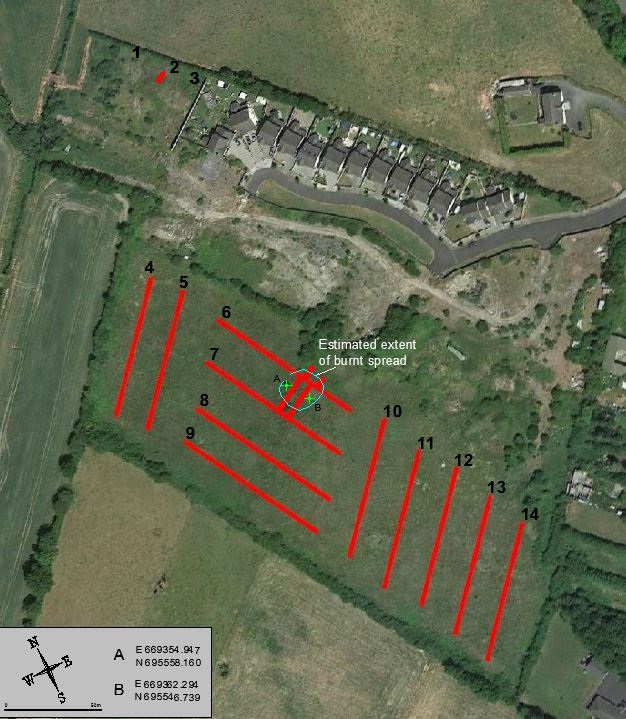
A total of 16 test trenches were excavated at Prusselstown Green, Prusselstown, Athy, Co. Kildare in accordance with the requirements of Kildare County Council planning reference PL. Ref. 18/718; relating to the proposed construction of a residential development.
The excavated trenches were 2m wide, 0.3–0.5m in depth and varied in length from 6–85m.
With the exception of the northern corner of the site, where the ground consisted of modern infill from previous developments, the stratigraphy across the site was relatively uniform. A layer of topsoil 0.25m in depth and comprising soft mid-brown clayey silt with moderate small stones sealed the natural subsoil comprising a mottled grey/orange clayey silt with frequent small sub-rounded stones and areas of coarse gravel. The subsoil became generally more orange-brown towards the south-east of the site.
A spread of burnt stone and charcoal-rich material was uncovered towards the south-eastern end of Trench 6. The deposit appeared shallow in depth but there were regular cut features, pits and possibly a ditch that contained concentrated fills with this material. Four additional short trenches were opened in this area around Trenches 6 and 7 to determine the extent of the burnt spread; an approximate 20m diameter was calculated for the burnt spread.
A number of modern drainage cuts and pipes were uncovered in Trenches 5, 8 and 9. A small pit interpreted as a probable stone socket was uncovered at the eastern side of Trench 8. Nothing of archaeological significance was recorded in the remaining trenches.