2018:665 - KILCOLMAN (1–3 & 5), Kerry
County: Kerry
Site name: KILCOLMAN (1–3 & 5)
Sites and Monuments Record No.: N/A
Licence number: 17E0538
Author: John Olney, for Archaeological Management Solutions
Author/Organisation Address: Unit 1, Hector Street Mills, Drimna, Kilrush, Co. Clare
Site type: Excavation - miscellaneous
Period/Dating: Multi-period
ITM: E 481585m, N 600141m
Latitude, Longitude (decimal degrees): 52.140421, -9.729998
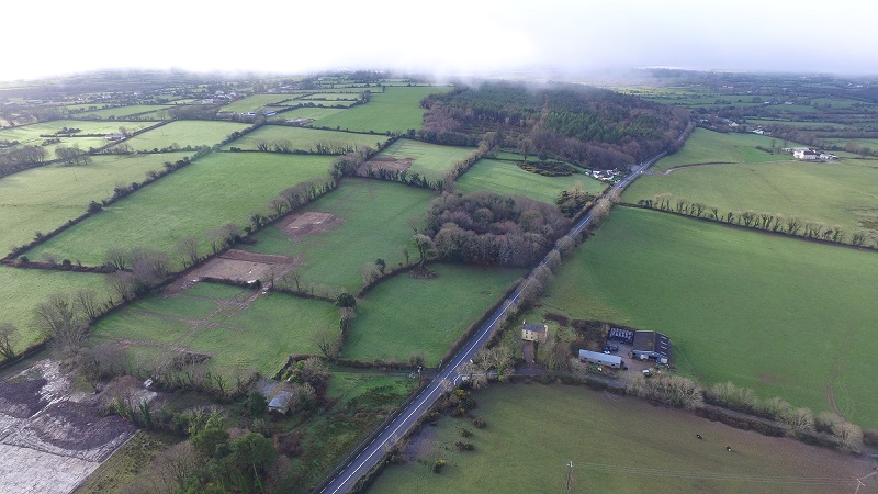
Kilcolman 1–3 & 5 were excavated in advance of the construction of the proposed N70 Kilderry Bends Road Improvement Scheme, between Milltown and Killorglin, Co Kerry. The sites were identified during Stage (i)a Test Excavations by Archaeological Management Solutions during September 2017 (17E0442) and were subsequently excavated between 21 November and 12 December 2017. A total area measuring 189 m2 was stripped at Kilcolman 1, 1,052 m2 was stripped at Kilcolman 2, 559 m2 was stripped at Kilcolman 3 and 2,190 m2 was stripped at Kilcolman 5.
The road scheme consists of the realignment of the N70 road between Milltown and Killorglin. The realignment links to the N70 on the western edge of Milltown and then heads west towards Killorglin. The first part of the realignment runs to the south of the existing road, it then climbs to the south-west to Kilderry Wood. Passing over a hill crest in Kilderry Wood, the proposed route descends gently to the south-west into the Maine Valley at Kilderry North. The route rejoins the existing N70 road just south of Tinnahally Crossroads.
Kilcolman 1 (481838, 600245) was located just west of the village of Milltown and Lissaniska ringfort (KE047-054), on flat poorly-drained land used for grazing. It was situated between two earthen banks within a long avenue associated with Lissaniska Lodge, shown on the first edition Ordnance Survey map of 1846 (surveyed 1840) and connected with the Godfrey estate. The remains of a burnt mound or fulacht fiadh were represented by an irregular-shaped spread of heat-shattered stone (predominantly limestone) in a charcoal-rich matrix, measuring a maximum of 8m north-south by 5m and 0.33m in thickness, overlying an oval-shaped trough, which measured 1.85m east-west by 1.24m and 0.44m in depth. The trough had a sharp break of slope at the top with gradually sloping sides to an uneven base and contained a 0.44m thick primary fill (C418) and a 0.21 m thick secondary fill (C417). A sample from the primary fill contained low levels of alder, hazel, oak and willow charcoal, with a 0.25g fragment of hazel returning a 2-sigma calibrated date range of 1493–1288 BC (3124±35 BP; UBA-41832), indicating a Middle Bronze Age date.
This feature was cut by two parallel north-west to south-east running ditches set approximately 2.8m apart and measuring 1.55–1.92m in width and 0.4–0.42m in depth. The northern extent of C412 had a stone-facing (C419) on the western side, consisting of a single course of large angular and sub-rounded stones extending for a length of c. 4.5m, a width of c. 0.4m and a height of c. 0.6m. At the southern end an irregularly-shaped, compact metalled surface partially overlay ditch C412. It measured 4m in length (north-west/south-east) by 2.2m and 0.18m in thickness and consisted of frequent angular and sub-angular stones. It most likely represented the remains of a road or boreen surface within the avenue or access to a gateway leading into the fields to the east. Agricultural furrows were also exposed, with those orientated north-north-west/south-south-east (C406, C407 and C413) appearing to post-date those orientated north-east/south-west (C405, C408 & C410), all probably representing 18th- or early 19th-century horse-drawn ploughing.
Kilcolman 2 (481755, 600184) was located in the south-east corner of a field of low grassland sloping slightly from west to east adjacent to the field boundary between Fort Agnes (KE047-053) and Lissaniska (KE047-054). A sub-rectangular-shaped pit (C135) with an adjacent charcoal-rich deposit (C126) was uncovered in the northern end of the site. The pit measured 0.8m in length (east-west), 0.64m in width and 0.29m in depth with a gradual break of slope at the top and steeply sloping sides to a concave base. It contained three fills (C136, C127 & C138) that had low levels of charcoal, with oak the only wood species identified. The adjacent deposit was sub-rectangular in plan, measured 2m in length (north-east/south-west), 0.8m in width and 0.05m in thickness and contained a high quantity of oak charcoal with smaller amounts of ash and hazel. A 0.03g fragment of hazel returned a 2-sigma calibrated date range of cal. AD 1018–1154 (967±27 BP; UBA-41833), indicating an early medieval date. Approximately 24m to the south-east of this pit and deposit were a further two deposits (C105 & C106) that may have been contemporary, although they only included low levels of oak charcoal. C105 was oval in plan, measured 1m in length (north-east/south-west), 0.8m in width and 0.05m in thickness and C106 was circular in plan, measured 0.65m in diameter and 0.03m in thickness.
An east-north-east/west-south-west running ditch (C104), extending across the southern end of the site, represented the northern limit of a planted tree-belt illustrated on the first edition OS map of 1846 (surveyed 1840) and forming part of the Godfrey estate. This ditch was exposed for a length of 28m, measured 1.2m in width, 0.1m in depth, had a gradual break of slope at the top, gradually sloping sides to a flat base and a fill (C120) of mid-dark brown silty clay that included round stones, a small fragment from a clay pipe stem (17E0538:120:1) and a base sherd of stoneware (17E0538:120:2), possibly from a preserve jar of later 19th-century date. Cartographic evidence indicates that this tree-belt was only demolished sometime after the late 1930s, perhaps during land clearance. This ditch was cut by two parallel north-north-west/south-south-east running drainage ditches (C128 & C129) set 1.85m apart and located beneath a field boundary extant at the time of excavation. Four post-holes (C134, C139, C140 & C141) extending parallel to the western side of the eastern drainage ditch most likely represented an old fence line, probably contemporary with the drainage ditches. One of the post-holes (C134) contained a small body sherd of black-glazed earthenware (17E0538:130:1), from a small jar of 18th–19th-century date, representing a residual inclusion. Based on the cartographic evidence, it is likely that these drainage ditches are at least mid-20th century in date, perhaps flanking an earlier iteration of the field boundary bank that was extant at the time of excavation. Agricultural furrows were also exposed, with those orientated north-east/south-west (C103, C107–C116 & C125) and west-north-west/east-south-east (C121) appearing to post-date those orientated north-west/south-east (C117–C119 & C122–C124). The width and regular spacing suggests they may represent machine ploughing, although horse ploughing cannot be ruled out, and at least some of the furrows are late 20th century in date.
Kilcolman 3 (481675, 600168) was located west of Kilcolman 2, midway along the southern boundary of the same field on the eastern slope of a north–south ridge, with Fort Agnes to the north. The earliest features may be represented by up to four pits (C12, C24, C36 & C47) and four post-holes (C40, C42, C49 & C56), however this interpretation is tentative as it is based on just one radiocarbon determination from one pit (C24) where a 0.06g fragment of Maloideae charcoal returned a 2-sigma calibrated date range of AD 1040–1207 (901±26 BP; UBA-41834), indicating early medieval activity. One of these pits (C12), which contained inclusions of heat-fractured limestone, also pre-dated a series of north-east/south-west agricultural furrows (C04–C06, C08–C11, C13, C15, C17 & C20), which in turn were cut by a ditch (C07) representing the boundary for a plot associated with a vernacular structure. The furrows were set c.1.78m apart and appeared to be evidence of 18th-century ploughing pre-dating the vernacular structure. This cottage is not indicated on historical OS maps, which suggests that there was no above-ground expression of this site by the middle of the 19th century (1840). The site may have been intentionally cleared during the early 1800s, perhaps when the nearby Fort Agnes and surrounds within the Godfrey estate were being landscaped. The vernacular structure (C21 & C44) was orientated north-east/south-west and the surviving remains measured approximately 7.2m in length by 4m in width and included a stone-lined fireplace (C29) in the south-western wall. This hearth contained four sherds (17E0538:26:1–4) of a stoneware vessel, such as a bowl or a teapot of probable early 19th-century date, one rim sherd (17E0538:26:6) from a plain glazed white earthenware cup of probable 19th-century date and a shoulder sherd (17E0538:26:5) most likely from a glass onion bottle of late 17th- to early 18th-century date. The boundary ditches (C07 & C50) associated with the vernacular structure were later cut by two roughly east–west ditches (C03 & C16). The southernmost ditch (C03) represented the same tree-belt ditch uncovered at Kilcolman 2, while the northern ditch (C16) was an 18th- or 19th-century drainage channel that was also exposed at Kilcolman 5. Overlying this drainage ditch was a spread of stones, most likely representing the remnants of field clearance, that included an unfinished spindle whorl (17E0538:19:1) of unknown date.
Kilcolman 5 (481556, 600126) was located in the south-east corner of the field west of Kilcolman 2 and 3, where the ground sloped from south to north. The earliest phase comprised Early–Middle Neolithic occupation in the form of two pit clusters, with associated radiocarbon dates falling within the late 37th to early 34th centuries BC. The northern pit cluster included seven pits (C323, C377, C381, C383, C384, C386 and C396) and possibly a post-pit (C374) with associated post-hole (C363), a stake-hole (C395) and a deposit (C394), while the southern cluster, located 16m to the south-east, consisted of six pits (C353, C354, C355, C359, C360 and C361). Two worn sherds of carinated bowl pottery (17E538:328:1–2), probably from a single vessel, were recovered from one of the pits (C384) in the northern cluster, with a 0.23g hazelnut shell fragment from the same fill returning a 2-sigma calibrated date range of 3628–3358 BC (4664±46 BP; UBA-41837). In the southern cluster, one pit (C361) contained a small, circular, centrally-perforated shale bead (17E0538:364:1), with a 1.24g hazelnut shell fragment from the same fill returning a 2-sigma calibrated date range of 3639–3379 BC (4754±40 BP; UBA-41835) and another pit (C353) included a sandstone rubbing/hammer stone (17E0538:305:1). Charred hazelnut shells and whole nuts were commonly found across all pits and the charcoal assemblage was dominated by oak with smaller amounts of hazel and birch and occasional inclusions of willow, holly and pomaceous fruitwood. A further seven pits (C352, C366, C367, C368, C371, C372 and C389) were outside of these clusters and remain undated, but at least some may relate to a stake-hole (C378) in the south-western corner of the site where a 0.06g fragment of hazel charcoal returned a 2-sigma calibrated date range of AD 80–227 (1862±28 BP; UBA-41836), indicating some Late Iron Age activity. Alternatively, other pits might be connected to a disturbed charcoal-rich deposit (C318, C326 & C382) that included burnt bone (cattle and sheep/goat) and a small amount of charred oat and barley, with a 2.5g fragment of burnt bone (a rib fragment unidentifiable to species) returning a 2-sigma calibrated date range of AD 1411–1442 (495±20 BP; UBA-41838), indicating additional activity in the later medieval period.
This later medieval deposit was truncated by an east–west ditch (C365) that represents the same drainage channel identified at Kilcolman 3. The fills included 31 sherds of glass (17E0538:330:1–31), most likely from at least two late 17th- to mid-18th-century ‘onion’ bottles, and a decayed iron object (17E0538:370:1). This ditch was cut by an north-north-east/south-south-west ditch (C338), which in turn was cut by three parallel north-north-west/south-south-east ditches (C333, C337 & C357). A sixth ditch (C351) was orientated north-east/south-west and had no direct stratigraphical relationship with any of the other ditches, but based on the similarities between its upper fill and the fill of a nearby ditch, may be early in the sequence. A small chert flake (17E0442:24:1) was recovered from the upper fill of this ditch during Stage (i)a testing and most likely represents a residual find from the Neolithic occupation of the site. All of these ditches may indicate additional phases of 18th- or 19th-century drainage, although it is also possible that some are the remains of hand-excavated plough furrows or potato ridges. Indeed, agricultural furrows were also exposed, the majority of which were orientated north-west/south-east (C331, C332, C334–C336, C339–C342, C344–C347 & C349), some of which post-dated at least one west-south-west/east-north-east furrow (C343), all probably representing 18th- or 19th-century horse-drawn ploughing.