2018:451 - Grousemount Wind Farm, Grousemount, Ballagh, Knocknaruddig and Gortlahard, Kerry
County: Kerry
Site name: Grousemount Wind Farm, Grousemount, Ballagh, Knocknaruddig and Gortlahard
Sites and Monuments Record No.: N/A
Licence number: 16E0127 ext.
Author: David Murphy
Author/Organisation Address: John Cronin and Associates, 3 Westpoint Business Centre, Ballincollig, Cork
Site type: Monitoring and testing
Period/Dating: —
ITM: E 509800m, N 569900m
Latitude, Longitude (decimal degrees): 51.873983, -9.309964
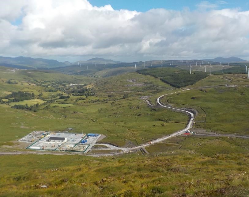
The archaeological mitigation programme undertaken by John Cronin & Associates (JCA) at the Grousemount Wind Farm development site continued throughout 2018. This entailed the completion of Phases 3 and 4 of testing as well as the undertaking of a watching brief of groundworks which ensured a constant archaeological presence was maintained at the development site.
Phase 3 of the testing programme commenced on 20 October 2017 and continued on an intermittent basis until 13 February 2018. Phase 3 comprised testing of the centre-line (or closest possible alignment thereof) of the main wind farm access road which extends from the SID entrance at Sillahertane (to the north-east of the Roughty River) (approx. ITM 508641, 572541), south-westwards and upslope as far as the previously tested Barnastooka element of the project (approx. ITM 507025, 571503), a distance of c.2.4km. As the final c.400m of the new access road follows the line of an existing farm track which cuts into the surrounding hillside, it was not considered necessary to test this portion of the route. As a result, approximately 2000m of 1.8m-wide linear test trench was excavated along the centre-line of the route of the c.5m wide new access road. Phase 3 also comprised the testing of the new site compound location in Coolnagoppoge townland (approx. ITM centre-point 508416, 572273). Three 120m long and 1.8m wide test trenches, spaced 20m apart, were excavated along the long axis (orientated north-east to south-west) of the new compound location. In general, the stratigraphy revealed consisted of c.0.3-1m of dark brown to black peat overlying varying colour stony, clayey silts. No artefacts, features or deposits of archaeological significance were revealed during Phase 3 testing at the Grousemount wind farm development site.
Phase 4 of the testing programme at Grousemount Wind Farm was undertaken between 9 and 12 April 2018. Phase 4 testing comprised the excavation of a 1.8m wide centre-line trench along the route of the proposed main wind farm spine road in portions of Cummeen Upper and Knockanruddig townlands, between approx. ITM grid co-ordinates 505836, 570907 and 506656, 570750. A total distance of c.920m was tested before trenching was terminated due to inaccessible terrain. Ultimately, no further testing was undertaken beyond this point due to factors such as excessive peat depths, inaccessible terrain and environmental, logistical and safety concerns. No artefacts, features or deposits of archaeological significance were revealed during Phase 4 testing at the Grousemount wind farm development site.
Monitoring of groundworks at the Wind Farm site commenced in January 2018 and continued throughout the year. The stratigraphy observed in the areas of excavation varied depending on the location within the site. In the lower lying areas of improved pasture in the north of the wind farm site 0.2-0.7m of peaty clay overlay a mix of light grey, brownish grey and yellowish grey sandy, clayey silt with frequent inclusions of varying sized glacial stones and frequent outcrops of sandstone bedrock. In the upland areas of the site, peat depths generally corelated with the gradient of the ground. In some level areas, for example adjacent to River Crossing 26, in the vicinity of T.22 or along the access spur to T.09, peat cover was sometimes over 2.5m in depth. Alternatively, in areas of steeper gradient, such as the main spine road between River Crossing 24 and Junction 06 or along the high ridge between T.19 and the proposed BP-E location, rock outcropping was far more prevalent and there was often only a residual covering of peat (0.3m or less). The underlying subsoil generally comprised a mix of stony, clayey silts and sandstone bedrock. The colouration of the stony, clayey silts generally varied from light brownish grey to purplish grey to reddish brown.
As a result of the daily on-site archaeological presence required to undertake the monitoring and watching brief programme, an additional 35 sites of archaeological/cultural heritage interest (designated Newly Identified Cultural Heritage Sites 13 to 47 (NICH13 to NICH47)) were identified within, or immediately adjacent to, the development land take. In the case of the majority of newly identified sites (mainly hut sites and post-medieval agricultural features), the establishment of a fenced 20m radius protective zone or the erection of development boundary fencing provided the necessary level of archaeological mitigation and protection as these sites were not located in the immediate vicinity of construction zones (i.e. within 20m). However, three of the sites identified were located in positions where additional mitigation was required. Mitigation in the form of access track realignment and protective zone establishment allowed for two of the three sites (NICH20 (sub-rectangular drystone enclosure) – T.07 access spur and NICH28 (oval drystone enclosure) – T.21 access spur) to be preserved in situ.
However, a concentration of loose, dry stones, originally tentatively interpreted as a possible collapsed hut site, which was discovered at the south-western end of the T.32 hardstand, was situated in a position where it could not be avoided by wind farm construction works and, as such, preservation in-situ was not feasible. Following consultation with ESBWDL and subsequent to the approval of NMS, excavation (under licence 18E0324) of the feature was undertaken. During the excavation it became apparent that the concentration of dry-stones revealed at surface level was in fact the upper portion of a substantially larger cairn. Following further consultation and approval from the NMS, the cairn was fully excavated and thereby preserved by record. Excavation revealed the cairn to be a burial cairn containing a small sub-rectangular cist of Bronze Age ‘short cist’ type, see entry for 18E0324 for a summary of the findings of the excavation.