2018:351 - TUAR SÁILÍN (Toorsaleen), Kerry
County: Kerry
Site name: TUAR SÁILÍN (Toorsaleen)
Sites and Monuments Record No.: KE081-065
Licence number: 18E0280
Author: Tony Miller
Author/Organisation Address: Tooreen, Dunmanway, Co. Cork
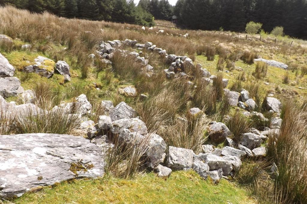
Site type: Enclosure and Field system
Period/Dating: Multi-period
ITM: E 461750m, N 579915m
Latitude, Longitude (decimal degrees): 51.954119, -10.011423
A monitoring condition was put onto the afforestation grant for c.35ha of land at Tuar Sáilín, to the east of Dromud. A cluster of hut sites had been recorded to the north of the perimeter and a cairn and enclosure within the planting area were to have buffer zones established around them. During the monitoring a c.40m length of relic field boundary was discovered at the extreme northern edge of the area (KE081-065). This, as well as the other new monuments recorded, have been submitted to the Survey database and given RMP codes, where a fuller description can be found. While supervising the buffer zone around the enclosure at the centre of the site and on either side of the main access track, it was discovered that it was part of a much larger complex including two areas of field systems (KE081-063001 & 066), three more enclosures (KE081-063 & 067 & 068) and a hut site (KE081-069). The field boundaries especially were pre-bog formation and were partially buried in the peat. These monuments covered such a large area that it was removed completely from the area to be planted.
Monitoring the rest of the site revealed very little as the ground was just notched with a v-shaped blade and no drains were permitted to be dug. In general the land consisted of bog with some considerable depth in places with some areas of exposed rocks. It was only along the southern boundary, adjacent to the public road, that there were any improved fields.
The whole land was south-facing and close to the head of a large, broad valley with views to the west of Bolus Head and Balliskellig Bay.