2018:835 - OLDTOWN (Phase 5), Rathbeal, Swords, Dublin
County: Dublin
Site name: OLDTOWN (Phase 5), Rathbeal, Swords
Sites and Monuments Record No.: N/A
Licence number: 17E0446
Author: Kim Rice, Courtney Deery Heritage Consultancy
Author/Organisation Address: Lynwood House, Balinteer Rd, Dublin 16
Site type: Excavation - miscellaneous
Period/Dating: Multi-period
ITM: E 716300m, N 748700m
Latitude, Longitude (decimal degrees): 53.475475, -6.248029
Oldtown, Phase 5 is located in the townland of Rathbeal, Swords, County Dublin. The site, which encompasses a total area of 14.5 acres, lies to the north-west of the Applewood Community Centre and Swords Educate Together, and to the north of the Rathbeale Road (R125). The grounds to the west are occupied by large tillage fields, while those to the east comprise the residential estates of Castleview and Ashtown. The Broadmeadow River is situated 500m due north, the village of Swords is c. 2.5km to the south-west and the Malahide Estuary lies c. 3km to the east-south-east.
Several archaeological assessments have been undertaken within the Phase 5 lands. A geophysical survey was carried out by Target Archaeology in 2011; however, the findings were largely inconclusive. The site was archaeologically tested by Gill McLoughlin in September 2017. Twelve test trenches were excavated, which uncovered two areas of archaeological potential, as well as numerous modern field drains and agricultural features. Archaeological monitoring was carried out of topsoil stripping between July and August 2018. Two zones of archaeological potential were exposed, comprising Areas 1 and 2.
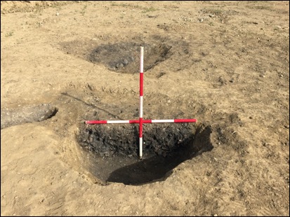
The features were excavated over six weeks in September and October 2018. The remains in Area 1 consisted of an inurned burial, two cremation pits and a post-medieval field drain, as well as a large water pit found in association with a burnt spread and three troughs. The Area 2 features comprised five pits with burnt stone fills, three other pits with charcoal-rich fills, three grain-drying kilns and three drainage ditches.
The prehistoric remains included the two Middle Bronze Age cremation pits and the Middle to Late Bronze Age urn burial in Area 1, while the burnt spread, troughs and water pit that were investigated to the south-west also dated to the Bronze Age. The cluster of pits with burnt stone fills from Area 2 similarly derived from the Bronze Age period. The remaining pits are as yet undated.
The three grain-drying kilns dated from the Iron Age to the early medieval period. One of the kilns produced sherds of Beaker pottery; however, the ceramics were residual. The drainage ditches were indicative of post-medieval agricultural land improvements.
The finds from the excavation included the aforementioned Chalolithic, Middle and Late Bronze Age ceramics. An assemblage of chipped stone was also recovered, which incorporated flint, silicate, quartz, rock crystal, limestone and sandstone artefacts. Furthermore, a small assemblage of medieval and post-medieval pottery was collected from the plough soil.