2018:165 - DUBLIN: Former Military Barracks, Infirmary Road, Dublin
County: Dublin
Site name: DUBLIN: Former Military Barracks, Infirmary Road
Sites and Monuments Record No.: N/A
Licence number: 18E0402
Author: Antoine Giacometti, Archaeology Plan
Author/Organisation Address: 32 Fitzwilliam Place Dublin 2
Site type: Barracks
Period/Dating: Modern (AD 1750-AD 2000)
ITM: E 713546m, N 734580m
Latitude, Longitude (decimal degrees): 53.349238, -6.294578
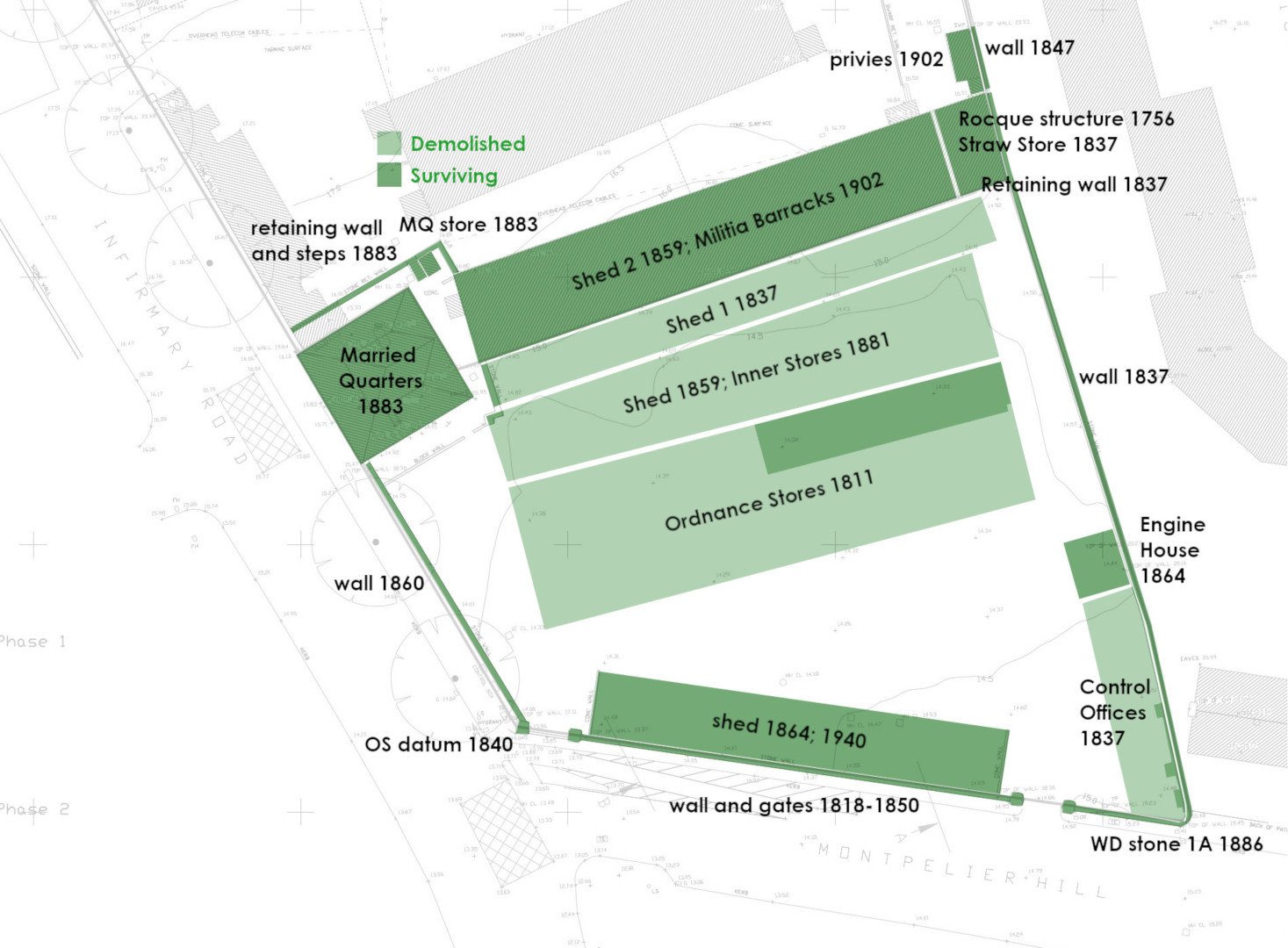
Two phases of engineering test pits were monitored at a former Department of Defence Site on Infirmary Road, Dublin 7. The work took place at the southern end of the site, just off Montpelier Hill. The site comprises a complex of disused military buildings enclosed by a masonry wall. Test-trenching carried out here in 1993 (Hayden 93E0063, excavations.ie ref. 1993:077) identified no archaeological remains.
The 2018 monitoring identified the foundations and cellar of the Ordnance Stores, an imposing building constructed in c. 1811 as a military store, and subsequently expanded over the course of the 19th century and early 20th century, until its destruction by fire in 1983. Evidence for scarping of the western half of the site allowed for the phasing of the boundary walls and gates of the site, which date from the beginning of the 18th century to the mid-19th century. A War Department boundary stone and Ordnance Datum were also identified. Evidence for an earlier structure was identified at the western end of the Militia Stores, which may be the field or gate structure depicted of Rocque’s map of 1756, perhaps incorporated into the ‘Straw Store’ in 1837.

