2018:164 - DUBLIN: 25–26 Usher’s Island and Island House, Island Street, Dublin
County: Dublin
Site name: DUBLIN: 25–26 Usher’s Island and Island House, Island Street
Sites and Monuments Record No.: DU018-020-264
Licence number: 18E0355
Author: Antoine Giacometti, Archaeology Plan
Author/Organisation Address: 32 Fitzwilliam Place Dublin 2
Site type: Water mill - unclassified
Period/Dating: Modern (AD 1750-AD 2000)
ITM: E 714255m, N 734260m
Latitude, Longitude (decimal degrees): 53.346211, -6.284050
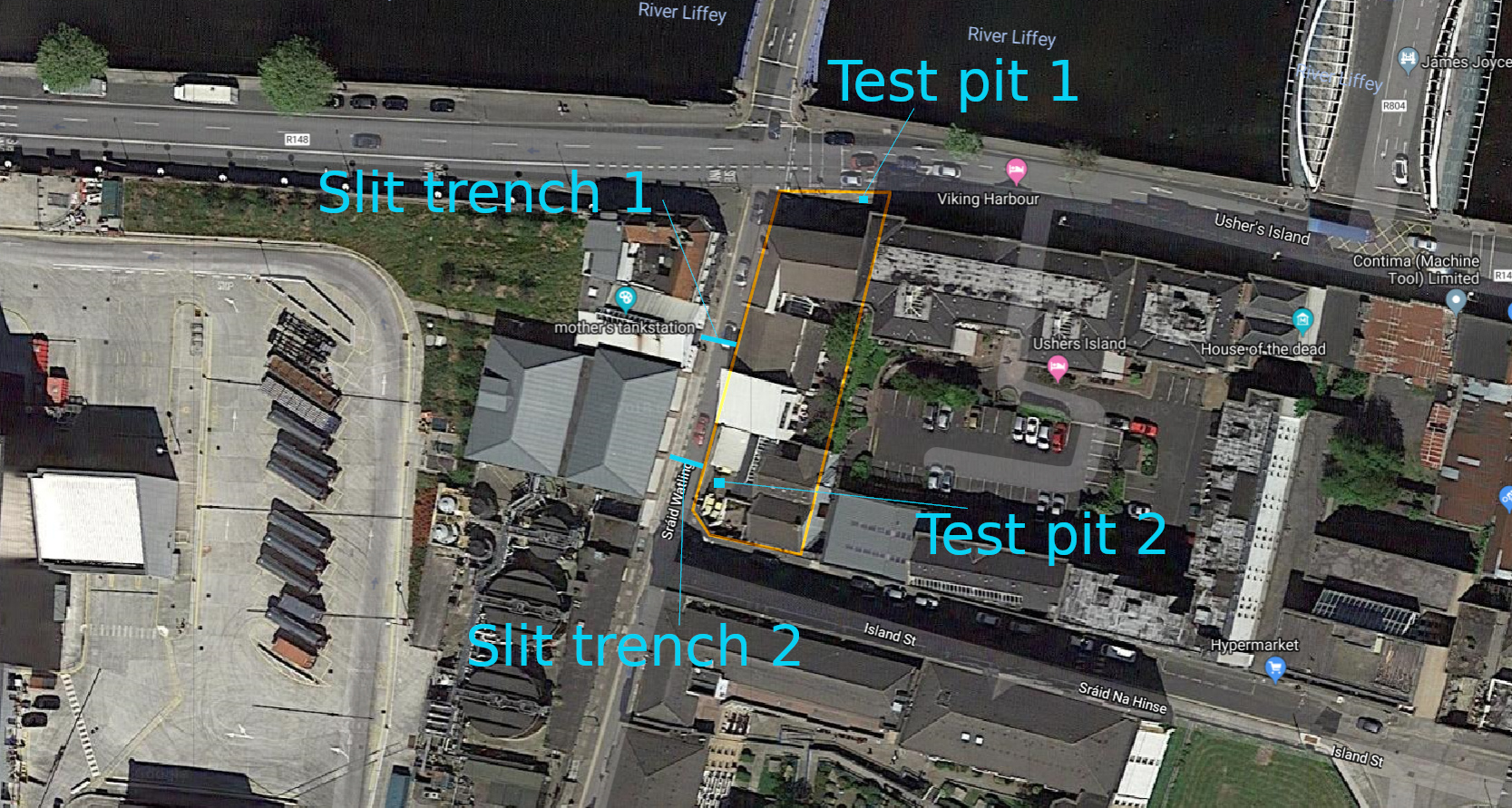
Monitoring of engineering ground works was carried out at 25-26 Usher’s Island and on Wattling Street, Dublin 8. The development site contains a watermill (DU018-020-264) known in the 19th century as Usher’s Flour Mill. The watermill was almost certainly in use by the mid-18th century based on cartographic evidence, but there is no evidence for its existence before 1697. It remained in use into the 20th century.
The watermill (Usher’s Mill is among its various names) was in use on the site during the mid-19th century based on primary historical references and cartographic depictions, and elements of the watermill complex survived into the 20th century based on contemporary accounts. Excavations in the Guinness complex directly west of the proposed development identified the associated millrace, which was dated to the late 18th and early 19th century. The watermill was almost certainly in use by the mid-18th century based on cartographic evidence, but despite a tentative suggestion by De Courcy (1996, p. 414), there is little evidence for its existence before 1700 other than a single reference from 1697 (Gilbert, p 275: ‘the mill-race at Bloody Bridge’).
A test-pit in the north of the site, on Usher’s Island, identified layers of 17th-, 18th- and early 19th-century dump deposits at between between 3m and 0m OD. These appeared to be primarily made up of horse manure, but also containing the contents of cesspits and rubbish heaps. Similar material has been identified in adjacent sites, and it is associated with the development and construction of the quays. Slit trenches across Wattling Street encountered a thick slab of concrete directly under the road surface and were abandoned.
References
De Courcy, J. 1996 The Liffey in Dublin. Gill and Macmillan: Dublin. Reference on page 414.
Gilbert, J.T. (ed.) (1889–1922) Calendar of the Ancient Records of Dublin, 19 vols., Dublin. Volume 6, p. 275.