2018:281 - KILWARLIN MORAVIAN CHURCH, Down
County: Down
Site name: KILWARLIN MORAVIAN CHURCH
Sites and Monuments Record No.: DOW014:004
Licence number: AE/18/178
Author: Colin Dunlop
Author/Organisation Address: 638 Springfield Road, Belfast, BT15 3JJ
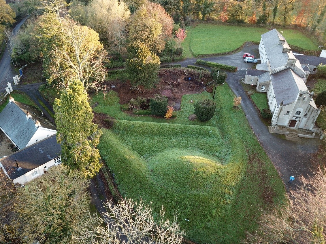
Site type: Designed landscape - formal garden
Period/Dating: Modern (AD 1750-AD 2000)
ITM: E 720894m, N 858883m
Latitude, Longitude (decimal degrees): 54.464031, -6.135185
While there are a number of parklands laid out in Battle Formations in Ireland (eg. Lyons, Co. Kildare) this site consists of the only ‘Battle Garden’ in Ireland, and the only known battle garden in the world to reference Thermopylae. The Northern Ireland Sites and Monuments Record (NISMR) records the gardens as landscape feature DOW014:004, stating: “In the churchyard of Kilwarlin Moravian Church, the feature was built c. 1755 by the original Greek Moravian pastor who constructed it as a representation of the site of the Battle of Thermopylae between the Greeks & Persians in which a small number of Greeks (Spartans) held off a much larger Persian force at the Pass of Thermopylae. The feature is roughly C-shaped c.25m NW–SE x 20m NE–SW. The open end of the C is partly blocked by a bank & its arms rise to meet at c.2.5m high.” The date listed for the landscape feature in the NISMR is inaccurate, as a date of 1755 would have the gardens built 41 years before the Greek Moravian pastor was born. The 1755 date refers to the original Moravian church and manse on this site. Documentary evidence suggests garden work started in 1839 and was largely completed by 1841.
The investigations included digital surveying of the gardens, identifying and recording any upstanding archaeological features, and undertaking four test trenches which were manually excavated to determine the fabric and composition of several of the garden features.
The trenches excavated though two of the mounds, which make up the main landscaping features, and found them to be comprised entirely of topsoil. The location of the summer house was identified through discovery of its brick floor. Pea gravel encountered in two of the trenches confirmed the former existence of paths which are visible on the Ordnance Survey 2nd edition mapping, and on contemporary illustrations. The pond which formerly contained a fountain was not examined during this phase. Therefore, it is not possible to ascertain whether elements of the fountain survive within the base of the pond. Within the garden a chimney pot, which formerly topped the manse, has been embedded within concrete. Within its base lies an up-turned metal bowl which may be part of a jardinière which once surmounted the Omega flower bed (noted on contemporary illustrations).
There was no archaeological evidence for the other 22 Greek Alphabet flowerbeds which documentary evidence suggests were formerly present within the gardens.