2018:273 - CARRYDUFF: Baronsgrange, Comber Road, Down
County: Down
Site name: CARRYDUFF: Baronsgrange, Comber Road
Sites and Monuments Record No.: N/A
Licence number: AE/18/56
Author: Stuart Alexander
Author/Organisation Address: 638 Springfield Road, Belfast, BT12 7DY
Site type: Excavation - miscellaneous
Period/Dating: Multi-period
ITM: E 737350m, N 865666m
Latitude, Longitude (decimal degrees): 54.520754, -5.878376
The site was located on the east side of the modern suburb of Carryduff, approximately 10km south of the centre of Belfast. The development area is situated on a low drumlin with ground sloping off in all directions. There are excellent views to the south, west and east. The view towards Belfast in the north is obscured by a slightly larger drumlin that has previously been developed.
Initial test trenching and topsoil strip revealed three areas of interest:
Area 1: was located at the south-east corner of the site in a flat area at the base of the slope. Previous investigation of this location had uncovered part of a ring ditch. The eastern extent of this was found along with other pits, post-holes, spreads and a small burnt mound trough (c. 1.9m long by 1.6m wide 0.39m deep). Struck flints were uncovered from features in this area. The ring ditch would have had an original diameter of approximately 5m and was dated to 848–792 cal. BC. The burnt mound trough returned a radiocarbon date of 2573–2465 cal. BC.
Area 2: Located on the southern slope of the drumlin, two irregular subsoil-cut features were uncovered, both contained post-medieval pottery. This area was deemed non-archaeological upon further topsoil stripping.
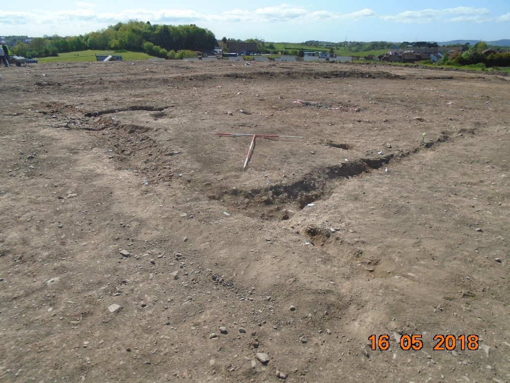
Area 3: The archaeology was found on the top of a drumlin and comprised three phases of activity, Neolithic, Iron Age and early medieval.
The Neolithic archaeology comprised a c. 17m diameter ‘C’-shaped enclosure which partially encircled the summit of the hill, and a small number of associated pits. The enclosure was dated to the early part of the Middle Neolithic, 3629–3588, 3530–3489 and 3471–3372 cal. BC. It had two entrances, one small gap on the north-west and a large terminus on the south-east; these may have aligned with the winter solstice. Sherds of Neolithic carinated bowls and Neolithic worked flint were recovered from pits around the edges of the enclosure. One of these was dated to 3335–3211, 3193–3151, 3139–3078 and 3073–3024 cal. BC.
The Iron Age archaeology comprised two 11m diameter penannular gullies (which have been interpreted as the remains of either a large building with two rooms or separate buildings) and a 5m diameter post-built structure and associated hearth. Due to the lack of post- and stake-holes and the shallow and ephemeral nature of the penannular gullies, it is thought that rather than having a structural function they acted as culverts channelling rainwater. If we consider that there may have been approximately 0.5–1m between the drip gullies and the walls, this would have allowed for two structures approximately 9m in diameter. A radiocarbon date from the single fill of one of the penannular gullies returned a result of 365–193 cal. BC; the post-built structure was dated to 206–52 cal. BC.
The early medieval archaeology comprised a series of gullies and post-holes which formed a c.10m long and 7m wide rectangular house. The house was dated to cal. AD 669–771.