2018:931 - N22 BAILE BUIRNE TO MACROOM, Killaclug 4, Cork
County: Cork
Site name: N22 BAILE BUIRNE TO MACROOM, Killaclug 4
Sites and Monuments Record No.: N/A
Licence number: E004946
Author: Siobhan McNamara, TVAS (Ireland) Ltd
Author/Organisation Address: Ahish, Ballinruan, Crusheen, Co. Clare
Site type: Watercourse
Period/Dating: Post Medieval (AD 1600-AD 1750)
ITM: E 529815m, N 573917m
Latitude, Longitude (decimal degrees): 51.912963, -9.020162
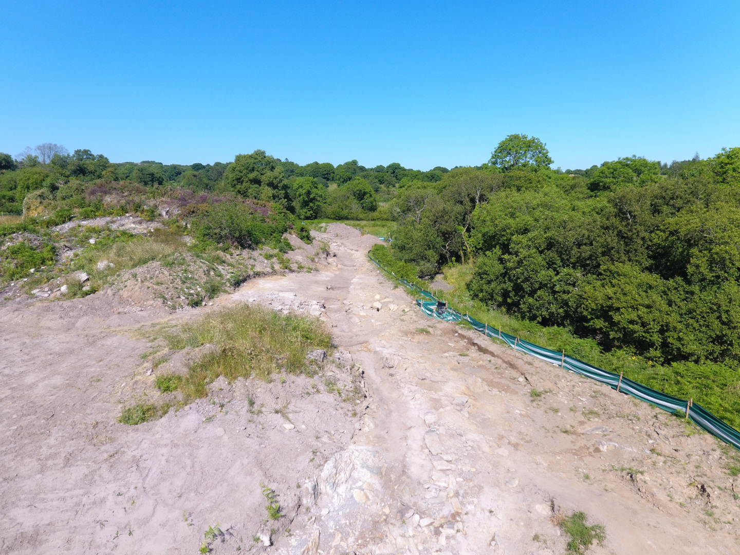
Killaclug 4 was located on the proposed N22 Baile Bhuirne to Macroom Road Project (Lot 2). The site lay in a large rough field partly on the Foherish River flood plain but rising steeply to the north to a high rock outcrop. The site itself was on the northern bank of the river and followed the natural curved shape of the river channel.
The excavated features represent the remains of a contour leat. A contour leat is characterised as an artificial watercourse built to follow the natural contour of the terrain to supply water by gravity to a destination, and in this case it appeared to relate to the multi-phase mill complex at nearby Killaclug 1 & 2 (E004944). Although the leat could not be directly dated, the earliest mill at Killaclug 1 & 2 appears to have been constructed in the 16th century, if not before, and there were mills in operation on the site through to perhaps the later 18th century. The contour leat at Killaclug 4 may therefore represent the earliest known remains of such a feature recorded in Ireland.
The contour leat was a cut and built feature which extended from the north-east end of the site at the river, to the west where it continued beyond the limit of excavation beneath powerlines and into an area that had been disturbed. The leat, which was 187m long within the site, was created using several construction techniques, depending on its relationship to the river. Whilst the leat maintained an almost constant level, following the same contour around the hillside, the river level dropped sharply over the same distance. This meant that whilst, at the east, the leat was on the river bank, at the west it was at least 2m above the river edge.
It is assumed that the leat continued westwards beyond the excavated area of this site, curving around another rock outcrop, disturbed during site clearance works, into the adjacent field where it was excavated within site Killaclug 1 & 2. Here the leat followed the same contour around the hillside in a terraced cut and the water was again presumably carried in a wooden aqueduct to the top of the mill. The total length from river to mill would have been approximately 375m.
The most important factor in the function of a contour leat is the level of the base of the channel, which dictates the direction and speed of water flow. The leat at Killaclug was therefore carefully surveyed and it was seen that over the 187m length of the feature on the site that there was a height difference of 0.6m from the base of the water level at the north-east by the river (height of 81.62m OD) to the west (81.02m OD). Within Killaclug 1 & 2 to the west the leat was fairly level and immediately above the mill; the base lay at 81.08m OD, meaning that there was a drop of almost 0.6m over the 375m length of the leat, a gradient of 1/625 or 0.16%.
At the eastern end a stone embankment formed the southern side of the leat, whilst the northern edge was bedrock. In the central part of the site, further from the river, the leat was set into a cut that was terraced into the hillside, whilst at the west a stone revetment was built to protect the leat above flood level. The leat channel, i.e. the part through which the water flowed, varied in character. At the west it was a cut feature, whilst at the east it occupied the gap between the cut or bedrock on the north and the stone embankment on the south. The channel, as it survived, varied in width from 1.33m to 2.6m and the surviving depth was 0.1-0.68m, being wider and deeper at the east. At the extreme north-east the channel widened dramatically to 5m where it was positioned against a large sloping sheet of bedrock. In profile, the leat channel had moderate to steep sloping sides with a roughly flat base. The profile was slightly different at the west of the site where there was a steep sloping side terraced into the hillside with a revetted edge towards the river.
At the north-east, the leat was fairly straight and built on the flat flood plain of the river where it was contained by the stone embankment. Westwards of the end of the embankment the channel was cut into subsoil, and in one location into bedrock. The leat followed the natural contour of the hillside around a rock outcrop and continued westwards across the side of the hill, where it was set into a terraced cut in the hillside. Without a stone-lined embankment here it would appear that the water was directed through a wooden aqueduct, although no direct evidence survived. Recorded wooden millraces or leats include examples of self-supporting structures that wouldn’t necessarily have left an archaeological footprint.
The stone embankment that formed the southern edge of the leat channel at the east was made of local stone and its northern side, i.e. the internal face inside the channel, was lined in places with stone slabs to prevent water leaking out through the voids, or indeed washing in when the river flooded. The embankment, which was almost completely covered by alluvial silts and gravels prior to excavation, was investigated in a number of slots and was also partly visible on the unexcavated surface of the site. Overall the embankment was recorded for a length of 49m; it was 0.8m high and 1.5-2.2m wide at its base, narrowing to the top. It is likely that when first built the embankment was substantially taller, essentially a large stone wall that prevented flood water from entering the leat and risking damage to the mechanics of the mill. The stone used was the same material as the surrounding bedrock and the embankment was loosely constructed onto the surface of the underlying river gravel with no construction cut visible. The stones were heaped over each other rather than being laid in clear courses and there was no bonding material surviving. The shale slabs that lined the eastern end of the channel were laid at an angle against the face of the embankment and had probably been quarried from the bedrock immediately to the north.
A cobbled or compact gravel surface was recorded in the base of the leat channel. Whilst the leat was in use it would have had water flowing through it constantly, so there were no use-related fills as such. Once water was no longer flowing the leat appears to have become filled with water-deposited material, mostly silts with some gravel and occasional stones. This suggests that without management of water flow the leat did indeed flood with silty river water and that this material was able to settle and fill the abandoned feature. Unfortunately OSL dates from these silts proved inconclusive and did not provide a terminus ante quem for the use of the leat.
It is possible to see the effectiveness of the stone embankment through the types of deposits recorded at the eastern end of site. Whilst the channel fills were generally grey-brown silt with few inclusions, the deposits recorded outside the embankment consisted of numerous laminated layers of gravel and silt with inclusions of small, medium-sized and large pebbles and stones. This shows that during flood events the embankment generally prevented larger inclusions of pebbles and stone from entering the watercourse which would have threatened the valuable machinery at the mill complex at Killaclug 1 & 2.