2018:250 - SHANTRAUD, Killaloe, Clare
County: Clare
Site name: SHANTRAUD, Killaloe
Sites and Monuments Record No.: N/A
Licence number: 18E0062
Author: David Murphy
Author/Organisation Address: 3 Westpoint Business Centre, Ballincollig, Cork
Site type: Kiln, Charcoal-making site and Watercourse
Period/Dating: Multi-period
ITM: E 570190m, N 672766m
Latitude, Longitude (decimal degrees): 52.805058, -8.442108
During testing of the proposed Aldi retail store development and associated wayleave at Shantraud, Killaloe, Co. Clare, twelve 1.8m wide linear test trenches totaling 502m in length were excavated across the 1.3-hectare site. Nine trenches (Trenches 1 to 9) were excavated across the footprint of the proposed retail store and car-parking areas, three test trenches (Trenches 10, 11, 12) were excavated across areas designated as a wayleave for potential services to the east of the development site.
Potential archaeological activity was revealed within three of the twelve excavated trenches (Trenches 1, 6, 10). At the eastern end of Trench 1, at approximate ITM grid co-ordinate 570204, 672781, an elongated, keyhole-shaped feature which truncated the natural subsoil was revealed. The morphology of the feature suggests that it is a possibly a kiln.
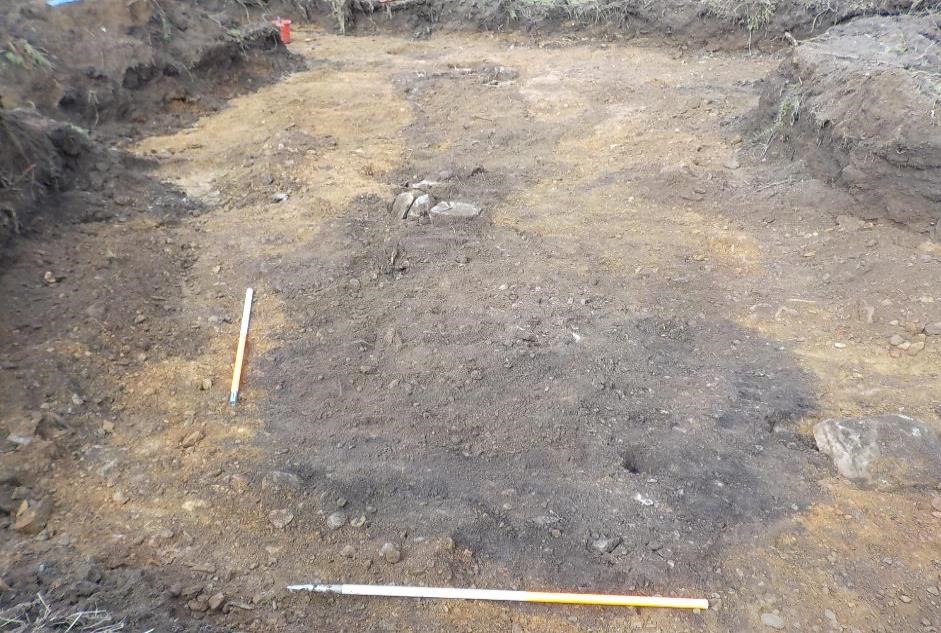
In Trench 6, c. 6m from its western end, at approximate ITM grid-coordinate 570208, 672684, a c. 7m wide spread of very dark blackish-brown silt, containing very frequent charcoal inclusions, was revealed. Further investigation of this area revealed at least three pits, one of which was subject to limited manual investigation. The assessment of this pit showed it contained stratified charcoal- and ash-rich fills and evidence of in-situ burning, indicative of a use as a charcoal-production pit. It is likely that the adjacent pit features were of similar type and that more may exist in the immediate vicinity.
In Trench 10, in the area of the proposed wayleave, an extensive spread of charcoal-rich material containing frequent inclusions of iron slag was revealed. While much of the spread of material revealed within the trench appeared quite shallow at c. 0.1m depth, limited manual investigation showed it to be increasing in depth at a number of points along the northern margin of the trench.
Linear cut features filled by both charcoal-rich material and redeposited natural extended across the trench north-west to south-east and north-east to south-west. It was not possible to interpret their function. Towards the north-east end of the trench a number of concentrations of heat-shattered stone were evident on the trench base. While this material and the charcoal- and slag-rich material is quite possibly the result of archaeological activity surrounding T.10, it must be noted that a 19th-century forge was located to the immediate north-east of the site on Abbey Street, as depicted by the 2nd edition 0.S. map. It is possible that the revealed charcoal- and slag-rich material could be dumped waste debris associated with this forge. The route of T.10 was excavated immediately adjacent to the route of an existing foul sewer, this likely caused significant disturbance in this area.
Finally, in the test trenches that dissected the route of the former mill-race channel in the southern portion of the site (Trenches 4 and 5), there was no evidence of any in-situ stone lining or architectural features. The backfilled soils within the channel contained much 20th-century debris.
Excavation of features which could not be preserved in-situ was undertaken in June 2018, see entry 2018:134 for details.

