2017:126 - RATHCORAN, Wicklow
County: Wicklow
Site name: RATHCORAN
Sites and Monuments Record No.: WI027-026001
Licence number: E004867: C817
Author: Alan Hawkes (Hawkes Archaeological Services)
Author/Organisation Address: 'Melrose' 5 Palmbury, Togher, Cork
Site type: Hillfort
Period/Dating: Iron Age (800 BC-AD 339)
ITM: E 688429m, N 689392m
Latitude, Longitude (decimal degrees): 52.948026, -6.684173
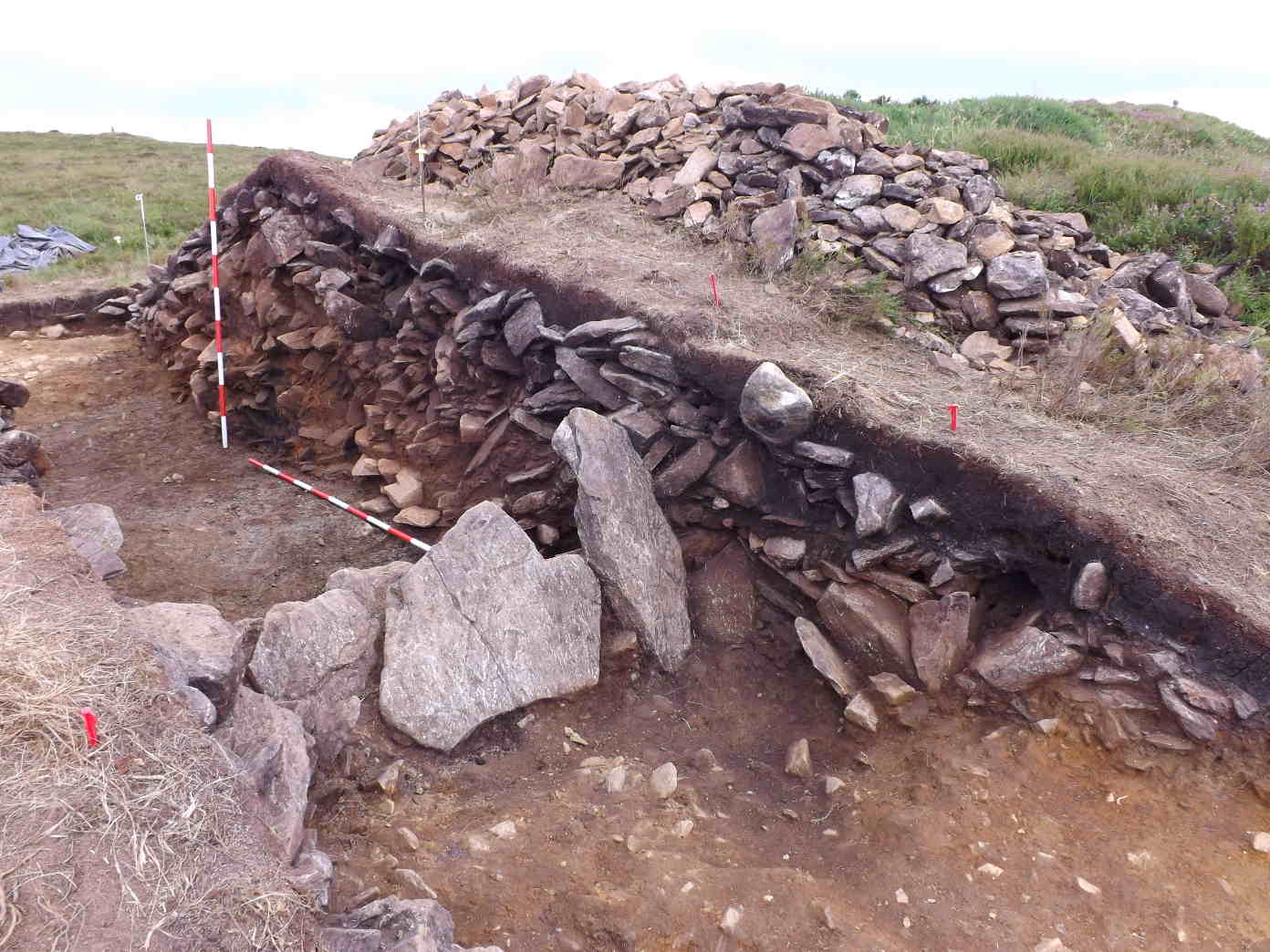
Excavation was undertaken in July 2017 at a multiple enclosure hillfort (Rathcoran) in the townlands of Collinarrig Upper, Pinnacle and Tuckmill Hill, Co. Wicklow. The inner enclosing element of this hillfort was trenched to recover dating material and to gain an understanding of the physical form of the rampart. Based on the results of the geophysical survey (Dr James O’Driscoll), the 2017 excavation aimed to recover secure dating material from this section of the internal enclosing element. It was hoped that this would confirm the date of construction of the ringwork and the survival of internal features such as burnt timber palisades/posts. It will also help to understand how the site relates to the surrounding settlement landscape.
The work was carried out under ministerial consent and funded by the Royal Irish Academy.
The excavation uncovered evidence of a light post-built palisade fence supported by a low stone and earthen bank. This fence line was subsequently burnt down, leaving a number of in situ burnt timbers and a heavily oxidised earthen bank. After a period, the enclosure was re-built, this time with an additional earth and stone bank, which was overlain with an additional mantle of loose rubble. This second phase of construction was associated with a large stone revetment on the north-eastern side. No associated ditch was recorded and no artefacts were recovered from the excavation. A number of charcoal samples associated with the primary phase of building were retained and are awaiting radiocarbon dating.