2017:616 - CREEVAGH, Offaly
County: Offaly
Site name: CREEVAGH
Sites and Monuments Record No.: N/A
Licence number: 17E0183
Author: Dominic Delany, Dominic Delany & Associates
Author/Organisation Address: Creganna, Oranmore, Co. Galway
Site type: No archaeology found
Period/Dating: N/A
ITM: E 599569m, N 729371m
Latitude, Longitude (decimal degrees): 53.314610, -8.006468
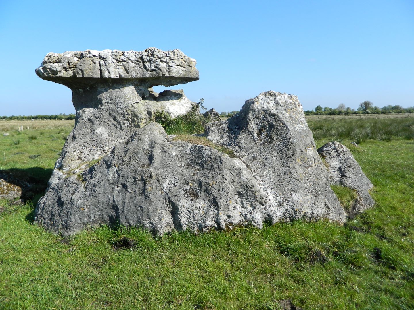
Monitoring was carried out on a proposed afforestation site at Creevagh, Co. Offaly from 3 to 22 May 2017. There are no recorded monuments within the 20.5 hectare site but there is a large boulder/rock outcrop which is named ‘The Piper’s Rock’ on the 1908–10 Ordnance Survey map and could be described as a cultural heritage feature. The technical approval for the afforestation required a 5m unplanted buffer around the rock. The rock is a geological phenomenon known as a ‘wavestone’ or ‘mushroom stone’, which were the subject of a publication ‘Ireland’s Mushroom Stones – Relics of a Vanished Lakeland’ by John Feehan and Louise Dunne (UCD, 2003). The greatest concentration of wavestones occur around the margins of the River Shannon’s floodplain, which accounts for almost half of the 63 recorded stones. Seven wavestones are recorded in Creevagh, three of which are located on the application site, and a further three stones are recorded in Clorhane immediately south of Creevagh. These water-worn limestone boulders, eroded up to a certain height by the solvent action of former lakes, indicate the locations of lakeshores at the end of the Ice Age. The stones are important landmarks from an archaeological perspective as these ancient shorelines are where the first people to come to Ireland hunted and fished in the Mesolithic period.
A tract of cutaway bog on the east bank of the River Shannon borders the site on the west while the R444 road, built on the Eiscir Riada between Shannonbridge and Clonmacnoise, borders the site on the east. The fields bordering the R444 in the east of the application site are grassland on the west slope of the Eiscir Riada. The remainder of the site is low-lying peatland, which was reclaimed for agricultural purposes in the 19th century. Prior to the commencement of groundworks a 5m buffer was established around ‘The Piper’s Rock’ in compliance with the archaeological condition attached to the technical approval. With the consent of the client buffers were also established around the additional two recorded wavestones located within the application site.
The peat in the north-east of the site varied between 0.3m and 0.4m in thickness and overlay grey fine-medium sand and silty sand with occasional inclusions of rounded stones and boulders. Yellow/brown silty sand and silty clay was occasionally uncovered. Over the remainder of the site the depth of peat generally exceeded the depth of the excavated drains. There was evidence of intensive burning of vegetation and field clearance cairns within a field of rocky outcrop in the north of the site. Remnant earth and stone field boundaries (grass-covered dry stone wall footings) were observed on the field surface at three separate locations. These boundaries are indicated on the 1908–10 Ordnance Survey map but not on the 1838 map. Finds comprised pottery sherds and occasional glass and clay pipe fragments, all of 19th/20th-century date, and most interestingly a possible hammer stone (0.09 x 0.07 x 0.045m) and a whetstone fragment (0.06 x 0.04 x 0.03m). No archaeological features were uncovered during monitoring.