2017:811 - DUBLIN: Blackhorse Avenue, Dublin
County: Dublin
Site name: DUBLIN: Blackhorse Avenue
Sites and Monuments Record No.: DU018-021
Licence number: 16E0192
Author: Declan Moore
Author/Organisation Address: 3 Gort na Rí, Athenry, Co. Galway
Site type: Well
Period/Dating: Post Medieval (AD 1600-AD 1750)
ITM: E 712316m, N 736062m
Latitude, Longitude (decimal degrees): 53.362813, -6.312518
Road realignment and improvement works at Blackhorse Avenue, Cabra Gate to Springfield Road, Dublin were monitored on behalf of Actavo. The works involved the widening, realignment and reconstruction of a 481m length of road from a point south-east of the Cabra Gate entrance to the Phoenix Park to a point south-east of its junction with Springfield Road.
Within this curved stretch, on the south side of the road, is ‘Poor Man’s Well’ (DU018-021). Testing had been carried out at the subject site by Judith Carroll and Associates in 2015.
Works took place between June 2016 and May 2017. Modern material was uncovered widely across the site and the area was very disturbed with the insertion of modern services and previous roadworks. A number of modern features were recorded as a result of the works.
Works also included the renovation of the ‘Poor Man’s Well’. A protective layer was erected adjacent to the boundary wall of the Phoenix Park, to prevent accidental damage to the structure.
A cobble-lock surface was recorded at a depth of 0.3m below the current ground level along the area of the Poor Man’s Well. This was visible for a length of approximately 35m. The stones were removed, cleaned and moved into storage.
A culvert was located at 0.4m below the current ground level at the junction of Nephin Road and Blackhorse Avenue. The culvert consisted of a dry stone limestone wall capped with shale capstones.
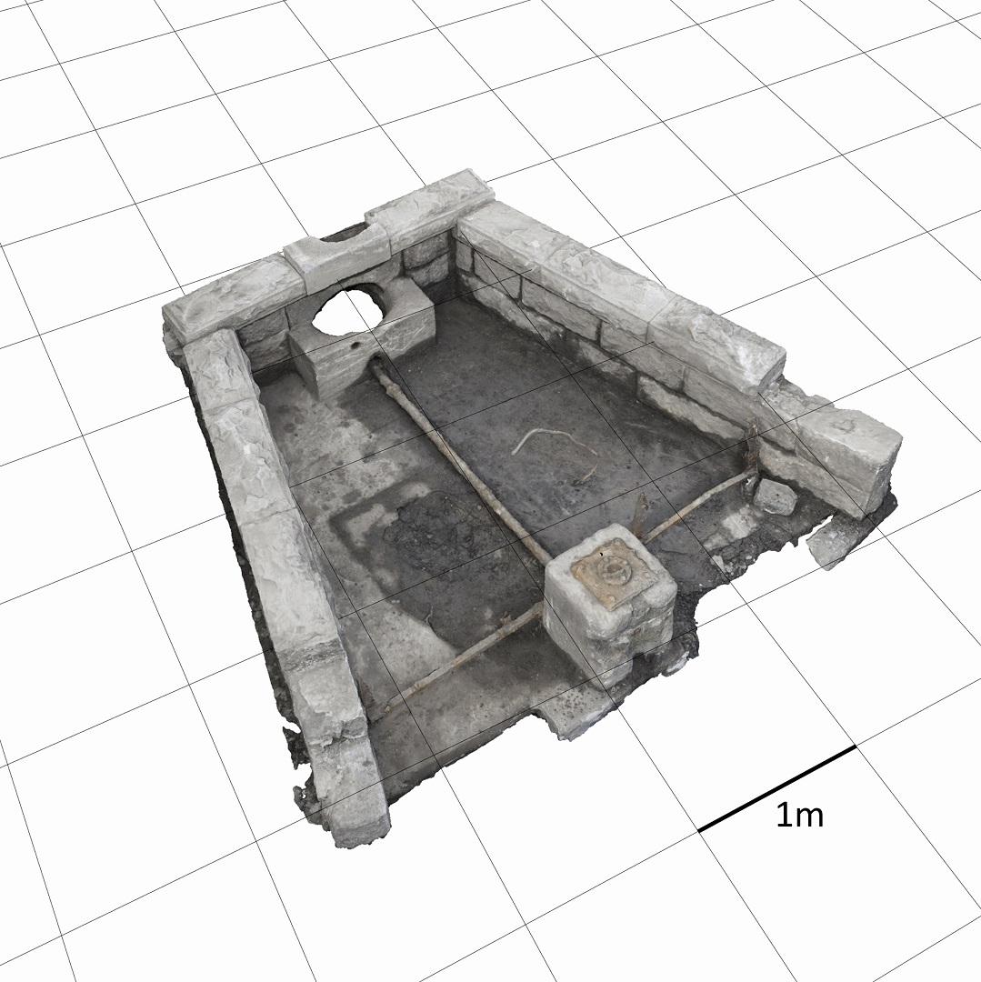
The ‘Poor Man’s Well’ was uncovered as part of the works. This had been covered in earth and rubble.
The well was fully exposed by machine and by hand. It consisted of three walls in a trapezoidal plan. The walls were constructed of highly dressed stone. The capstones were still in situ except at the east and west where two had become loose. The well was at the south of the feature and has been reworked with concrete as has the floor which has been covered in concrete. A 20th-century pipe connected the well to a now-removed pump at the east at the roadside.
The well was initially a main local source of water and generally used by the local population; later in the 19th century a pump was established and the well was mainly used to water horses, hence its reputation in local memory as a horse trough.
Works at the well involved exposing the site, stabilising the structure and renovating it. A series of steps were undertaken to enhance the site setting and ensure its survival into the future.

