2017:523 - DUBLIN: 8 Hanover Quay (former Durabond House), Dublin
County: Dublin
Site name: DUBLIN: 8 Hanover Quay (former Durabond House)
Sites and Monuments Record No.: N/A
Licence number: 16E0143
Author: Padraig Clancy, CDHC
Author/Organisation Address: Lynwood House, Ballinteer Road, Dublin 16
Site type: No archaeology found
Period/Dating: N/A
ITM: E 717704m, N 734111m
Latitude, Longitude (decimal degrees): 53.344117, -6.232333
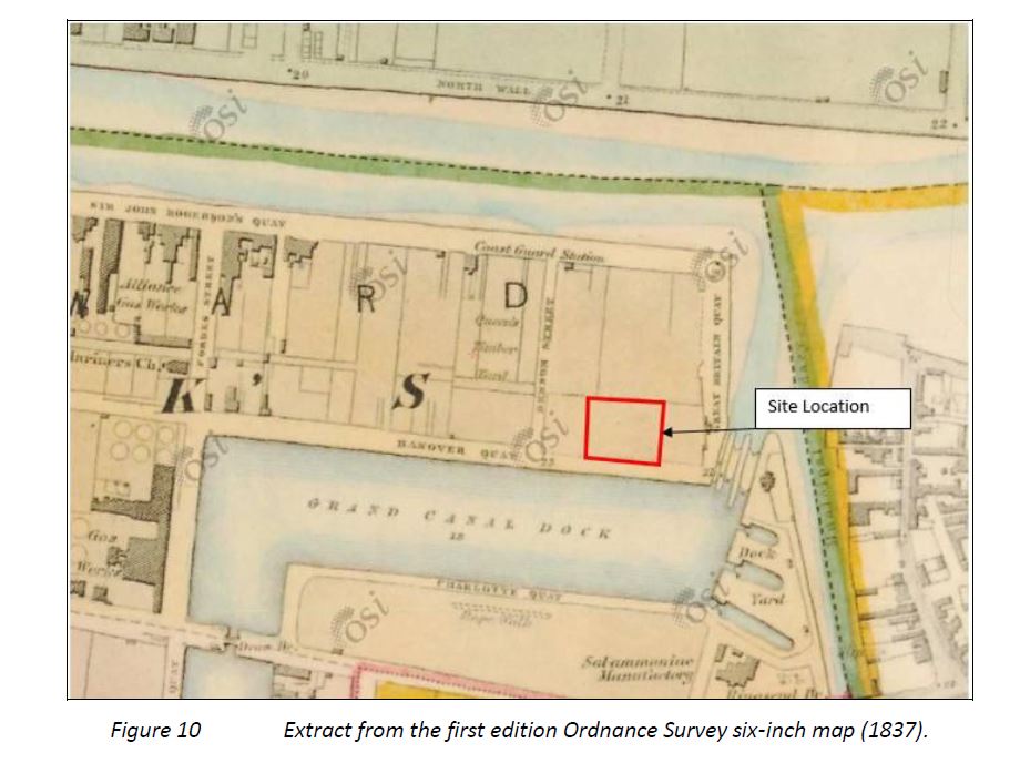
Monitoring was carried out by Courtney Deery Heritage Consultancy Ltd. between October 2016 and February 2017, in compliance with Condition 6 of the Planning Condition. The works were carried out for Hanover Quay Property Development Company Ltd at the proposed mixed-use residential and commercial development located on a site of 0.43 hectares at 8 Hanover Quay (former Durabond House), Dublin 2.
The site displayed a sequence of 18th- and 19th-century deposition which reflects later land reclamation activity in the Grand Canal area. Exposed foundations and perimeter walls, now preserved in situ, are indicative of the footprints of the 19th- and 20th-century industrial land plots and structures which were depicted in the later editions of the Ordnance Survey maps.
Prior to excavation the ground level was at 3m O.D. A general stratigraphy appeared across the site:
3m to 1.4m O.D. 19th/20th-century basement and foundation levels.
1.4m to 0.2m O.D. 19th/20th-century silty clay fills.
0.2m to -0.4m O.D, late 18th/19th-century landfill material of mid grey/ brown soil.
-0.4m to -0.9m O.D. Riverine deposits of a black sedimentary silty clay with a few finds (butchered bone, white ware pottery, occasional brick).
-0.9m to -1.4m O.D. Riverine or coastal deposits of layers of sand and silt/clay with assorted shell inclusions.
No features of archaeological significance were uncovered during the monitoring. No further archaeological works are considered necessary at this site.