2017:464 - DUBLIN: 58a Arbour Hill, Stoneybatter, Dublin
County: Dublin
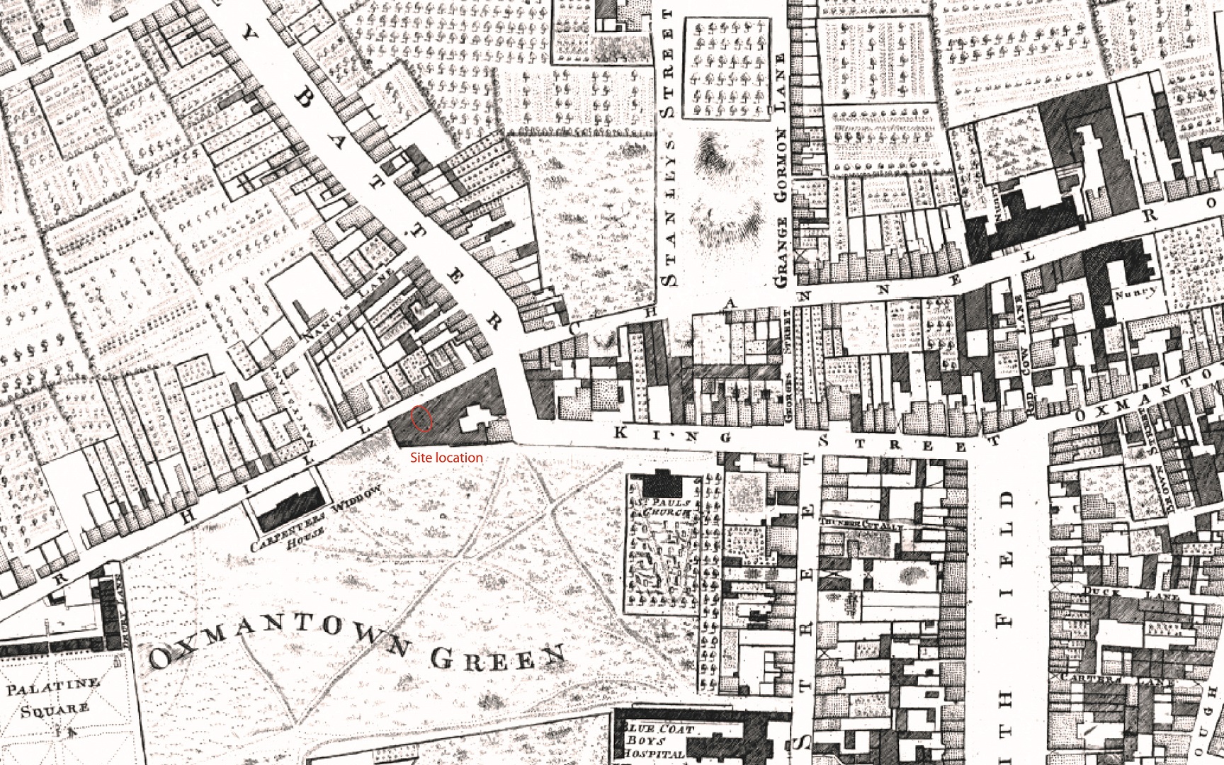
Site name: DUBLIN: 58a Arbour Hill, Stoneybatter
Sites and Monuments Record No.: DU018-020
Licence number: 17E0644
Author: Steven McGlade, Archaeology Plan
Author/Organisation Address: 32 Fitzwilliam Place, Dublin 2
Site type: Structure
Period/Dating: Post Medieval (AD 1600-AD 1750)
ITM: E 714348m, N 734700m
Latitude, Longitude (decimal degrees): 53.350143, -6.282495
Monitoring was carried out on a site at 58a Arbour Hill, Stoneybatter, Dublin from November to December 2017. The existing structure on the site was found to be a 19th-century cottage with a half-basement, recorded as a tenement in the 1860s. The existing rear yard of the property was created in the 20th century. Prior to this it was part of a large yard behind all the houses from 57-66 Arbour Hill, accessed to the west between No. 57 and the Carpenters’ Alms House. The eastern end of this yard was associated with Paul and Vincent in the 19th century, a manufacturers of farm machinery and iron mongers. Cartographic analysis indicates that a number of small houses were constructed within the western portion of the yard at this time. The cobbled surface of this yard was identified during the monitoring programme c. 1.35m below the present pavement level to the rear of the site.
Beneath the existing cottage the walls of an earlier building were identified. Cartographic analysis suggests a large building had been constructed on the site in the late 1670s or early 1680s. It is depicted up until Rocque’s map of 1756, where it is shown as a warehouse or similar type structure, with a large associated dwelling to the south-east fronting on to the southern end of Stoneybatter. The function of the building is unknown, however it was located in a prime location at the edge of the city on the approach from Cabra and the north-west. The basement remains identified during the monitoring are likely to relate to this building. Along the northern side of the site, fronting on to the road, a masonry wall predating the 19th-century cottage was identified, which continued down to full basement level at 2.06m below the level of the pavement. A parallel masonry wall was identified 9m to the south indicating the rear wall of the basement. This wall had almost been completely levelled in the past with only the base of the wall surviving to a height of 0.42-0.52m. The base of this wall was at c. 2.8m below the present pavement level, deeper than the northern basement wall due to the sloping nature of the site. The width of the southern wall was 0.55-0.6m. The southern wall may relate to the back of the building previously on the site, or an internal wall in the larger building. The late 17th-century structure had an earthen floor with no formal flooring identified during the monitoring, with the basement having a number of layers of infill and demolition rubble up to the base of the 19th-century half-basement. A layer of broken slates 0.05m thick above the floor may relate to the roof of the former building.
Beneath the late-17th-century building a levelling up deposit measuring 0.4m in depth was identified, likely to have been deposited to counteract the slope of the site prior to construction. The northern end of the basement was cut into natural, however the southern end was cut into the layer of yellowish-brown silty clay mixed with demolition rubble. Beneath this a layer of buried topsoil sloping down to the south was identified, measuring 0.2-0.27m in depth. This contained a sherd of Westerwald pottery, iron fragments, cockle and mussel shells and animal bone. The site was located at the northern end of Oxmanstown Green and the buried topsoil beneath the levelling-up layer may relate to this former open green space.
Neither of the walls relating to the 17th-century structure will be impacted by the current development, with the southern wall lying below the required works level and the northern wall being maintained, and will be preserved in situ.