2017:489 - Lands c. 500m west of 16 Ballylintagh Road, Hillsborough, Down
County: Down
Site name: Lands c. 500m west of 16 Ballylintagh Road, Hillsborough
Sites and Monuments Record No.: DOW 021:019
Licence number: AE/17/37
Author: Francis Woods, Gahan & Long Ltd
Author/Organisation Address: 7-9 Castlereagh Street, Belfast BT5 4NE
Site type: No archaeology found
Period/Dating: —
ITM: E 727618m, N 855947m
Latitude, Longitude (decimal degrees): 54.436022, -6.032793
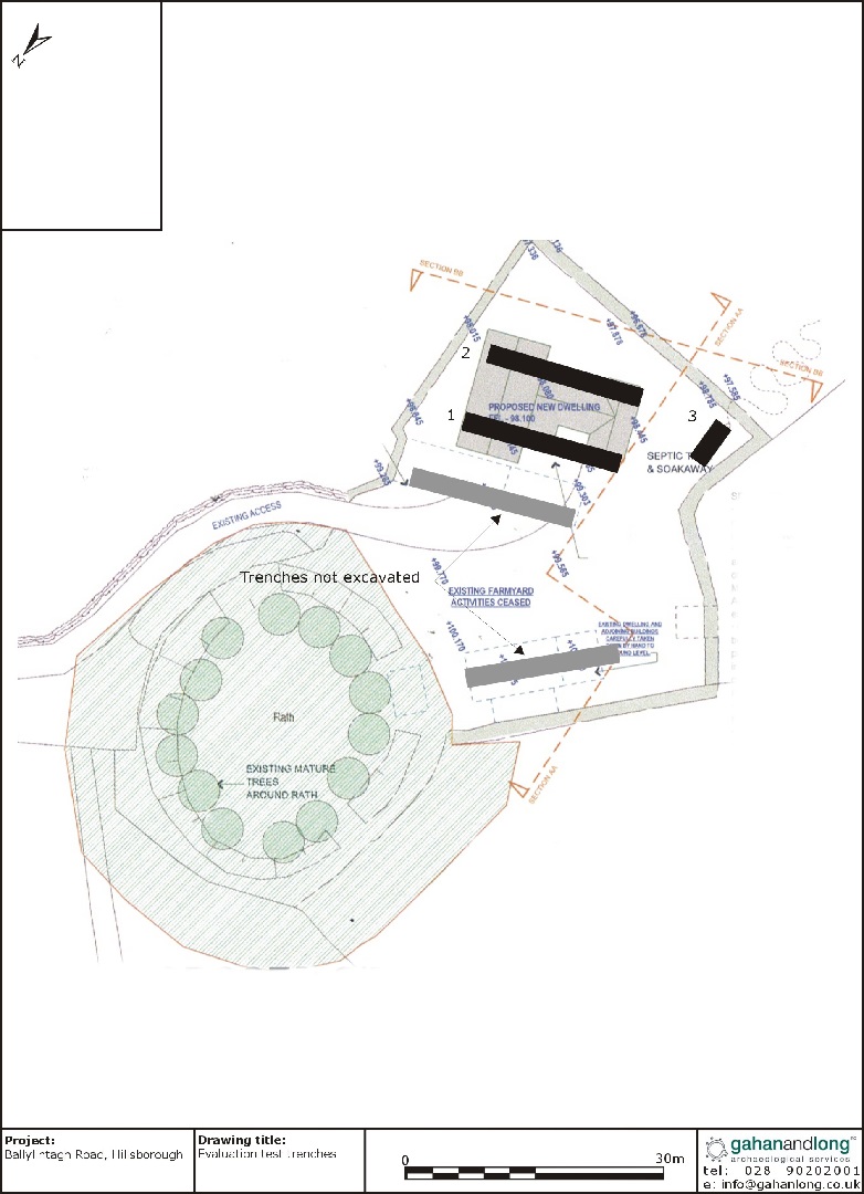
An archaeological evaluation was carried out prior to the proposed construction of a single dwelling on lands c. 500m west of 16 Ballylintagh Road, Hillsborough. The proposed development site is located beside a scheduled monument, DOW 021:019, identified as a rath.
A series of test trenches were excavated by mechanical digger fitted with a toothless bucket. The depths of the trenches remained consistent at c. 0.2m. The trenches were all excavated through mid/dark brown topsoil onto yellowish/grey subsoil with inclusions of small stones. No archaeological features were identified within any of the trenches. Two trenches were not excavated to the north-east and north-west of the development as the structures here are still erect; the structure to the north-west, a house which has been shown on the first edition map, is being retained as part of the dwelling’s planning permission. The second structure consisted of metal agricultural sheds. These buildings will be reduced to ground level prior to construction of the house commencing. No ground penetrating works will be conducted within the footprint of these sheds.

