2017:461 - DERRY: Belt Road, Church Road and Ashcroft (Lisaghmore or The Trench}, Altnagelvin, Derry
County: Derry
Site name: DERRY: Belt Road, Church Road and Ashcroft (Lisaghmore or The Trench}, Altnagelvin
Sites and Monuments Record No.: N/A
Licence number: AE/17/52
Author: Chris Lynn, Gahan & Long Ltd
Author/Organisation Address: 7-9 Castlereagh Street, Belfast BT5 4NE
Site type: Habitation site
Period/Dating: Bronze Age (2200 BC-801 BC)
ITM: E 645024m, N 914761m
Latitude, Longitude (decimal degrees): 54.978447, -7.296673
This excavation was conducted prior to the construction of a housing development at Belt Road, Church Road and Ashcroft, Altnagelvin, Derry. It uncovered evidence of prehistoric activity at this site which can tentatively be dated to the Bronze Age based on pottery recovered throughout the site.
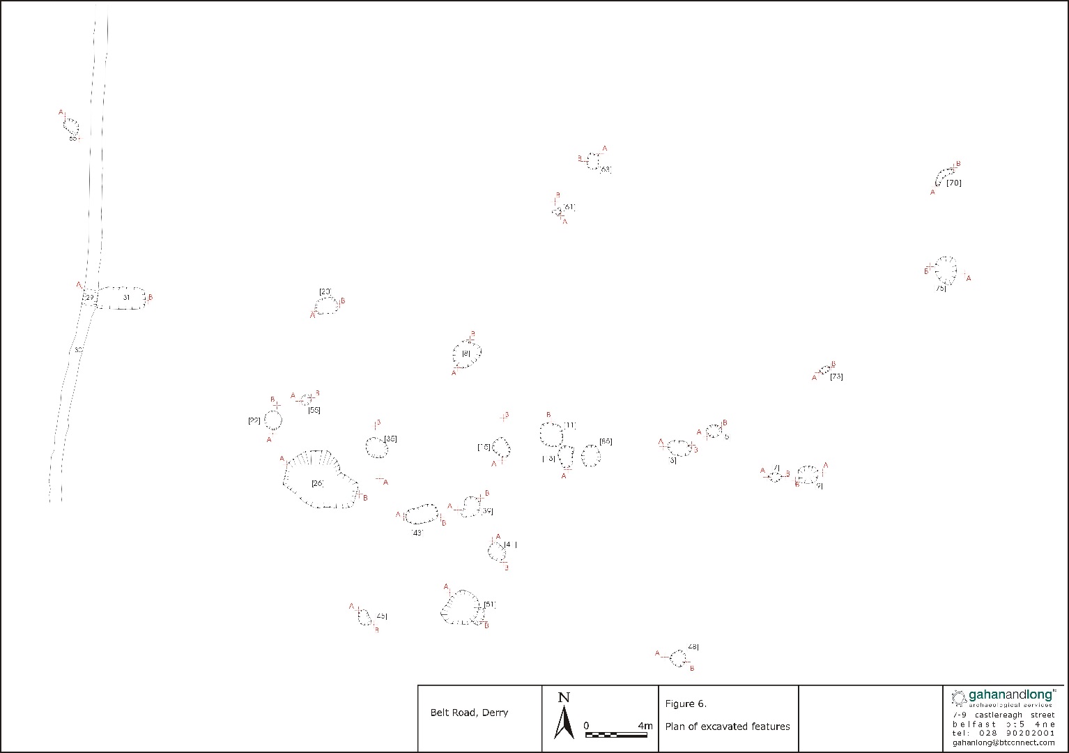
There was no stratigraphic layering on the site and all features were cut directly into the subsoil, except where individual features cut each other. Nonetheless, there appeared to be two main areas of archaeological interest on the site. These were located in Area A and Area B. Area A is located in an area of flat ground stretching for some 100m in length and width, at the base of a slope and at the top of a new slope. Area B is located at the northern edge of Field 2, downslope and to the north-east of Area A.
The main area of archaeological interest in Area A is centred around [26], a particularly large pit, which is surrounded by three pits, 2-3m to its north ([22], [35] and [55]) that form a rough semi-circular shape. To the south-east of [26] is another series of five pits ([43], [39], [41], [51 and [45]) starting with pit [43] and ending with pit [45] arranged in a rough penannular shape. Only three of these features contained pottery. Pit [26] contained fifty-nine sherds of Bronze Age domestic pottery, pit [45] a single sherd of prehistoric pottery and pit [22] a single sherd of post-medieval pottery. A single struck flint was found on the surface of pit [55]. Although archaeological in nature it is difficult to say that these features represent a structure. It is possible that these features (and possibly smaller “internal” features no longer present) had been truncated during topsoil stripping.
There were a number of pits and post-holes distributed randomly throughout Area A, however not many of these were overly convincing as archaeological features. The random nature of these investigated features located in Area A did not suggest that anything structural was located here. Many of the excavated features had some evidence of horticultural activity. Only two features contained any finds, spread [31] and pit [63]. Pit [63] contained a single sherd of blackware. Spread [31] contained six sherds of Bronze Age pottery and two sherds of tin glazed earthen ware. Spread [31]’s shallow nature, presence at the base of a slope and its truncation by a modern drain [29] could indicate that some or all of the pottery sherds had been washed in at a later date.
Two features were present in Area B. Pit [59] was a shallow pit cut by a shallow linear slot [57]. This feature contained no finds and there is no evidence of its use of function. [57] may have been the remains of a furrow.