2017:423 - COBH COASTLINE; multiple surveys, Cork
County: Cork
Site name: COBH COASTLINE; multiple surveys
Sites and Monuments Record No.: N/A
Licence number: 17D0024, 17R0036
Author: Rex Bangerter, ADCO
Author/Organisation Address: No. 2, Main Street, Bennettsbridge, Co. Kilkenny
Site type: Excavation - miscellaneous
Period/Dating: Multi-period
ITM: E 580023m, N 566505m
Latitude, Longitude (decimal degrees): 51.850399, -8.289966
Underwater archaeological impact assessment (UAIA) took place along a series of foreshore/seabed impact locations associated with the proposed Cork Lower Harbour Main Drainage (CLHMD) project. Inter-tidal and sub-tidal assessment was carried out at a series of locations along the Cobh shoreline encompassing nineteen impact areas associated with both the decommissioning existing outfall pipes and the construction of new overflow structures as part of the CLHMD project:
• C01- Ballynoe, Intertidal [ITM: 577542E, 567360N]
• C12- Rushbrooke Overlfow, Underwater/Intertidal [ITM: 577408E, 566869N]
• SW002- Dock Cottages Overflow, Underwater/Intertidal [ITM: 577408E, 566869N]
• C11- Pebble Beach Overflow, Underwater/Intertidal [ITM: 577820E, 566951N]
• C07- Whitepoint Drive ‘C’, Intertidal [ITM: 578479E, 565819N]
• C10- Whitepoint Drive ‘A’, Intertidal [ITM: 578491E, 565786N]
• C09- Whitepoint Drive ‘B’, Intertidal [ITM: 578493E, 565788N]
• C08- Whitepoint Drive ‘D’, Intertidal [ITM:579505E, 565898N]
• C06- Whitepoint Moorings ‘A’, Intertidal [ITM: 578545E, 565981N]
• SW003- Railway Cottages, Intertidal [ITM: 578556E, 565975N]
• SW004- Whitepoint Playground, Intertidal [ITM: 578660E, 566073N]
• C04- Station Carpark Overflow, Intertidal [ITM: 578766E, 566117N]
• C03- Station Carpark, Intertidal [ITM: 578836E, 566145N]
• SW007- Old Town Hall Overflow, Underwater [ITM: 579975E, 566472N]
• SW014- Lynch’s Quay, Underwater [ITM: 580023E, 566505N]
• SW002- Sirius Wharf, Underwater [ITM: 580130E, 566530N]
• SW008- Connolly Street ‘A’, Intertidal [ITM: 580480E, 566590N]
• SW010- Connolly Street ‘B’, Intertidal [ITM: 580564E, 566584N]
• SW011- Pilots Pier, Intertidal [ITM: 580480E, 566590N]
The assessment was carried out by a team of underwater archaeologists on 30 and 31 March 2017.
The UAIA comprised systematic non-disturbance assessment at each of the impact locations and extended significantly beyond the identified limits of each of the proposed foreshore impacts. The assessment sought to provide a thorough background to the maritime landscape present along the Cobh shoreline, record seabed/foreshore topography, assess the potential of foreshore/seabed deposits to retain archaeological material, and identify any material, features or structures of archaeological or historic significance that are present.
A total of fourteen features (Features 1–14) of historic significance were identified as part of the onsite assessment, mainly comprising foreshore features of nineteenth-century date. One structure, located along Whitepoint Strand (Feature 7) is of particular interest as it may represent the remains of an eighteenth-century quayside. While many of the features lie outside the identified footprint of the proposed foreshore works, two features will be impacted upon by the proposed development; Feature 8 (nineteenth-century sea wall) and Feature 9 (Lynch’s Quay). However, these constitute localised impacts and have been categorised as slight, negative, impacts to the overall structures present.
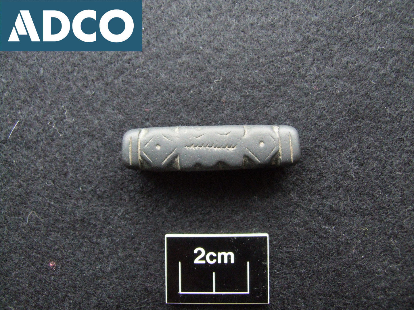
A considerable amount of historic debris was encountered along the various foreshore areas under assessment, and the potential for archaeological material to remain buried within foreshore/seabed deposits should be considered to be relatively high, particularly for those areas located in proximity to Cork Dockyard, Whitepoint Strand, and surrounding the Connolly Street A–B and Pilot’s Pier outfalls. In addition, a number of interesting finds were also recovered as part of the UAIA (Find numbers 1–10). Most significant amongst these is a possible Merchant’s/Sailor’s Seal (Find 17D0024:01), which was recovered from the foreshore 8.9m to the east of the existing Connolly Street A outfall (SW009), at ITM: 580489E, 566604N. This artefact is of possible sixteenth- or seventeenth-century date and constitutes a rare find, perhaps the first of its kind to be recovered from an Irish context.

