2017:510 - BALLYCLARE: Ballycorr Road, Antrim
County: Antrim
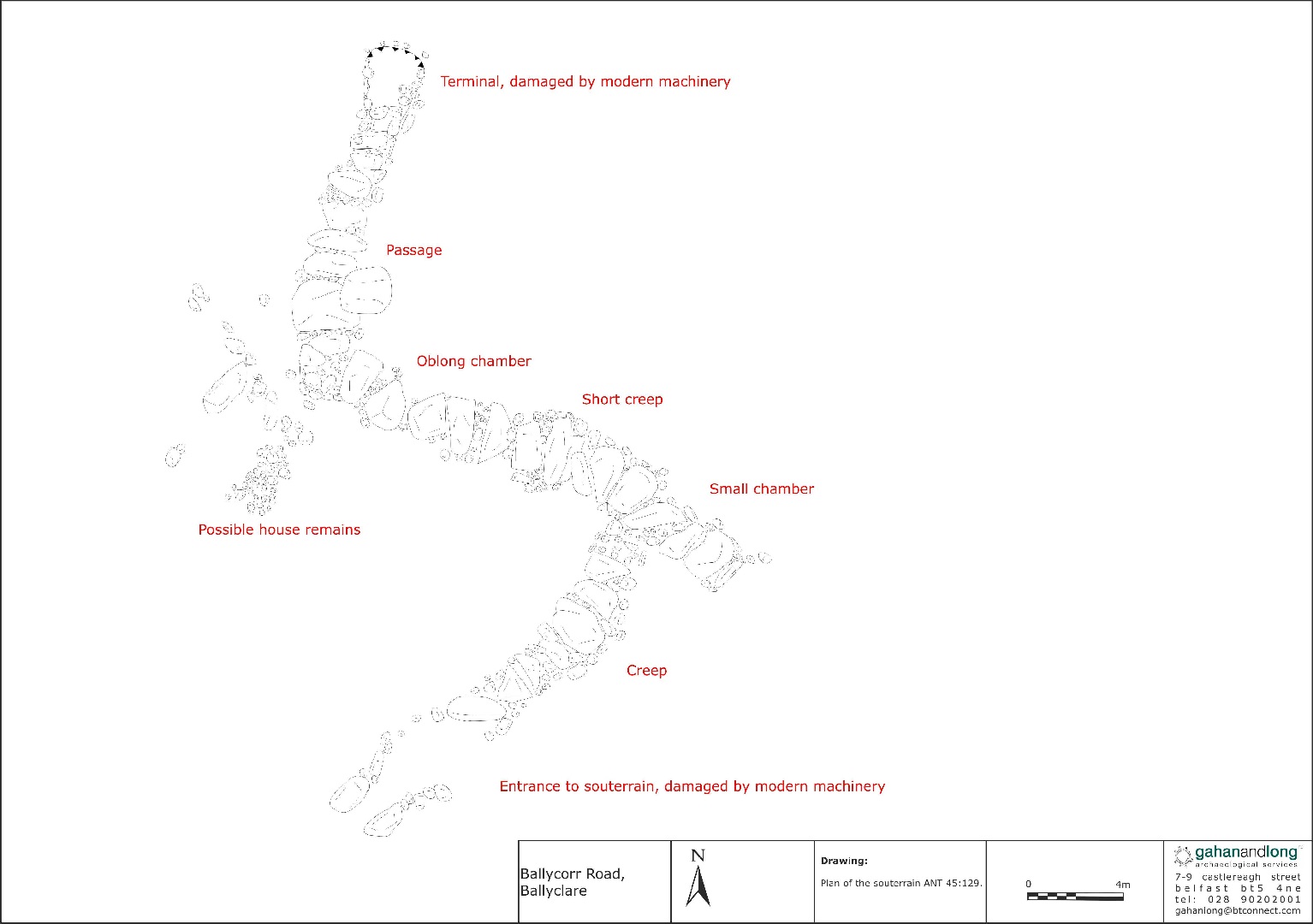
Site name: BALLYCLARE: Ballycorr Road
Sites and Monuments Record No.: ANT045:129 and ANT045:121
Licence number: AE/17/118
Author: Peter McAuley, Gahan & Long Ltd
Author/Organisation Address: 7-9 Castlereagh Street, Belfast BT5 54NE
Site type: Souterrain
Period/Dating: Early Medieval (AD 400-AD 1099)
ITM: E 728829m, N 891771m
Latitude, Longitude (decimal degrees): 54.757405, -5.998421
An archaeological evaluation was carried out prior to the proposed construction of a residential development on lands off Ballycorr Road, Ballyclare. One known archaeological monument, ANT 045:129, is located within the red line boundary, with a second, ANT 045:121, located immediately adjacent to the site boundary. Both date to the Early Christian period and in conjunction with the other monuments located in the wider study area, indicate that this area was the subject of significant human activity during that period.
The evaluation consisted of locating the exact extent of souterrain ANT 045:129. Using a machine, fitted with a toothless bucket, the topsoil was removed from this area, following the line of the souterrain as it extended within the development area. The topsoil was removed to the level of any surviving lintels. These were manually cleaned, but not removed. Any smaller stones beside or between the lintels were also left in place. A margin of 1m on either side of the cut for the souterrain was maintained, which was topsoil stripped to the level of subsoil, or associated archaeological remains.
The exposed souterrain was photographed, drawn and a written record taken. The precise location and extent of the souterrain was recorded by GPS. The lintels were then covered with geotextile material and backfilled. The area of the souterrain will now be contained within a green space in the proposed development.