2017:509 - BALLYCLARE: Templepatrick Road, Antrim
County: Antrim
Site name: BALLYCLARE: Templepatrick Road
Sites and Monuments Record No.: N/A
Licence number: AE/17/227
Author: Chris Long, Gahan & Long Ltd
Author/Organisation Address: 7-9 Castlereagh Street, Belfast BT5 4NE
Site type: Ringfort - rath and Prehistoric site - lithic scatter
Period/Dating: Multi-period
ITM: E 727735m, N 889814m
Latitude, Longitude (decimal degrees): 54.740115, -6.016262
An archaeological evaluation was carried out prior to the proposed construction of a residential development on lands to the north of 220 Ballyrobert Road to the south-west of 107 and 111 Templepatrick Road and to the south of the Six Mile River Ballyclare.
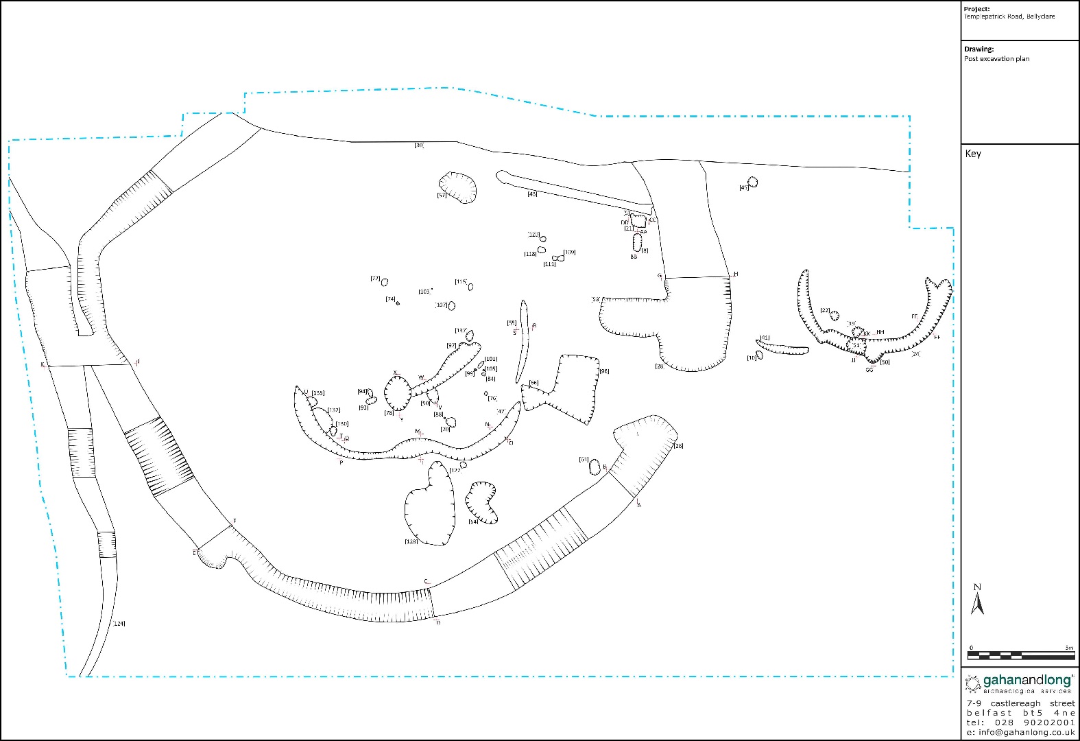
Monitoring of test trenches of the site under licence AE/11/20 identified a roughly circular enclosure of uncertain date. Excavation of the site identified during the 2011 evaluation was conducted in January-February 2018 under licence AE/17/227.
The main features of the site are interpreted as being a rath of Early Medieval date. It consisted of a sub-circular enclosure ditch, measuring 29m north-south by 30m, with a 3m wide opening in the east. The ditch enclosed a possible structure, consisting of two slot trenches and associated post- and stake-holes. A second possible structure was located to the east of the ditch, and consisted of a slot trench.
There was also evidence of activity predating the rath. Within the area where the rath bank would have been located, there were a number of pits, one of which contained a quantity of struck flint that has been provisionally identified to be a hoard, dating to the late Mesolithic. This struck flint consists of butt-trimmed flakes, predominately knifes and spear heads, which display very little sign of wear and appear to have been purposefully deposited here. A specialist report on the flint assemblage of this site is forthcoming.