2017:498 - ANTRIM: (Phase 3) lands to south of Birchhill Road and to east and north of Ballygore Road, Irishtown, Antrim
County: Antrim
Site name: ANTRIM: (Phase 3) lands to south of Birchhill Road and to east and north of Ballygore Road, Irishtown
Sites and Monuments Record No.: ANT 050:156
Licence number: AE/17/47
Author: Chris Lynn, Gahan & Long Ltd
Author/Organisation Address: 7-9 Castlereagh Street, Belfast BT5 4NE
Site type: Pit and Burnt mound
Period/Dating: Bronze Age (2200 BC-801 BC)
ITM: E 716803m, N 887735m
Latitude, Longitude (decimal degrees): 54.724098, -6.186766
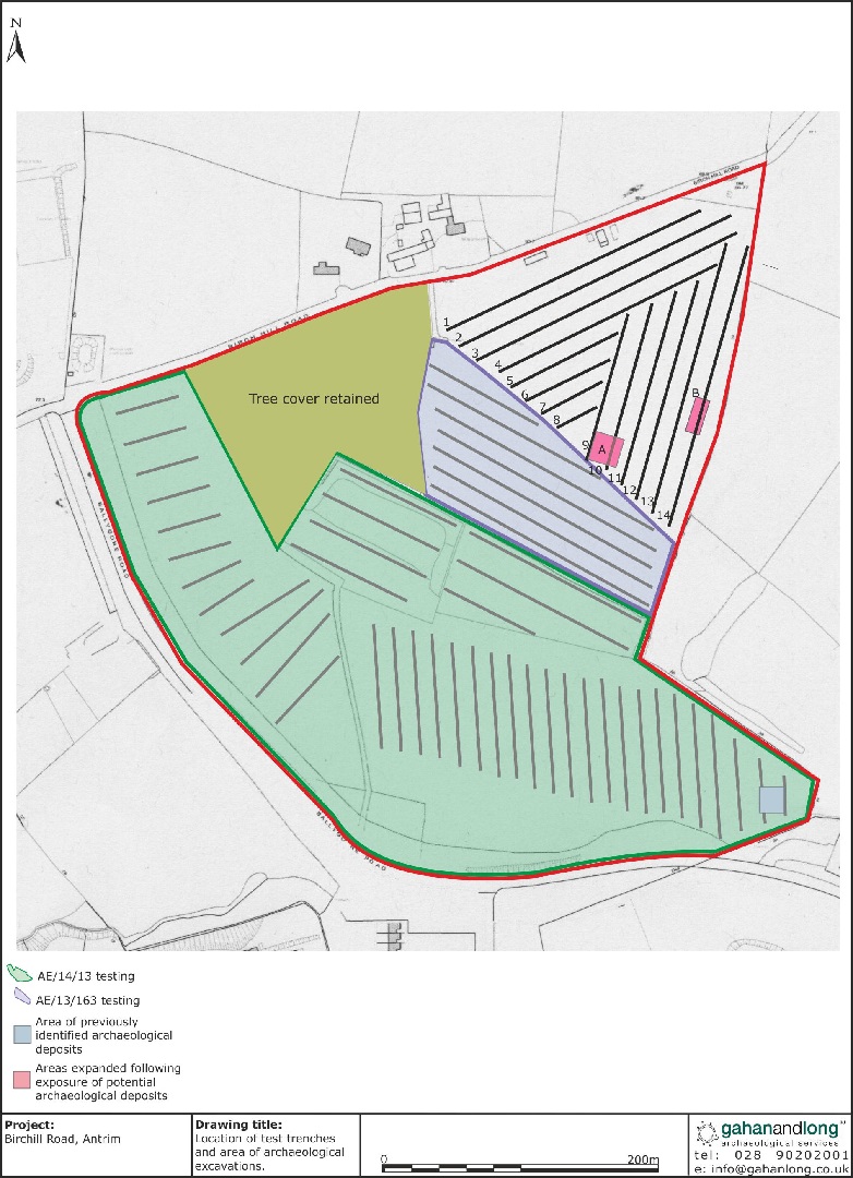
An archaeological evaluation was carried out prior to the proposed construction of a residential development on lands to south of Birchhill Road and to east and north of Ballygore Road, Antrim. The proposed development site contains an aerial photography site, ANT 050:156, a circular cropmark.
A series of 14 trenches were excavated by a machine fitted with a toothless bucket. The depths of the trenches varied slightly across the site with those on the north-eastern and eastern half of the site being excavated to a depth of 0.3m. As the trenches extended further south, the depth at the base of the hill increased to 0.7m. In all cases the topsoil was removed onto naturally occurring subsoil which primarily consisted of an orange glacial till. Subsoil at the base of the hill consisted of a light grey plastic clay and some areas of peat were also noted. Two areas of potential archaeological deposits were identified within Trenches 10 and 14.
In Trench 10, the potential archaeological deposits within Area A consisted of a possible burnt spread and a linear feature. however, after excavation the features were identified to be non-archaeological.
In Trench 14, two small pits were identified during the evaluation. Both were roughly circular in plan with a diameter of approximately 0.8–1m and contained a single light brown clay foam fill with moderate to frequent charcoal inclusions. The features were fully excavated.
In addition, full excavation took place of deposits identified during an earlier phase of works (AE/14/13). The excavated remains consisted of a burnt mound, containing a trough (2.2m x 1.3m) and 12 stake-holes. In addition, an oval pit, containing threes stake-holes cut into its base, a second potential trough and a further 3 pits were uncovered.
The excavated remains indicated that this is the site of a burnt mound or fulacht fiadh. These sites are typically dated to the Bronze Age. Radiocarbon dating of the fill from the main trough provided a date of 2954BP (+/- 39) placing the site in the Middle Bronze Age.