2017:496 - BALLYMENA: Ballygarvey Road Solar Farm, Antrim
County: Antrim
Site name: BALLYMENA: Ballygarvey Road Solar Farm
Sites and Monuments Record No.: N/A
Licence number: AE/17/185
Author: Chris Lynn, Gahan & Long Ltd
Author/Organisation Address: 7-9 Castlereagh Street, Belfast BT5 4NE
Site type: Habitation site
Period/Dating: Prehistoric (12700 BC-AD 400)
ITM: E 712086m, N 905334m
Latitude, Longitude (decimal degrees): 54.883221, -6.253147
An archaeological evaluation was carried out prior to the construction of a solar farm located on lands south of Ballygarvey Road, Ballymena. A geophysical survey of the development area was first undertaken under licence AE/17/71G, which assessed the potential for surviving subsurface archaeological remains.
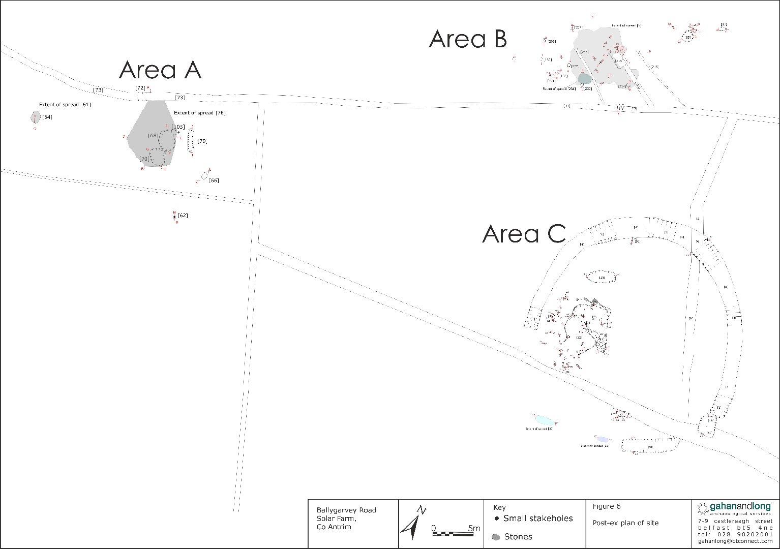
For this evaluation, a total of 122 test trenches were excavated by mechanical digger fitted with a toothless bucket. Following identification of archaeological remains within Field 2, Trenches 29 and 38, the full extent of these deposits was exposed through topsoil removal of a wider excavation area. In total an area of 8000m2 was stripped. This revealed the extent of an enclosure, two large burnt spreads and associated pits, a cluster of pits possibly representing some form of structure, some additional randomly scattered pits and several linear features.
The site contained three main areas of interest, designated Areas A, B and C. In Area A, the earliest known activity dates from the Late Neolithic with the presence of a burnt mound or fulacht fiadh containing a flint knife. Area B also contained a fulacht fiadh, but probably of a Later Bronze Age date, with a Bronze Age structure defined by an arc of post-holes partly covered by the fulacht fiadh. Area C contained an enclosure of unusual outline: the penannular enclosure is probably contemporary with the interior structure, though no dateable artefacts were recovered from its fills. It does, however, respect the interior structure too neatly to be a later feature. Only the western area of the enclosure contains archaeological features, whilst the east is devoid of features. This could represent a yard or assembly area. The probable function of the ditch could have been for drainage, as no sign of a bank was visible.
The remains found at Ballygarvey form a significant contribution to knowledge of structures at a place and time when evidence is scarce. They suggest a relatively lightweight structure formed around stakes some 6m or 7m square, possibly with an entrance on the south side. An intriguing find from the interior of the structure was what looked like a stone seat situated above a stake-hole [125] which contained fragments of nut shells that provided a radiocarbon date of 4094 BP (+/-36). The deliberate placement of the seat above a stake-hole containing nut shells would suggest a ritual component for its use.
A variety of lithic material was collected during the excavation, in total 30 lithic artefacts were recovered from features and 12 elements were recovered from the surface of the site. The excavation produced only a small number of lithic artefacts—only 7 retouched elements from features. On the whole, these were relatively un-diagnostic. The lithic assemblage can be taken as generally indicative of a rather small-scale prehistoric presence in the background of the site, mostly dating to the Neolithic.