2017:479 - Antrim Solar Farm, Deer Park, Antrim, Antrim
County: Antrim
Site name: Antrim Solar Farm, Deer Park, Antrim
Sites and Monuments Record No.: ANT 055:013, ANT 055:014
Licence number: AE/16/214
Author: Peter McAuley, Gahan & Long
Author/Organisation Address: 7-9 Castlereagh Street, Belfast BT5 4NE
Site type: No archaeology found
Period/Dating: —
ITM: E 713722m, N 883181m
Latitude, Longitude (decimal degrees): 54.683905, -6.236351
An archaeological evaluation was carried out prior to the proposed construction of a solar farm on lands extending west from the A57 Dublin Road, Antrim. The proposed development site contains two recorded monuments, ANT 055:013 and ANT 055:014, both identified as enclosures on the SMR.
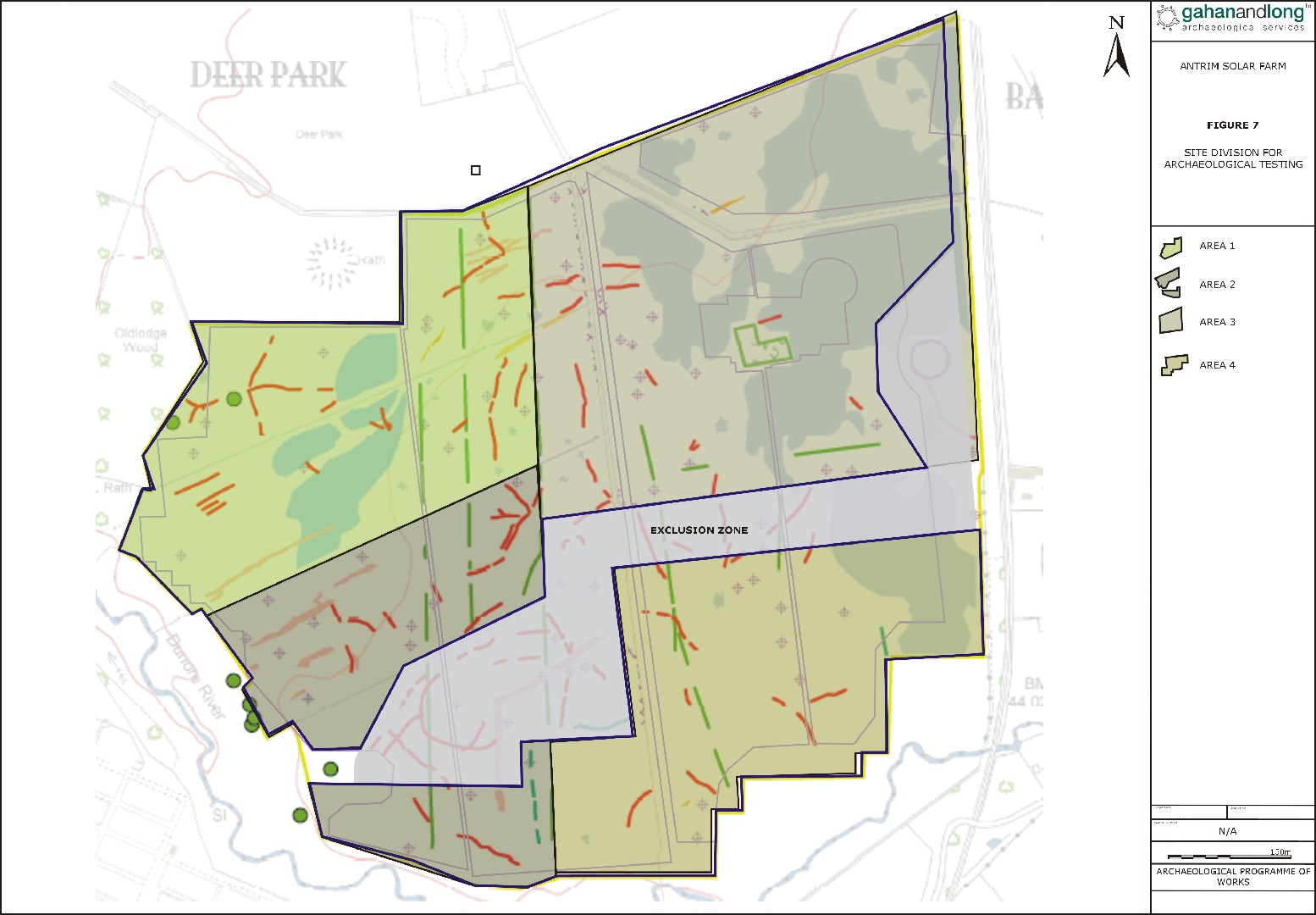
A geophysical survey of the development area was conducted. The geophysical survey confirmed the location of rath ANT 055:015 and also identified a significant number of anomalies which may represent further archaeological features. Due to underlying geological interference, no results were identified for the north-eastern section of the site. On the basis of the findings of the geophysical survey, a central area within the site was excluded from development. This area appears to contain what would be a substantial, roughly circular enclosure.
Phase 1 of the archaeological evaluation concentrated on the southern section of Area 2 and the full extent of Area 4. A series of test trenches were excavated by mechanical digger fitted with a toothless bucket. The position of a number of trenches was targeted to assess the nature of anomalies identified in the geophysical survey. Within Area 4, additional trenches were included within an area where the results of the geophysical survey were hampered by underling geology. In all a total of 30 test trenches were excavated.
No archaeological deposits were identified during the course of the evaluation.