
County: Dublin Site name: Monalin/Netownmountkennedy
Sites and Monuments Record No.: N/A Licence number: 14E0132 ext.
Author: Paul Duffy
Site type: Various - burnt mound, ringditch, metalworking, pits and linear features
Period/Dating: —
ITM: E 726223m, N 705574m
Latitude, Longitude (decimal degrees): 53.085827, -6.115754
A programme of geophysical survey followed by targeted test trenching was carried out by Margaret Gowan and Co. Ltd. in 2005 (05E1423) in advance of construction of a large housing development in the townlands of Monalin and Newtownmountkennedy, Co. Wicklow. Trenching towards the centre of the Phase 3 strip area identified a pit containing burnt stones. This was interpreted as the possible remains of a truncated fulacht fiadh. Stripping of topsoil followed on a phased basis from 2014.
Stripping of topsoil across the site in Phase 1 was monitored in 2014 and 2015 by IAC Ltd. (Licence no. 14E132). A report was produced detailing the results and was submitted to the NMS and NMI in February 2015 (Bailey and Kyle) with further information issued in July 2015 after the licence was reactivated by David McIlreavy. Stripping of the topsoil across Phase 2 of the site is now completed. Nothing of archaeological significance was identified during the course of these works.
The licence was transferred to Paul Duffy of IAC Ltd in April 2016 and further stripping of a Wicklow County Council access road in the southern portion of the development area was carried out. During the course of these works, three archaeological areas were excavated under licence 14E132 ext. These areas are:
Archaeological Area 1
A small metalworking area on the southern side of a small stream was identified, in the form of three bowl furnaces/smelting pits and an associated rakeout spread. A quantity of ferrous material was uncovered from a number of these features.
Archaeological Area 2
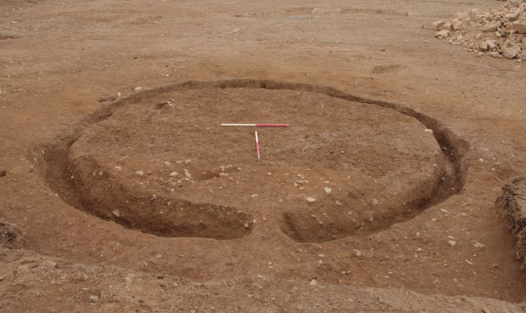
A ringditch or foundation slot for a circular structure surrounded by an extended area of archaeological activity (approx. 40m x 40m) comprising 3 possibly associated linear features; 4 pits with burnt stone debris; a rectilinear enclosure and several possibly associated linear features were excavated in this area.
Archaeological Area 3
A number of dispersed troughs pits, post-holes, stake-holes and linear features spread over a wide area (200m east-west x 150m) on a south-sloping field were excavated. The majority of these features were located close to the banks of a small stream and were generally filled or covered with burnt spread material comprised of heat-cracked stone. In one instance a trough, fire pit and possible well were grouped together with evidence, in the form of a slot trench and numerous post- and stake-holes, for a structure over the trough.
Post-excavation analysis is ongoing and further phases of topsoil stripping in adjacent areas are scheduled for late 2017/2018. This record will be updated once the excavation report is finalised.
IAC Ltd, Unit G1, Network Enterprise Park, Kilcoole, Co. Wicklow


