2016:423 - KILGOBBIN: Field 4, Landsdowne/Old Wesley Rugby Grounds, Dublin
County: Dublin
Site name: KILGOBBIN: Field 4, Landsdowne/Old Wesley Rugby Grounds
Sites and Monuments Record No.: N/A
Licence number: 16E0197
Author: Steven McGlade, Aileach Archaeology, on behalf of Archaeology Plan
Author/Organisation Address: 32 Fitzwilliam Place, Dublin 2
Site type: No archaeology found
Period/Dating: N/A
ITM: E 718940m, N 724643m
Latitude, Longitude (decimal degrees): 53.258793, -6.217327
A programme of archaeological test-trenching was carried out on the site of a former rugby pitch, ‘Field 4’, in Kilgobbin, Co. Dublin on 28 and 29 April 2016. This is the next phase of a development that was previously archaeologically assessed at Fields 1-3, Landsdowne/Old Wesley grounds, Kilgobbin in 2014, with three areas of the development site being excavated under Licence No. 14E339, Excavations Ref. 2014:127. Area 1 was a medieval processing area to the south, probably associated with the settlement in the vicinity of Kilgobbin church which included two kilns and an industrial structure, possibly a smokehouse. Area 2 was to the north-west, east of the current site, and consisted of a number of small cremation pits on the slope above a shallow natural pool or pond into which two Early Bronze Age wells had been dug. There was evidence from human activity in this area from the Early Neolithic to the Late Bronze Age. The third area was in the north-east, further to the east of the current site. This included an Early Bronze Age barrow and cremation pit, an associated C-shaped structure, possibly associated with feasting, an Iron Age pit and kiln, a medieval metalworking pit, and a series of medieval water management features including a controlled pond, probably associated with the medieval settlement in the vicinity of Kilgobbin Castle to the north-east.
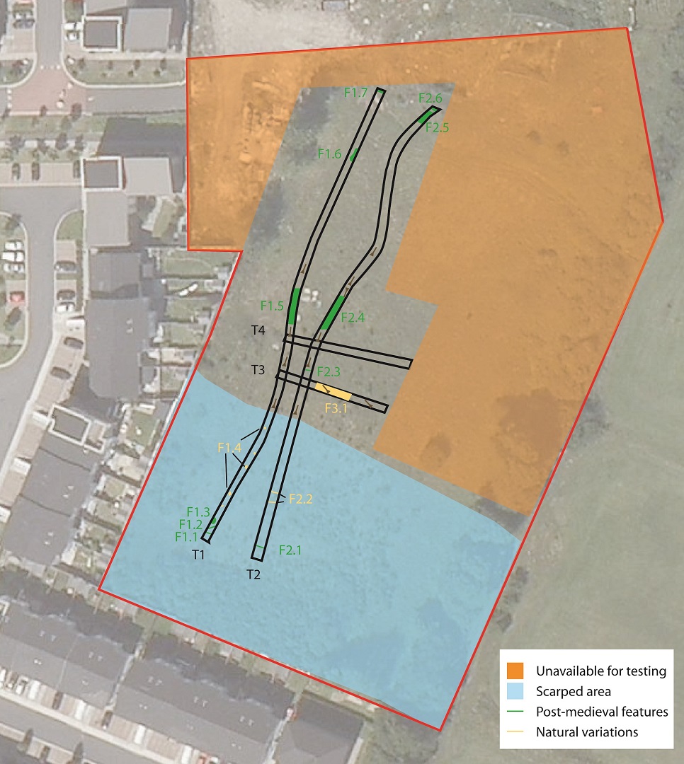
The western portion of the current site was made available for testing at this time, with the eastern side being occupied by a site compound, temporary carpark and a large spoil heap. Four trenches were opened across the western portion of the site, two running north-north-east/south-south-west lengthways along the site, winding slightly to avoid the existing spoil heaps, and two running east-south-east/west-north-west across the site.
No archaeological features were identified during the works. There was evidence of significant ground alteration across the site, with the southern c. 54m having been reduced, and the northern end of the site having been raised by up to 1m. This took place in the 1970s to create a level surface for the playing pitch that previously occupied the site. No further archaeological works are required for the portion of the site tested during this programme of works.
There is no likelihood of archaeological material surviving in the southern end of the site given the significant ground level reduction. To the north of this the ground level has been built up, with a layer of re-deposited natural overlying the former topsoil. As such there is potential for survival of archaeological features to the north of the scarped area. Given the depth of the build-up material (up to 1m), combined with the depth of the original topsoil (c. 0.6m), it was decided that it would be best to assess this portion of the site through monitoring and this is to be carried out in the future.